Oak fire tops 18,000 acres, destroys 41 structures as crews continue to battle blaze
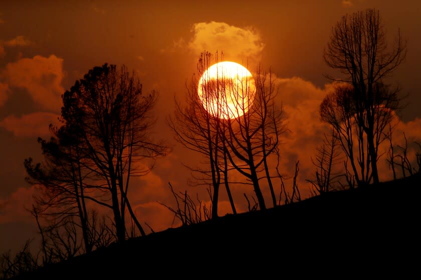
As the sun rose over the Sierra Nevada foothills, it appeared burnt orange through hazy skies in Mariposa County.
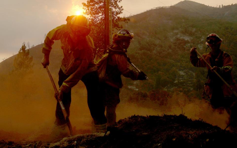
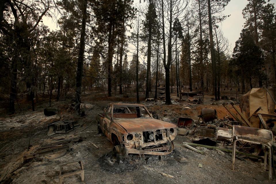
Since Friday, the Oak fire has consumed more than 18,000 acres of the sparsely populated mountain community. And by Tuesday morning, the blaze, located near Yosemite National Park, had destroyed 41 structures and forced thousands of people to evacuate their homes.
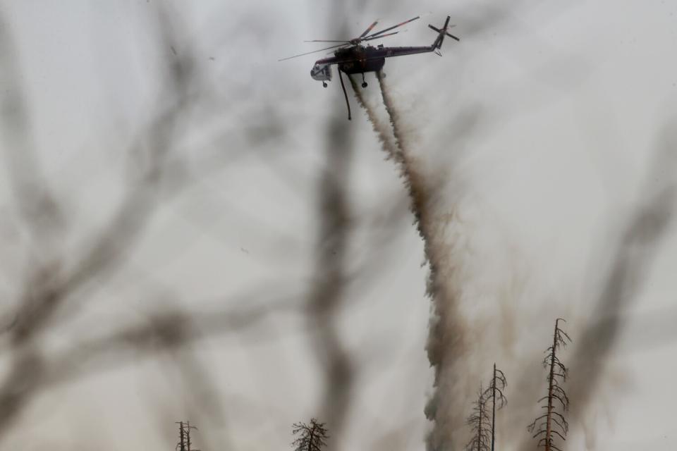
But California Department of Forestry and Fire Protection officials are hoping that an end is in sight. Crews were still putting out hot spots and providing structure defense Tuesday.
The northeast side of the fire is brushing against steep terrain and has a risk of bumping around the bottom side of the 2018 Ferguson fire burn scar, which could then ignite new brush and forest, making the fire harder to control, according to Escondido Fire Department public information officer Dominic Polito, who's working with Cal Fire on the blaze.
"Today's gonna be a big determinant," Polito said. "If it runs up and around that Ferguson scar, then we're off to the races. If not, then we're looking very good."
The fire reached 26% containment Tuesday, up from 16% Monday, according to Cal Fire.
"We've contained a lot of the spread," Polito added. "We're getting a good grip on it, but the northeast side of the fire is still an open candle."
Winds are expected to reach about 7 to 10 mph in the afternoon, with gusts up to 13 mph, Polito said. Coupled with humidity levels reaching between 5 to 10%, there's a concern of long-range spotting — embers that are blown outside the main perimeter and can spark flames.
"The biggest time it would potentially happen is during those afternoon gusts," he said. "The fire has been blowing around 3 p.m. and that's when we have those 13 miles per hour gusts, so during that period is when we're most concerned with spotting."
The destroyed structure count rose from 21 on Monday to 41 Tuesday morning, but Polito attributed the big jump to finally being able to send in their damage assessment teams after days of fighting the blaze.
"It's a waste to put in resources to count when you don't have enough to put out the fire," Polito added.
Peter Dowling, 60, knew the fire was serious when he looked over the mountain ridge and saw a towering plume of dark smoke. Moments later, Cal Fire and other first responders screamed through Mariposa's two-lane roads.
“It looked like someone had just dropped a bomb because a huge plume just came up in minutes,” Dowling said Tuesday morning.
The community has experienced several wildfires in recent years due to drought. Dowling, a resident of Mariposa County since the 1980s, said wildfire preparation, like maintaining a well or septic system, has become the new normal for residents.
In years without wildfires, Mariposa County typically enjoys cleaner air than much of the state. But in 2020, it led the nation in annual average concentrations of fine particulate at 22.6 micrograms per cubic meter — more than four times the World Health Organization recommended guidelines.
An air quality advisory was issued Sunday and remains in effect until Wednesday for communities in the Bay Area as residents braced for smoke drifting across the state. However, the smoke was expected to stay at higher elevations, and air quality remained good to moderate across the region, according to the Bay Area Air Quality Management District.
The air quality index hovered around 140 Tuesday morning in Mariposa, unhealthy for sensitive populations. Some residents could be seen walking, jogging or biking. But elsewhere, the air quality index exceeded 300, the highest threshold that is deemed hazardous to breathe.
Karen Dickinson and Kim Newby sat at a picnic table outside the convenience store where they work reflecting on the toll the fire has taken on the close-knit community. It’s been especially hard to hear about residents who have lost their homes in the fire, including a resident in his 90s whose family has asked for help, they said.
“The homeowner’s insurance for fire has like tripled," Dickinson said. "A lot of people who have lost their homes did not have fire insurance because they could not afford it, especially our seniors. And it’s terrible because now where do they go?”
About 1,400 structures remain threatened by the fire, which is burning near the southwestern part of Yosemite National Park.
“At its closest point, it’s maybe four or five miles from the park,” said Scott Gediman, a park spokesperson. “It’s not expected to go into the park but based on the fire progression, there’s an area on the southeast part of the park where the fire could go in. It’s a fairly remote area with no roads or hotels or visitor services.”
No roads or park entrances have been impacted by the Oak fire, but Gediman said because Highway 140 is closed near the fire near Ponderosa Way, access to the El Portal Road entrance is limited. He recommends people drive into Yosemite from the west or south and use Highways 41 or 120 to enter the park instead of Highway 140.
The Washburn fire, which ignited July 7 in the park, has burned nearly 5,000 acres and is 87% contained. That blaze threatened the park's grove of ancient sequoias, but Gediman said "for the most part, they're fine."
A few areas in the evacuation zone have been repopulated, and damage assessment teams and crews are currently going into colder sections to check for hidden fires in order to make sure it's safe to return, according to Polito.
"Compared to what it was at the beginning, it turned a huge corner," Polito said, "but we're still not out of the woods yet."
This story originally appeared in Los Angeles Times.

