One man in a kayak working to make a virtual 360-degree view of the Puget Sound shoreline
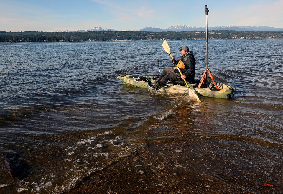
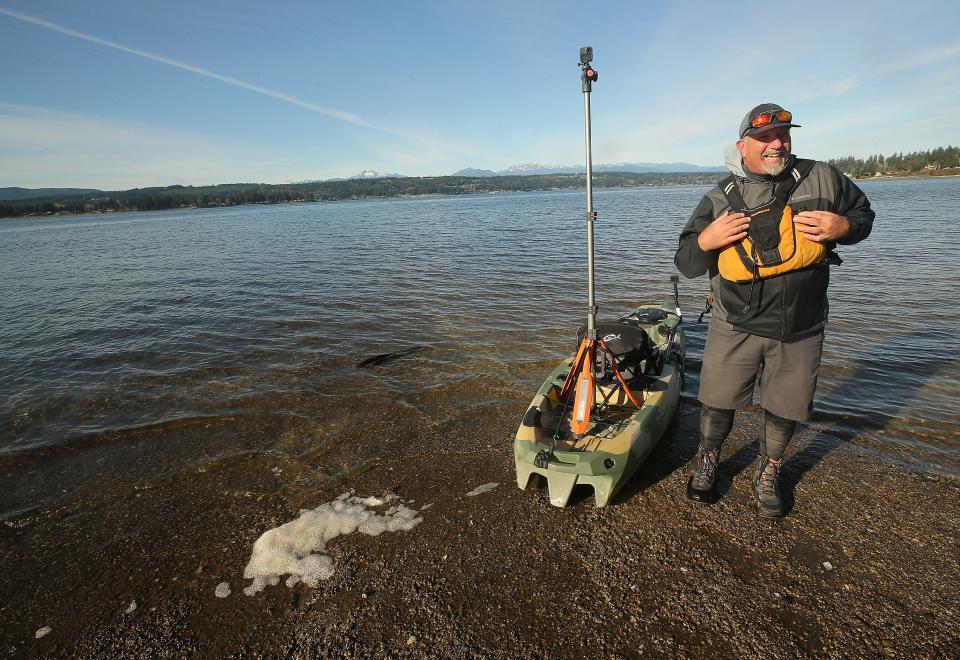
TRACYTON — The waves gently slap the cracked concrete as Brian Footen pushes his kayak from the boat launch and into the saltwater. It's a crisp, fall morning under blue skies and the snow-capped Olympic Mountains, an ideal time for the former fisheries biologist to map the deep fjord estuary that is Puget Sound.
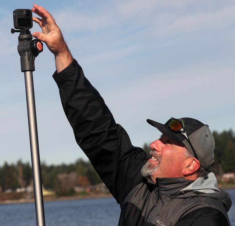
Footen has made it his mission to document every tideland of the sound's nearly 1,300-mile nearshore environment, using 120 pounds of instruments as he paddles — namely, a GoPro camera equipped with a 360-degree view that shoots a picture every 10 seconds. The result: the most comprehensive collection of images ever captured along its shores.
“It’s a way to interact with Puget Sound in a way we never have before,” said Footen, who on Nov. 17 launched the first mapping he's completed on the Kitsap Peninsula.
On most days of his 10- to 15-mile journeys, he collects about 6,000 images, a similar number of water quality samples, as well as a number of wildlife observations — a swooning Eagle or bobbing seal, for instance. He's already amassed a trove of data, having kayaked the eastern shore of the sound, from Olympia to Seattle.
His goal is to shine a light on the problems facing the sound and the wildlife in it. Through his company, EarthViews, he's crowdfunded the project and hopes it will be helpful to scientists, policymakers and the public at large, who can use it the same way they web surf roads on Google Street View.
But in an era where the health of Puget Sound is precarious and climate change will change the landscape, he's also doing the work for posterity.
“These places aren’t going to look like this, 50 years from now,” Footen said.
'An intuitive perspective'
Footen, a Seattle resident, worked for two decades as a fisheries biologist for federal, state and tribal agencies. In his work counting nests of salmon eggs called redds, he began to wonder if there was a way to help bring researchers and others closer to the streams and rivers without actually having to travel there. He tried using Google Street View, but it had its limitations — namely to the roads, and perhaps a bridge or two, that crossed them.
“You can’t drop the little peg guy into the water,” he joked.
The first attempt at mapping rivers was to take a dinner plate and glue a bunch of cameras to it. As the technology improved, Footen saw an opportunity. He quit his job and became an entrepreneur, starting EarthViews. In the time since, the small Seattle startup has worked with governments, companies, conservancies and tribes.
In 2014, the company mapped the Elwha River just 48 hours after the largest dam removal project in history, digitizing a "baseline of habitat conditions" as restoration took hold. In 2015, EarthViews teamed up with National Geographic to conduct ongoing "transects," or journeys through the Okavango Basin in Angola (but using a mokoro, the common canoe of the region, instead of kayaks.)
Along the way, others have helped to do their own mapping, and the company helps aggregate it all together on its website.
“We just want to get out here and preserve these precious ecosystems,” said Footen, who runs the company of two with its CEO, Courtney Gallagher, a retired Navy F-18 pilot.
Footen is sometimes asked why a kayak is necessary for his company's work to be successful. Satellite images, and even a yearly flyover by the state's Department of Ecology, can only chart so much detail. A powerboat wouldn't be able to get into tidelands where he's often just in a few inches of water.
“This is a different perspective, an intuitive perspective,” Footen said.
Packed with data, Footen will not just map the entire nearshore environment of Puget Sound but also take water quality measurements along the way. He's already noticed low oxygen levels in certain pockets of Puget Sound, a sign of environmental degradation. He's also tracking for acidification, an indicator of increased carbon dioxide in the water.
He likens the project to the days around the dawn of the 20th century when photographers lugged pioneering box cameras to the shores of the sound. Those pictures remain archived and tell a valuable story of what the Sound looked like then. His project will grow more valuable with time in the same way, he believes.
“This is digital preservation,” he said.
On the web: https://www.earthviews.com/
Josh Farley is a reporter covering the military and Bremerton for the Kitsap Sun. He can be reached at 360-792-9227, josh.farley@kitsapsun.com or on Twitter at @joshfarley.
This article originally appeared on Kitsap Sun: One man in a kayak working to make a virtual 360-degree view of the Puget Sound shoreline

