With only a 10% chance of a storm strike, let's go to the hurricane season mailbag
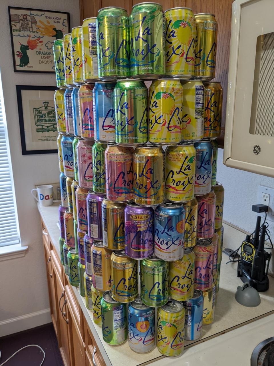
Like the eyeball-topped pyramid on the dollar bill and the Eyesore on I-4, my 2023 LaCroix tower is unfinished entering the closing chapter of hurricane season.
Forged can-by-can at WeatherTiger World HQ in the crucible of late-night forecasting as storms threaten, I pessimistically gave this year’s edifice a wide base in the wake of Idalia.
Fortunately, the lack of U.S. landfall threats in the second half of the season has left that refreshing LCX in the office fridge and the prospective heights of the pyramid unrealized.
A 10% chance of a Florida storm strike is still a chance
Before I dig into the mailbag and answer your questions, we must still grapple with the potential for more cans and thus more problems over the next few weeks.
While the historical frequency of landfalls drops off entering deep fall, the #1 hit song in America right now is “Cruel Summer,” so the normal progression of seasons may no longer apply. Every hurricane season is unhappy in its own way, and a named storm strikes the continental U.S. in about 10% of Novembers.
The only active storm on the map is Tammy, now southeast of Bermuda in the open Atlantic after winging the northeastern Lesser Antilles over the weekend as a Category 1. Tammy has since peaked as a Category 2, but increasing shear will cause it to weaken and transition to a post-tropical cyclone over the next few days.
Tammy’s remnants may stagger around the Atlantic like a drunk Frankenstein (the doctor, not the monster) into next week, but it should have no land impacts other than Bermuda.
The other area to keep an eye on is the Caribbean, where most late-season U.S. threats originate. While there is nothing there now, next week the interaction between a tropical wave and the tail end of a front that will cross Florida on Monday may trigger an increase in showers and storms. With low shear and weak steering currents in the Caribbean to the south of western Atlantic ridging, this disturbance may have time to slowly develop into a tropical storm over the first week of November.
If something forms, it would more than likely either continue west into Central America or escape northeast into the Atlantic across the Greater Antilles. However, if the timing of development and steering fronts comes up snake eyes, this theoretical storm could hypothetically threaten Florida. I’ll keep an eye on it but am not too concerned at this point.
Canned food, water, plywood: What should you do with this stuff after hurricane season is over? Can you reuse it?
It's time go to our mailbag: Your hurricane questions answered
With that, it’s time to play our annual game of Stump the Tiger. This year, you kept it pithy with your questions, so let’s go straight to the Lightning Round.
“I've lived here for 35 years and it seems to me that most hurricanes that hit western Florida have a distinct trend of "eastern misprediction." That is, the predictions will slowly over the days shift more and more to the west… If they originally show a track going over Tallahassee, it will ultimately hit Panama City or Pensacola. Obviously and fortunately, this didn't apply to this summer's hurricane! Am I just crazy?” — Thomas
Much madness is divinest sense to a discerning eye, Thomas. That east bias is real and has been caused by models underestimating the strength and persistence of subtropical ridging. For instance, the tracks of Ivan (2004) and Irma (2017) shifted notably westward with time on approach to Florida. However, biases only are predictable if the guts of the computer model are unchanged; with recent upgrades to the American models, this tendency is either gone or much reduced. In fact, the GFS and other U.S. computer guidance were too far west with both Ian and Idalia, so it may be time to retire that piece of hurricane folk wisdom.
Who wrote the first report on a hurricane?
We don’t know if Mayan meteorologists ever responded to “When will the wrath of sky-god Hunraqan hit my house?” queries, but the first recorded hurricane forecasts were issued by Cuban priest Benito Viñes in the 1870s. Padre Viñes used cloud trajectories to infer the location and motion of hurricanes across the Caribbean, established a network of weather observation sites, and issued life-saving warnings decades ahead of his American counterparts.
What future American politician wrote about his experience with a hurricane in the Caribbean?
That would be ten-dollar Founding Father Alexander Hamilton, whose teenage symphony to a 1772 tempest in St. Croix led a moved citizenry to provide funds for his education in the colonies. The rest is history.
What's your opinion on the causes of recent rapid intensification (48-24 hrs) of major U.S. landfalling hurricanes?
There is quite a bit of observational evidence and a strong theoretical argument for Michael- and Idalia-like rapid intensification into landfall becoming more common than even a few decades ago as oceanic heat content rises. Warm waters can’t create a hurricane from nothing, and atmospheric conditions will always act as a check, but it’s a good bet that a category or two worth of intensity for recent high-end U.S. landfalls can be attributed to significant trends warmer in the Gulf and elsewhere.
Can you name all the LaCroix flavors?
No. Several classified LCX flavors are written on page 42 of the Book of Secrets, and thus only known to U.S. presidents and Nic Cage.
Will the Seminoles make the playoffs this year?
In the illustrious words of my academic adviser, “never make a forecast you don’t need to.” However, I predict conditions will be highly unfavorable for Hurricanes in the vicinity of Tallahassee on Nov. 11.
The final quandary of the week is whether this column will actually be my last one until late November’s season-in-review. In two of the past three years, I have tried to sign off about now and soon been dragged back to active duty by a November threat.
This time around, I won’t say goodbye, just a generally applicable thanks to all you Weather Fans for watching the skies with me this year. Here’s looking forward to the day in the not-too-distant future that the pyramid cans, like all my jokes, are triumphantly recycled.
Dr. Ryan Truchelut is chief meteorologist at WeatherTiger, a Tallahassee start-up providing forensic meteorology and expert witness consulting services, and agricultural and hurricane forecasting subscriptions. Get in touch at ryan@weathertiger.com, and visit weathertiger.com for an enhanced, real-time version of our seasonal outlook.
This article originally appeared on Tallahassee Democrat: Late Florida hurricane season tracker: 10% chance of danger remains

