Ontario facing heavy rain and snow, messy travel conditions ahead
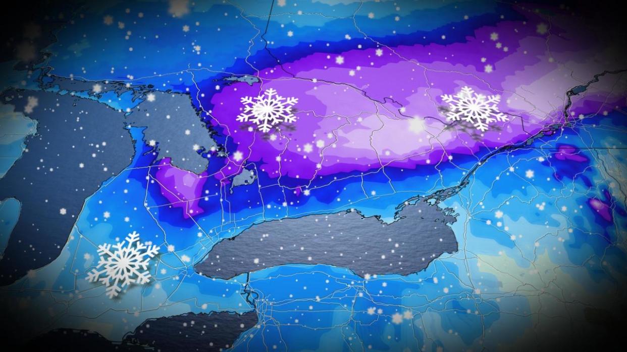
The week is set to end with a messy mix of heavy rain and snow for central and southern Ontario.
A low pressure system will develop south of the border and make its way toward Ontario and Quebec Wednesday night as another, weaker low pressure system makes its way to northeastern Ontario and southern Quebec from northwestern Ontario. Both systems are set to merge as they move into southern Quebec, leaving behind a messy trail of snow.
There is high confidence that central and parts of southern Ontario will, in fact, bear the impacts of the heavy snow and rain associated with the system.
Some uncertainty does remain, however, in the amount of snow the southwestern region of the province and the Greater Toronto Area (GTA) will receive.
The southern low pressure system is expected to move into the province early Thursday. Precipitation will begin as rain for southwestern regions before advancing northeast and continuing to spread snow further into the province. Regions experiencing heavy rain will see a transition to snow late Thursday and into Friday morning as colder air wraps in behind the system.
SEE ALSO: Newfound comet not seen for 50,000 years will soon swing by Earth
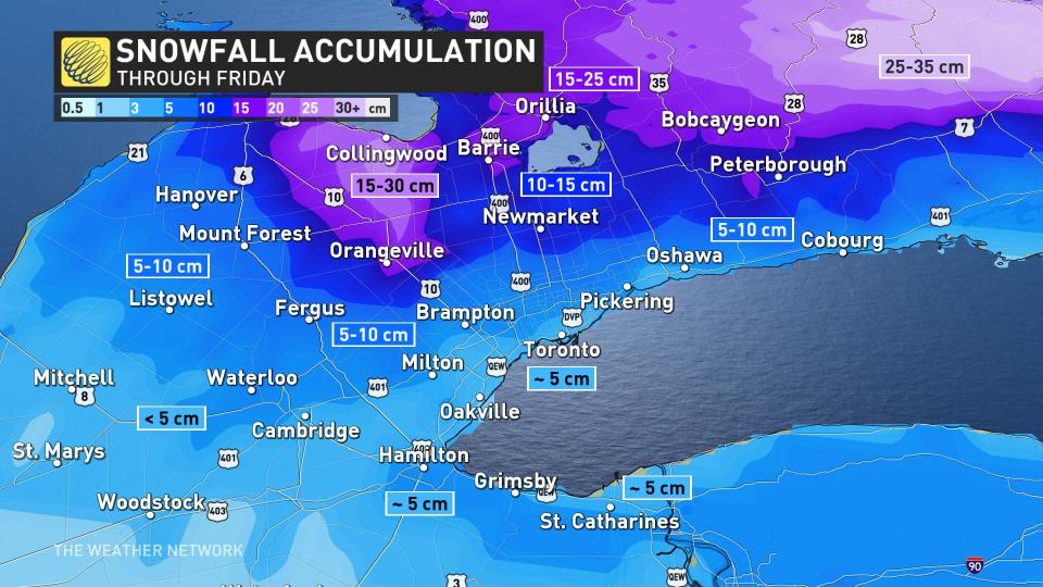
How much snow falls in southwestern Ontario and the GTA is ultimately dependent on how fast the transition from rain to snow is and how much moisture is left in the atmosphere as the cold air moves in. Currently, snowfall amounts of 5-10+ cm of snow are forecast for regions between the lakeshores and north end of the GTA.

Areas between Barrie and Ottawa will bear the brunt of the snowfall, with amounts between 25-35 cm expected by Saturday morning as the system makes its way into southern Quebec. The heaviest period of snow will be overnight Thursday through Friday morning.
Rain will persist in Kingston until transitioning to snow by Friday morning.
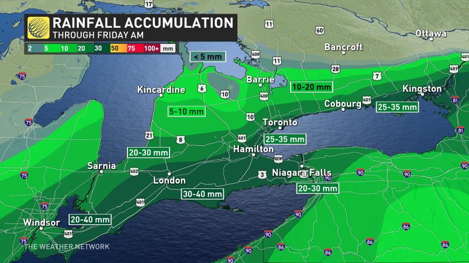
Regions north of the shores of Lake Erie and Lake Ontario will see between 20-40 mm of rain between Thursday and Friday morning, with amounts drastically reducing northward until reaching the central regions of the province, where there will be only snow.
The system will move out of the province and into Quebec by Friday afternoon, with all snow departing with it by Friday evening.
WATCH NOW: Hidden icy danger present across Ontario through Friday
For more forecast information and updates, keep checking back to The Weather Netowork.

