Ontario hit by 3 blockbuster snowstorms since autumn. Will there be more?
The past few months have brought three storms that will stay in our memories for years to come. So, can we squeeze in a fourth before it’s time to bring out the shorts?
Let’s look at the highlights and whether or not there’s more to come.
DON'T MISS: March came in like a lion, but can and will it go 'out like a lamb?'
In November 2022, before the Great Lakes could get into winter mode, an abnormally cold and prolonged stretch of Arctic air sat over the warm waters. All eyes were on Buffalo, N.Y., where a historic event came to fruition with 206 cm of snow falling on the south side of the city. Ontario’s biggest challenger was Wiarton, receiving 125 cm of snow over four days.
The days leading up to the holidays brought an incredible pool of frigid air racing across eastern North America. Wind gusts of 110 km/h, 10-metre waves and a multi-day blizzard blanketed much of southwestern Ontario. Highways were closed to the north, east, south and west of Toronto, forcing travellers to spend Dec. 25 in a Walmart in Chatham-Kent.
After a couple of quieter months, March 2023 brought the third round, courtesy of a perfectly aligned Texas low. 20-30 cm was covered everywhere from Kitchener to Montreal but that wasn’t the top attention getter. The peak of the storm brought prolonged thundersnow to the Greater Toronto Area (GTA).
Although winter storms aren’t common later in March, when they do happen they can be quite potent due to the increasing warmth and moisture south of the border.
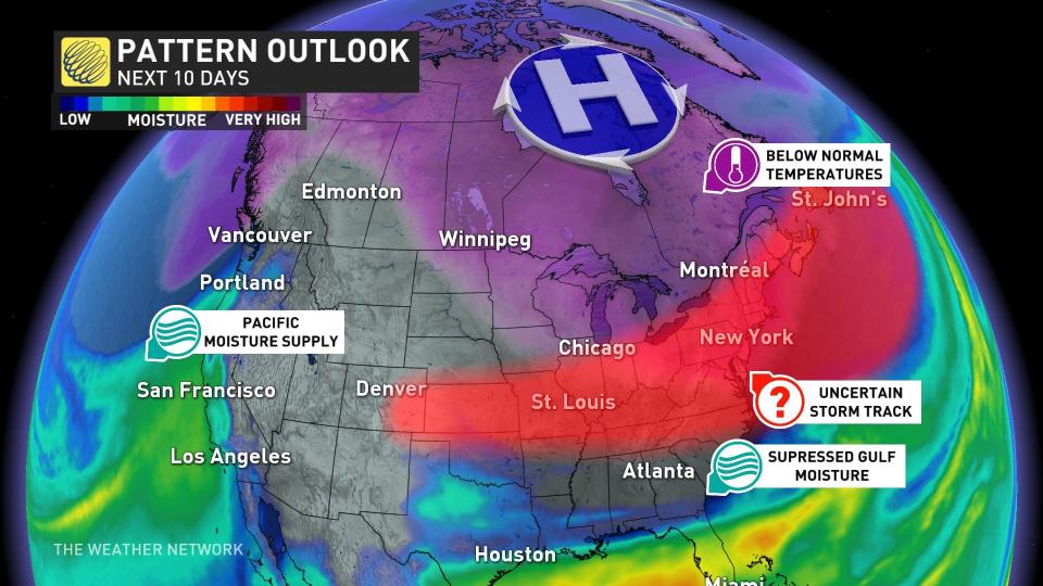
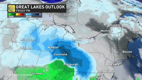
Over the next few weeks, a blocking pattern in the North will hold strong, holding colder air over the Great Lakes. This will provide the ingredients for impactful storms but the blocking pattern may be strong enough to force the storms to remain south of the border.
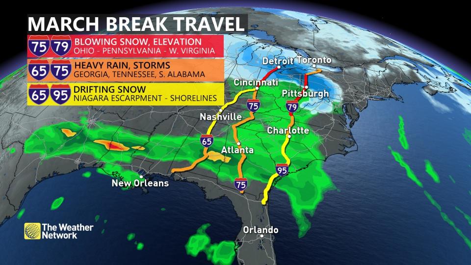
However, this isn't great news if you plan to head south of the border in the coming weeks, particularly during March break.