Fall is here and Southern Ontario's first Colorado low of the season is brewing
After days of rain and a distinct autumn chill, the low pressure system that has sat over northern Ontario will finally continue to push eastwards.
While more seasonal conditions and even splashes of sunshine will round out the week, forecasters are now closely watching the first Colorado low of the season in southern Ontario, which threatens a widespread rain and raw east wind off of Lake Ontario for Saturday.
This forecast is not so cut and dry, however, and one slight shift may mean a washout of a weekend, or a pleasant one. Here's what we know.
RELATED: How a super typhoon will alter Canada's late-October weather
Keeping a close eye on the track of this weekend's storm
Areas: Southern Ontario
Timing: Throughout Saturday and into the overnight
Weather: Colorado low
Southern Ontario's first Colorado low is brewing stateside, and will attempt to impact any outdoor weekend plans.
MUST SEE: How Colorado lows and Texas lows affect our weather in Canada
The storm is expected to develop and sweep across the Great Plains Thursday and Friday. Typically, storms that originate in southeastern Colorado track into the Great Lakes with widespread heavy rain and gusty winds -- a typical fall storm. However, high pressure that's brought above seasonal warmth to northern Canada will also converge over the province and attempt to bend the low's path south. Timing will be everything.
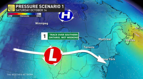
Scenario 1: The Colorado low dominates
A few long range models show the low barely being phased, and taking its normal track across the Great Lakes. This would mean a soaking 25-50 mm of rainfall and 50-60+ km/h winds Saturday and Sunday in southern Ontario.
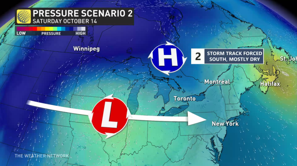
Scenario 2: High pressure dominates
A few other computer models show the high blocking precipitation all together for Toronto and areas north and east of the city. This would keep the heaviest rain and wind stateside, brushing southwestern Ontario with 5-20 mm of rain on Saturday with 30-50+ km/h winds gusting through the weekend.
Visit our Complete Guide to Fall 2023 for an in-depth look at the Fall Forecast, tips to plan for it and much more!
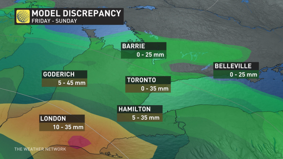
At this time, with 30-40 mm differences between the trends, rainfall totals are highly uncertain.
It is best to remain flexible with weekend plans, and check back as we lock down your forecast.
Confidence: Medium for storm impacts, low for exact totals
Stay tuned to The Weather Network for the latest forecast updates in Ontario.

