Oregon wildfire map: See where fires are blazing on West Coast as evacuations ordered
Rural areas near California's border with Oregon were under evacuation orders Wednesday after gusty winds from a thunderstorm sent a lightning-sparked wildfire racing through national forest lands, authorities said.
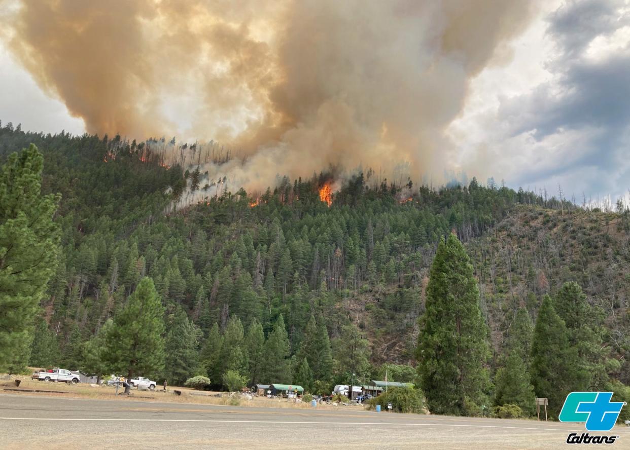
The blaze in Siskiyou County, dubbed the Head Fire, was one of at least 20 fires — most of them small— that erupted in the Klamath National Forest as thunderstorms brought lightning and downdrafts that drove the flames through timber and rural lands.
The U.S. Forest Service said in a Facebook post Wednesday night that there were 13 fires within the Smith River Complex in Del Norte County, three of which had been fully contained. The remaining 10 fires are estimated to cover over 1,500 acres, according to the post.
The California Department of Transportation closed U.S. Route 199 from Pioneer Road near Gasquet to the Oregon state line on Wednesday.
There is no detour and no estimate on when the highway will be reopened, according to the Oregon Department of Transportation's TripCheck. The status of the closure can be monitored via Caltrans Quickmap.
Travelers in the Rogue Valley are recommended to use U.S. Highway 101 to State Route 42S, the U.S. Forest Service said in a release Wednesday evening.
"Other routes are not recommended due to emerging fire activity and hazardous conditions," the Forest Service said. "Forest Service and Bureau of Land Management roads should not be considered for an alternate route."
MORE WILDFIRE NEWS: Evacuations ordered after winds whip Northern California wildfire near site of 2022 deadly blaze
Oregon wildfire map
US wildfire, smoke map
Oregon air quality map
Contributing: Salem Statesman Journal staff
This article originally appeared on USA TODAY: Oregon wildfire, smoke maps 2023: Active fires blazing on West Coast

