Oregon wildfire updates: Bedrock Fire brings closure to Fall Creek, new fire near Newport
Updated at 9:18 a.m. on Thursday, July 27
Here's the latest updates on major wildfires burning around Oregon.
Evacuations lifted on Sams Creek Fire east of Newport
The level 1 evacuations on the Sams Creek Fire east of Newport have been lifted, the Lincoln County Sheriff's Office said Thursday morning.
"There are no remaining evacuation notices in place for Lincoln County," the agency said.
Fire crews will remain on scene for the next 24-48 hours completing mop-up operations.
The fire grew to 5 to 7 acres on Wednesday night.
Crater Lake National Park bans campfires
With the increase in fire danger in southern Oregon, Crater Lake National Park will go into a full fire ban, the park said Wednesday.
"The outlook is for above normal significant wildland fire potential for the next several months," the park said in a news release. The fire ban, which includes developed campsites, goes into effect on Friday.
Wood fires and charcoal fires will not be allowed in Crater Lake National Park. Liquid fuel and propane camp stoves and gas grills are permitted in campgrounds, picnic areas, backcountry areas and residential areas.
Smoking is only allowed in cars and fireworks are also prohibited.
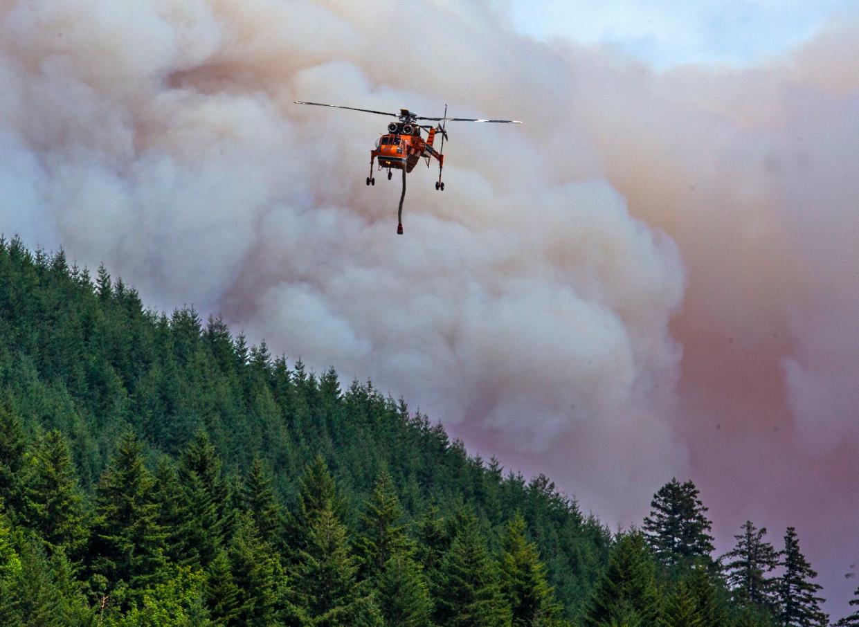
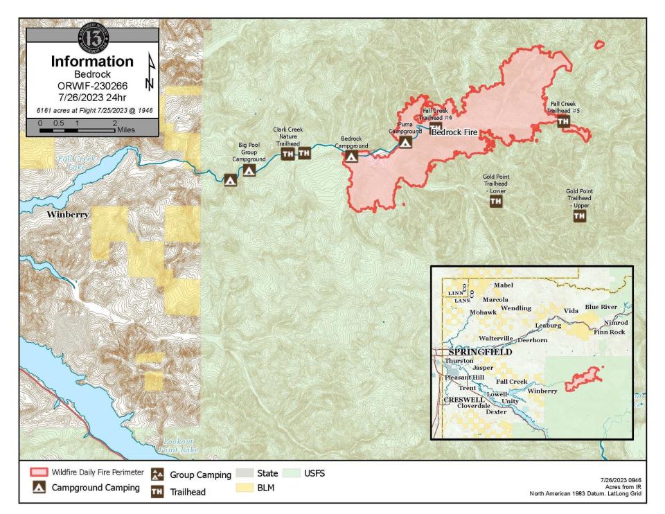
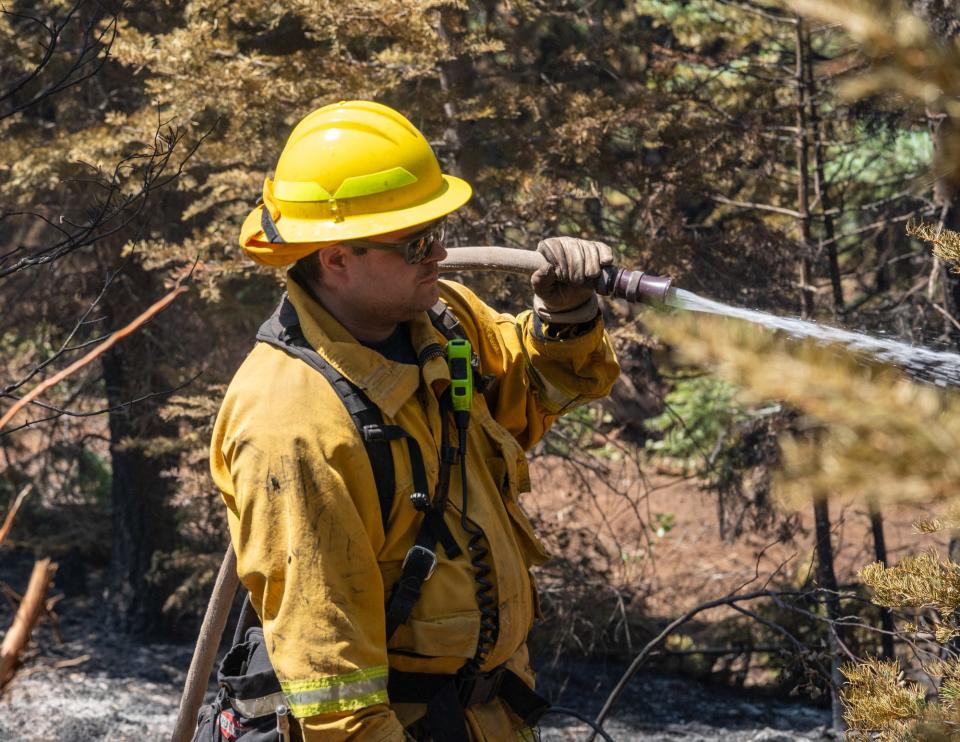
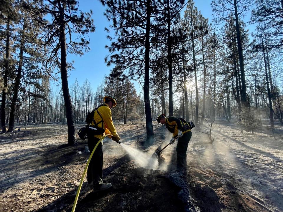
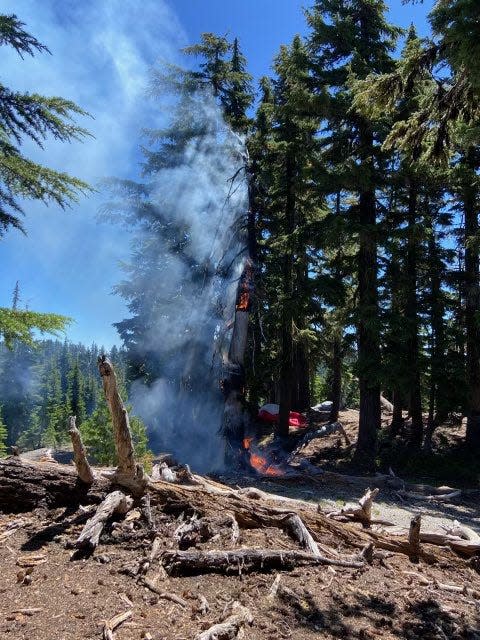
Bedrock Fire grows to 7,100 acres, brings major closure to popular Fall Creek area
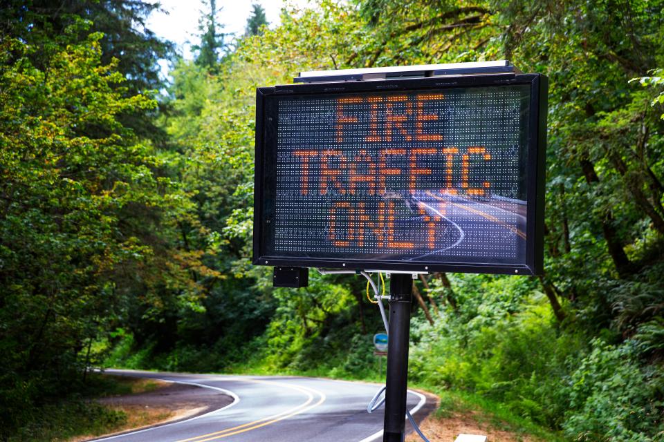
An emergency closure has been issued for the length of the popular Fall Creek area east of Eugene in Willamette National Forest in response to the 7,156-acre Bedrock Fire. The closure was made Wednesday afternoon by the U.S. Forest Service for the safety of the public and firefighters on the scene.
The area closed includes all recreation sites upstream of Fall Creek Reservoir. A full list of trails, campgrounds, recreation sites and trailheads are included in the closure order from the Forest Service.
Firefighting aircraft will also be scooping water from Lookout Point Reservoir Wednesday to fight the spread of the Bedrock Fire. The Lane County Sheriff’s Office added that anyone near or on the reservoir should use extreme caution and consider finding another area to recreate in the meantime.
The fire has spread to the east and north up Fall Creek.
“Fuels are abnormally dry for this time of the season due to drought," fire behavior analyst Dean Warner said in a Wednesday update, explaining why the fire has been so active in late July. "Drier fuels take less energy to ignite, and burn more rapidly and intensely than wetter fuels.”
The fire first ignited Saturday at the Bedrock Campground, in an area with a mosaic of some previously burned and unburned forest.
Fire personnel are working to establish fire lines along ridgelines between Little Cowhorn Mountain and Fawn Peak.
"In other areas, they are evaluating previous fire lines from past fires to see if any are suitable to reuse for Bedrock Fire," the Wednesday update said.
'One of those pristine Oregon experiences'
With camping, hiking and swimming access, the area sees its fair share of visitors over the summer. That includes Robert Aspen and his two kids, who live in the Fall Creek area and frequented the Bedrock Campground every other weekend.
"Driving through there you could see previous burns, but this one had been untouched... it really was one of those really pristine Oregon experiences," Aspen said. "This is our third big fire experience in four years or so, and it just seems to me like this is becoming a common part of living in the Pacific Northwest."
It's the third major fire to ignite in a campground this season, following the Boulder Fire and Flat Fire. No official cause has been listed.
Information requested on how fire started
Fire officials have asked the public for any information about how the fire ignited.
"The Forest Service asks that the public recall any information, photography, or videos they may have from their visit to the area where the fire began on July 22. Any information can assist investigators in determining the cause of the fire," a news release said. "Please submit any information that could assist fire investigation efforts to SM.FS.R6TipHotLine@usda.gov."
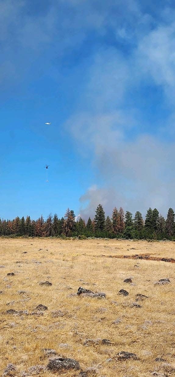
Flat Fire held at 23,687 acres, up to 4% containment
The acreage of Oregon's largest wildfire bumped up a little to 23,687 acres by Thursday morning, but it marked yet another day when the fire had seen very little growth. It increased containment slightly to 4%.
Fire crews continue to work on mop-up and burn-out operations along the permitter, other firelines are being added as an additional safety net.
"Forces working west from Game Lake are readying for firing operations to tie together the southwestern side of the fire. This action is critical to keep the fire from moving further to the southwest," a Wednesday afternoon update said.
More than 1,500 fire personnel are now working the blaze. As of Wednesday, drones and helicopters were also playing an important part with firing operations.
The fire is burning near the town of Agness near the confluence of the Illinois and Rogue rivers. In Sunday's report, the fire was listed as "human caused" for the first time. The fire ignited at Oak Flat Campground. No other details were released.
More: Fire crews get OK to use heavy equipment in Kalmiopsis Wilderness to fight Flat Fire

Pacific Northwest Team 3 — a team tasked with managing some of the nation's largest and most complex fires — took over management of the fire Sunday.
A fire line starts at Game Lake and stretches east over the Kalmiopsis Wilderness to its northern boundary. The fire team also will move resources toward the fire’s perimeter to establish lines.
There is a large closure area and a level 2 evacuation warning — meaning "be prepared to go" from Agness to Quosatana Creek. Curry County is sending evacuation notices utilizing Everbridge, which provides notices via phone.
Forest Service warns of increased fire danger
The U.S. Forest Service sent out a warning Wednesday morning that fire danger was high across the Northwest and likely to climb.
The agency's news release said this, in part:
"Summer 2023 is only halfway over and low spring rainfall has resulted in abnormally dry conditions as hot temperatures persist across the Forest Service’s Pacific Northwest Region. This situation poses a significant risk of wildfires, and residents of Oregon and Washington are urged to take precautions to prevent human-caused wildfire starts," a news release said.
This dryness, combined with record and near-record heat, has resulted in excessively dry vegetation in many areas. As a result, a new fire start could grow quickly, and existing fires may remain on the landscape until weather conditions change. This raises the threat of prolonged smoke impacts, which can have serious health consequences for those with respiratory issues.
To mitigate these risks, the Forest Service is encouraging the public to take the following steps:
Prevent human-caused wildfire starts. To report a wildfire, call 911.
Keep an eye on smoke forecasts and plan outdoor recreation accordingly.
Stay informed of fire restrictions and fire closures before heading out.
Golden Fire burned 43 homes, may have ignited from illegal marijuana grow
A wildfire that started over the weekend in southern Oregon has burned dozens of homes and caused area residents to lose 911 service and internet, state officials said Tuesday.
The Oregon State Fire Marshal said preliminary damage assessments from the Golden Fire east of Klamath Falls showed that 43 residences near the town of Bonanza were destroyed. More than 40 outbuildings were also consumed by fire.
The fire marshal said most of the structures are believed to have burned Saturday, when the fire started and spread rapidly in hot weather and gusty winds. Crews were unable to access the structures before Tuesday because of unsafe conditions, the fire marshal said.
Sherry Booth told KATU-TV that she lost her home to the fire.
She said she was in town when she got a call saying the fire was headed toward it.
“They were closing everything off, but we know a back way in so we did get to the house,” she said. “We had to go try to save our animals, and the cops were at the house and they were just telling us to grab our animals, go, go, go.”
By the time Booth returned home, her house was engulfed in flames.
“I did have insurance,” she said. “We’re going to see what we can do, what they have to say.”
The Red Cross Cascades had opened an evacuation shelter in response to the Golden Fire at Bonanza Schools (31610 Mission St., Bonanza).
The fire also significantly damaged a fiber optic line affecting most of the 8,200 residents in neighboring Lake County, causing a loss of 911 service, internet and phone service. The Lake County Board of Commissioners declared a state of emergency Monday because of the outage and said an estimate for restoring the line wasn’t yet known.
911 calls were being rerouted to Klamath County, and county emergency officials have been working with multiple state agencies to restore emergency connections, the commissioners said in statement. Temporary internet towers have also been put up and are providing services, commissioners said.
Fire crews also have been coordinating with utility companies that are working to repair damaged infrastructure, fire officials said Tuesday.
“Our hearts go out to the Bonanza community and those affected by the Golden Fire,” said Matt Howard, Oregon Department of Forestry Team 2 incident commander. “Our job now is to fully suppress this fire so the recovery process can begin.”
As of Tuesday morning, the blaze had burned about 3.2 square miles and was 9% contained.
Multiple fire crews and aircraft are working the fire. The estimated cost has grown to $2,937,000, according to an update from crews.
The cause of the fire is under investigation, the Klamath County Sheriff’s office said. According to initial information, the blaze may have started on private property being used to grow marijuana illegally, law enforcement officials said. The Golden Fire began Saturday afternoon at about 1 p.m.
Crews have made progress on the fire, holding it within its original footprint, although high potential exists for the fire to keep growing because of heat, high winds and available fuel, officials said.
Some mandatory evacuations were lowered Tuesday, but several hundred homes are still impacted by evacuations at all levels, officials said. A shelter remained open and served more than 80 people over Saturday and Sunday nights, according to the state fire marshal.
An air quality advisory also remained in effect for the central and southern parts of Oregon into at least Wednesday night because of the Bedrock Fire burning between Eugene and Bend and the Flat Fire burning in southwest Oregon.
Oregon Department of Environmental Quality spokesperson Laura Gleim said air quality levels will vary between unhealthy and hazardous, improving at times during the day then getting worse overnight, Oregon Public Broadcasting reported.
-Associated Press

Haight Creek Fire containment grows to 40%
Southwest of Veneta in Lane County, containment of the Haight Creek Fire had grown to 40% by Sunday. A Monday update from the fire team said the crew was able to expand mop-up efforts after clearing other hazards near the line.
Some smoke may be visible to communities nearby as the rest of the fuel is burnt inside the fire’s perimeter, alongside other conditions from fires farther away.
“Fighting an active fire always draws a lot of the public’s attention, but the mop-up phase is equally important, and it takes considerably more time,” Ole Buch, Oregon Department of Forestry district forester, said in Monday’s release. “Folks are often surprised that trapped heat within the fire can smolder for months and even put off smoke. District staff will patrol the fire’s perimeter throughout the summer to keep a close eye.”
No evacuation orders have been issued and no structures or powerlines are threatened. The biggest threat is to natural resources, the Oregon Department of Forestry said. Access to Oxbow Road is also closed near the fire for the safety of the fire team.
The fire started July 18 on Oregon Department of Forestry-protected BLM land. The cause of the fire is under investigation.
Simnasho Fire improves to 25% containment on Warm Springs
A wildfire burning west of Simnasho on the Warm Springs Indian Reservation was listed at 1,249 acres Monday but has been bumped up to 40% containment.
There are no evacuations or road closures at this time. Highway 9 is limited to local and fire traffic only.
"Today the focus will continue to be the southern flank and continuing to watch for spot fires," a Facebook post from the Wildland Fire Management Team for Warm Springs said Monday.
Human-caused fire contained on South Sister climbers trail near Moraine Lake
A human-caused wildfire was contained Sunday on the South Sister climbers trail near Moraine Lake Trail. Smokejumpers were dispatched and had a line around a blaze that didn't grow larger than an acre.
“The fire is human caused,” Central Oregon Fire Information added.
Abigail Landwehr is an outdoors journalism intern for the Statesman Journal. She can be reached at alandwehr@gannett.com
This article originally appeared on Salem Statesman Journal: Oregon wildfire updates: Bedrock Fire brings closure to Fall Creek

