Oregon wildfire updates: Boulder Fire 100% contained, Flat Fire grows to 15,217 acres
This story was updated at 11 a.m. Friday
A number of wildfires have continued their spread in Oregon. Here are the latest updates.
Haight Creek Fire
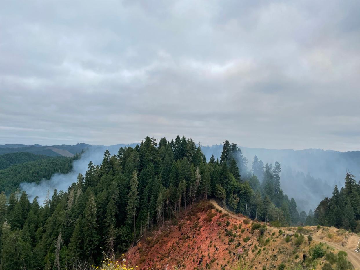
The Haight Creek Fire is estimated to have burnt more than 107 acres southwest of Veneta in Lane County.
A Friday morning report from ODF Western Lane District said crews stopped the forward progress of the fire by finishing a direct line around the fire perimeter. As of Friday morning, the fire was 10% contained.
“ODF will retain two type-two helicopters to assist with mop-up activities and any potential risks,” the department said in Friday's update. “Last night was also the last fully staffed night shift on the fire; although, day shifts will continue for some time.”
Firefighting aircraft began scooping water from Fern Ridge Reservoir Wednesday afternoon to fight the fire's spread near Alma. However, the containment of the fire also means less of a need for aviation help, and all type-one helicopters were released as of Friday.
No evacuation orders have been issued and no structures or powerlines are threatened. The biggest threat is to natural resources, the Oregon Department of Forestry said. Access to Oxbow Road is also closed near the fire for the safety of the fire team.
The fire started Tuesday on Oregon Department of Forestry-protected BLM land. The cause of the fire is under investigation.
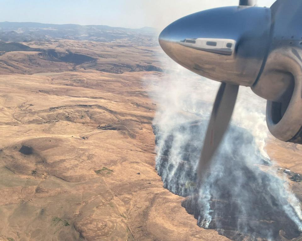
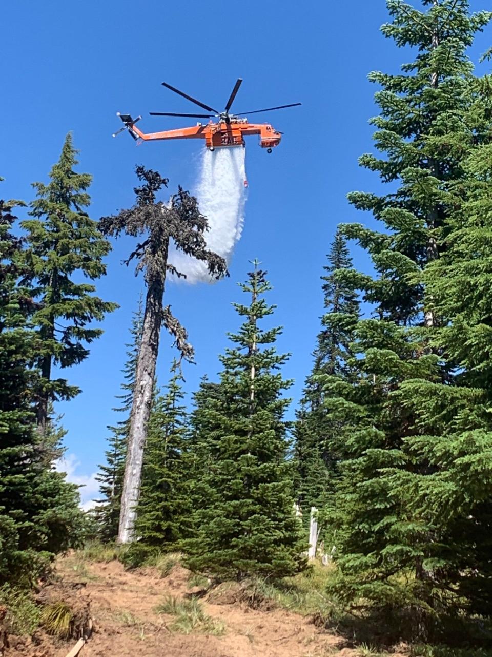
Flat Fire in southern Oregon grows to 15,217 acres
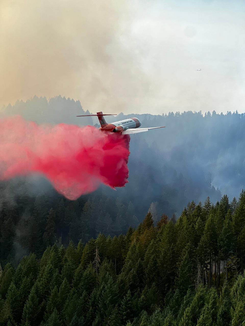
Growing 2 miles southeast of Agness, the Flat Fire has burned 15,217 acres, according to the fire team. No infrared was flown Thursday night because of visibility issues.
A Level 2 evacuation notice from Agness to Quosatana Creek was issued by the Curry County Sheriff’s Office Thursday. The county is issuing evacuation notices through Everbridge, an emergency program that can be signed up for on the Curry County website. July 15's Level 3 evacuation order on Old House Creek Road is also still in place.
A community meeting will be held Saturday in Gold Beach High School cafeteria at 3 p.m. The event will also be livestreamed on the Flat Fire Facebook Page.
Flames became more active toward Lawson Creek along Wildhorse Ridge Friday. While the rest of the scene is still active with moderate behavior, the fire team has been able to maintain minimal spread to the north and southeast. The fire's path is driven by a mix of large timber and dead ground vegetation.
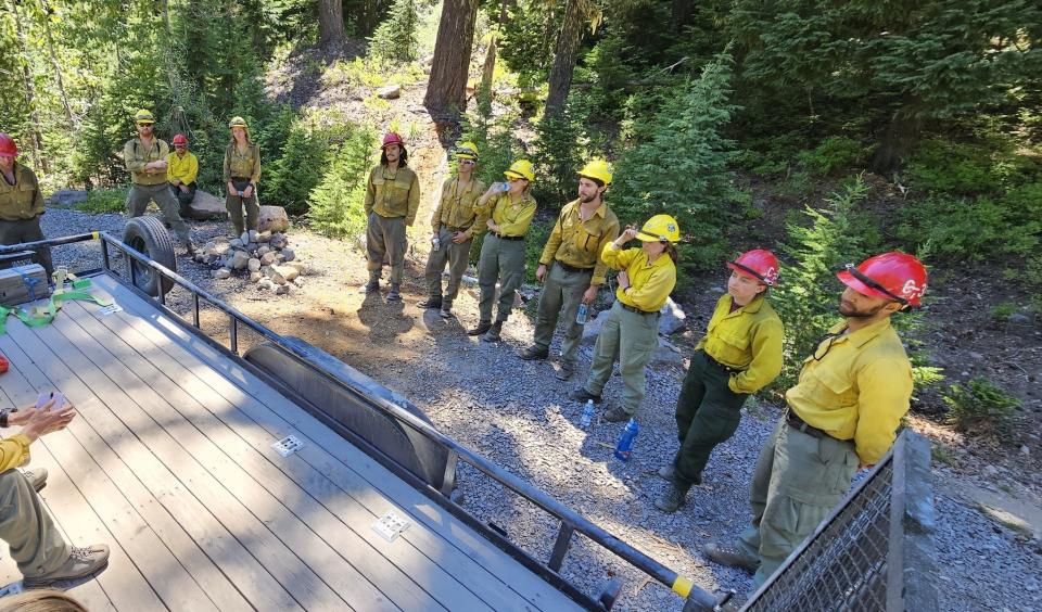
The fire team working the Flat Fire includes at least 936 personnel.
The fire’s perimeter has been moving back and forth between the Oak Flat and Agness area of southwest Oregon's Rogue River-Siskiyou National Forest, also burning about an hour east of Gold Beach near the confluence of the Illinois and Rogue rivers.
“Structure groups remain in place ensuring protection of nearby structures,” Friday’s release said. “Crews will continue small burnout operations, slowing fire spread, ensuring the fire stays away from Gold Beach and Agness.”
The focus of teams Wednesday was shifted toward the north side of the fire as crews worked to protect the community of Agness. Structure protection groups are also in place working to protect buildings. The fire has threatened about 40 structures, the fire team has said previously.
A public lands closure was issued for the area on Monday night. That closure covers the Illinois River, its trail and the northern half of the Kalmiopsis Wilderness. Still, the Rogue River remains open and accessible.
Roads, trails and part of the Illinois River are under other closures issued by Rogue River-Siskiyou National Forest. Increased fire traffic on the roads nearby should also mean increased caution for drivers in the area, the fire team added in a news release.
Mixes of winds and low humidity have also led to a red flag warning, now in effect throughout southern Oregon.
The wildfire first ignited at Oak Flat Campground toward the mouth of the Illinois River on July 15. The cause of the fire is still under investigation, according to the team.
The 224 Fire
Now at 75% containment, the 224 Fire has not grown from 38 acres. The 224 Fire first ignited 5 miles southeast of Estacada. While all evacuations were lifted Tuesday night, North Fork Road 4610 in the area is closed for firefighter safety.
Promontory Park opened to the public Wednesday.
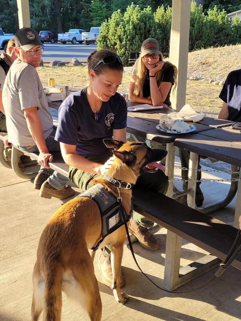
By Thursday evening, a 100 foot mop-up was completed along the fire line. The fire team also took a quick break to spend some extra time with the DoveLewis Portland Area Canine Therapy Team.
“Tonight, operations will work to mop-up into 100 feet of fire with the assistance of an infrared camera, where safety allows,” an update from the Oregon Department of Forestry North Cascade District said. “The infrared camera is a thermal imaging camera that finds heat in the fire during night, allowing our crews and firefighters to mop them up efficiently.”
The cause of the fire is still under investigation, according to the fire team.
Antelope Creek Fire
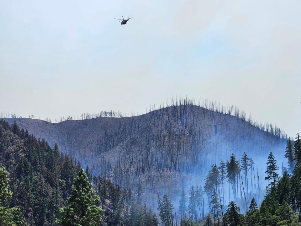
South of Antelope, the Antelope Creek Fire flared up Wednesday evening and is now 100% contained. Burning 380 acres and fueled by wind, teams were able to quickly stop forward progression Wednesday night. The cause is still under investigation, according to Central Oregon Fire Information.
Boulder Fire
The Boulder Fire in Mount Hood National Forest is now 100% contained, overall burning 233 acres. Active firefighting wrapped up Thursday, according to an update from the Forest Service.
Next on the list: suppression repair, backhauling equipment and patrolling the fire area. Some of those efforts include removing extra dirt and vegetation debris which were added for fire lines, or removing fire-weakened trees. Repairs of roads that were damaged during the fire are also a new focus for the team.
During the Boulder Fire, roadways, campgrounds and trails north and east of Forest Road 48 in the Barlow Ranger District were closed. Boulder Lake Campground, Little Boulder Lake, Bonney Meadows Campground, Badger Lake Campground, Camp Windy and Port Camp Campground remained under a Level 3 evacuation as of Thursday.
Fire officials are also asking for help in determining how Boulder Fire started. Any information, photos or videos that could help fire investigators can be sent to SM.FS.R6TipHotLine@usda.gov
Abigail Landwehr is an outdoors journalism intern for the Statesman Journal. She can be reached at alandwehr@gannett.com
This article originally appeared on Salem Statesman Journal: Flat Fire grows to 15,217 acres, Boulder Fire 100% contained

