Oregon wildfire updates: Fire shuts down Cottonwood Canyon State Park
This story was updated at 4:44 p.m. Tuesday.
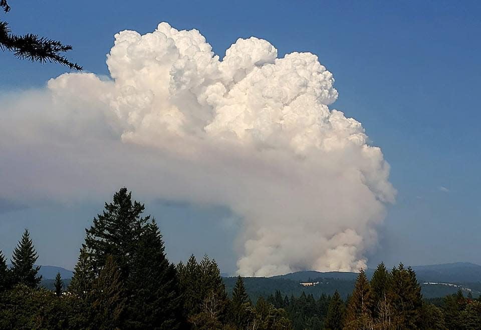
Lightning strikes brought some 50 new wildfires to Western Oregon last week, and now some of those fires have grown into a blazes bringing air quality issues, evacuations and public lands closures.
Here’s the latest updates. This page will be updated with new information as it becomes available.
Closure breakdown: McKenzie Highway 242 closed, massive land closure issued due to four wildfires
4:44 p.m. Tuesday: Wildfire shuts down Cottonwood Canyon State Park, closes Highway 206 in Eastern Oregon
A rapidly-growing wildfire burning in the John Day River Canyon has closed Cottonwood Canyon State Park and shut down Highway 206.
The fire is about 1 mile south of the Eastern Oregon state park, burning on both sides of the river and growing rapidly, according to the Sherman County Sheriff's Office. The section of river where the fire is burning is considered among Oregon's most scenic stretches of water and best floating trips.
Park visitors and staff have been safely evacuated, Oregon Parks and Recreation Director Lisa Sumption said.
"Firefighters on the ground are supported by aerial resources, including four single-engine air tankers and two large air tankers," Central Oregon Fire Information said.
12:50 p.m. Monday: Will incoming rain be enough to quell Oregon wildfires?
Two system of rainfall are expected to hit Western Oregon this week, potentially bringing a major slowdown to what’s become a very busy wildfire season.
There are two slugs of moisture forecast — one arriving Tuesday and another on Thursday, said meteorologists at the National Weather Service in Portland and Medford.
“Overall, it’s looking very favorable for a decent amount of precipitation,” said David Bishop, a meteorologist with NWS Portland. “It won’t necessarily put the kibosh on every fire that’s currently active, but it should put down some of the smaller ones and improve conditions on the bigger ones.”
The system arriving on Tuesday is the lighter of the two, with 0.1 to 0.2 of an inch possible, with more likely in the mountains. Northwest Oregon should get at least some rain, while southwest Oregon is unlikely to see as much.
🙋♀️ Who is ready for some rain? A weather system is forecast to bring chances of rain showers to much of NW OR & SW WA tomorrow - Wednesday. There's also a 15-35% chance of thunderstorms across the region Monday afternoon - Tuesday. #ORwx #WAwx pic.twitter.com/OtWYh35JzJ
— NWS Portland (@NWSPortland) August 28, 2023
The big question centers on Thursday’s storm, which is forecast to be heavier and could bring a quarter to a half inch of rain, said Bishop.
“I’m not saying it’s going to happen, but the Thursday system could overperform and really bring a lot of help,” Bishop said.
Bishop said he understood the skepticism, given how dry Oregon has been.
“We’re getting a really good sign of a pattern change already with that cool marine layer spreading across the area. That’s a good sign this one is going to hold up.”
In southwest Oregon, Chandler Price, with NWS Medford, said they were optimistic about a few tenths of an inch and up to a quarter to a half inch of rain in the mountains.
“I wouldn’t call this a fire-season ending event,” Price said. “It should be beneficial, helping clear out smoke and slowing down the fires, but I don’t see it bringing an end to fire season.”
Big change to our weather pattern this week & beyond. @NWSCPC is giving the Pacific Northwest a high likelihood of above normal precipitation (and near normal or below normal temps) as we wrap up August and start September. Fires won't like that! Here comes Fall! #ORwx #WAwx pic.twitter.com/vcXBIu2yXd
— Jeff Forgeron (@WeatherJefe) August 28, 2023
12:05 p.m.: Highway 242 and massive public lands closure issued (updated)
McKenzie Pass Highway 242 is closed and a massive public lands closure was issued Monday for the McKenzie Corridor, McKenzie Pass, South Santiam area and Three Sisters Wilderness due to multiple wildfires in the area.
The closure will have a major impact on recreation in the Cascade Range between Eugene and Bend, as more than 100 campgrounds, trailheads and trails, boat ramps and other recreation sites are closed. Segments of the Pacific Crest Trail are included in the closure (see details below).
The closures are due to four active and growing wildfires in the area. including the Lookout Fire (21,135 acres) and Horse Creek Fire (616 acres), which are just north and south of Highway 126 near the town of McKenzie Bridge.
The other two fires include the Pothole Fire (74 acres), which is located south of Highway 242 and the Pete's Lake Fire (300 acres) in the Three Sisters Wilderness.
All wildfire closures Willamette-Deschutes national forests by Zach Urness on Scribd
An online version of the map can be found here at https://www.fs.usda.gov/Internet/FSE_DOCUMENTS/fseprd950391.pdf.
The new fires ignited following a lightning storm last week that brought more than 1,600 strikes across Western Oregon.
Highway 242 closed
Highway 242 is closed on the west side at the winter snow closure gate, 7 miles from its intersection with Highway 126, and on the east side, 14 miles east of Sisters.
That closure cuts off large parts of the Three Sisters and Mount Washington Wilderness areas, including iconic sites along the highway such as Dee Wright Observatory.
Pacific Crest Trail closure
A large segment of the Pacific Crest Trail is closed from the junction with Winopee Lake Trail (#16) and Elk Creek Trail (#3510) to the junction with Mirror Lakes Trail (#20).
(For more in-depth details on the closure, see this story)
11:20 a.m.: Camp Creek Fire outside Portland grows to 1,600 acres
The Camp Creek Fire burning outside Sandy, in the basin that brings Portland's drinking water, grew to 1,600 acres with 0% containment by Monday morning.
"Yesterday’s somewhat more favorable weather conditions moderated fire behavior and limited growth," a Monday update said. "The fire stayed mostly in its footprint from Friday. The fire burned in heavy fuels, and it continued to move up drainage to the northeast and east."
Aircraft is dropping water on the blaze using helicopters and fixed-wing aircraft, also known as dippers, which scoop water from Bull Run Reservoir and the Columbia River.
"No fire retardant is being used, but it could be if needed to help contain the fire along Forest Road (FR) 14 on the fire’s southern flank," fire crews said.
Incoming "rain showers and isolated thunderstorms are possible this evening, but warm and dry weather conditions are expected to continue today and into the future," the Monday update said.
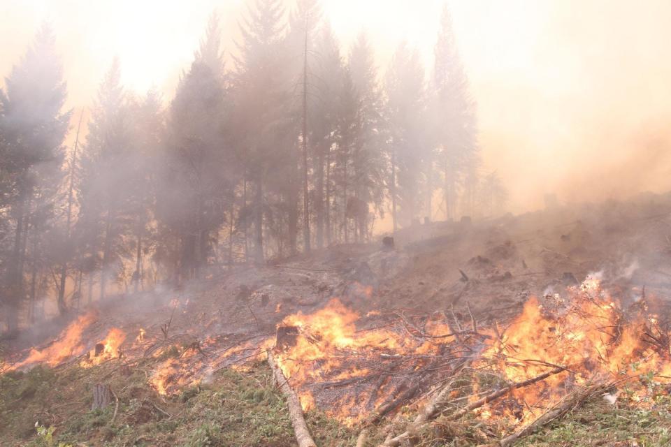
10:20 a.m.: Lookout, Horse Creek and Pothole fires all show growth in McKenzie area
The three wildfires burning in the McKenzie River corridor, east of Eugene, all showed growth by Monday morning.
The Lookout Fire which has been burning longest, grew to 22,317 acres but is also 17% contained.
Of greater concern — and the reason for a wave of new evacuations and closures — has been the Horse Creek Fire, which doubled in size to 616 acres. Horse Creek fire is located about five miles southeast of of McKenzie Bridge.
"Fire crews, equipment, and air resources are actively engaged in full suppression efforts in the Horse Creek drainage," a Monday update said. "Firelines on the north and west edges are holding well. The fire has been moving eastward due to terrain and winds. Some dozer and hand lines have been installed to check eastern fire spread."
The Pothole Fire, located 6.5 miles south of Belknap Hot Springs, grew to 99 acres
"It is adjacent to a previously burned area which is slowing its rate of spread. Active fire is moving uphill to the west," the Monday update said.
10 a.m.: Bedrock Fire reaches 71% containment, evacuations downgraded
Containment of the 31,000-acre Bedrock Fire, in the Fall Creek area east of Eugene, reached 71% by Monday morning, bringing a new wave of evacuation downgrades.
Peninsula Road east of Timber Creek and Big Fall Creek Road were downgraded to level 1 (be set) evacuation warnings.
Evacuations for Three Sisters Wilderness, closures coming
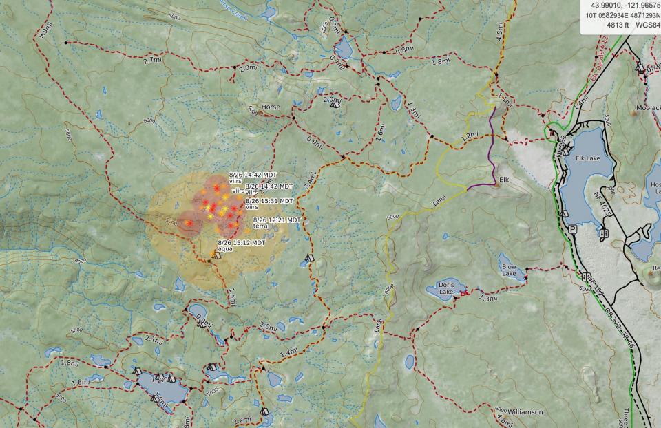
A level 3 evacuation order (go now) has been issued for parts of the Three Sisters Wilderness west of Elk and Hosmer Lake along Cascades Lakes Scenic Highway outside Bend due to the Pete's Lake Fire.
A level 1 evacuation warning (be set) is for the east side of the highway. A map of the evacuation order can be found here.
The fire has grown to an estimated 100 acres.
"Although only 100 acres, the fire could spread rapidly & evacuating hikers is very difficult," Central Oregon Fire Information said.
The areas included in the level 3 evacuation include: All areas west of the Cascade Lakes Highway from the Lucky Lake Trailhead north to the Mirror Lake Trail. This includes the areas around Lucky Lake, Leech Lake, Doris Lake, Blow Lake and Mirror Lakes.
Areas in the level 1 include: Areas around Elk, Hosmer, Lava and Little Lave Lakes. This includes areas east of Cascade Lakes Hwy from Blue Lagoon north to Quinn Meadows.
A public lands closure for the area will be issued later in the day.
Silver Falls fire out cold, closed trails to reopen
The small wildfire that sparked in the backcountry of Silver Falls State Park and brought closures to four trails is out. Known as the Conference Fire, it burned less than an acre. The four trails that were closed — Upper Smith, Cutoff Trail, Buck Mountain, and Howard Creek trail — will reopen Monday.
Wildfires burning near Mary's Peak, on Oregon Coast near Florence
Two fires are burning in the Oregon Coast Range or in coastal areas of Siuslaw National Forest.
The Rock Creek Fire, located 10 miles west of Corvallis near Marys Peak, is burning in large timber on a steep and rugged slope, officials said. The fire is holding at approximately 12 acres.
"Smoke is visible from the summit of Marys Peak. There are no closures or impacts to recreation at this time"," a news release said. "Throughout the weekend, over 60 firefighters aided by Oregon Department of Forestry and Miller Timber Services, worked aggressively to keep the fire as small as possible."
The Three Buttes Fire, burning 15 miles northeast of Florence, is estimated at 50 acres.
A hot shot crew is scouting for the best access to directly engage, officials said. A Type 3 incident command team will take over managing the fire Sunday afternoon.
The cause of this fire is under investigation.
"Late summer hot temperatures and dry conditions lead to ground cover and vegetation that is highly receptive to fire," a news release said.
Lookout, Horse Creek, Pothole fires bring evacuations
Fire crews have had their hands full managing both the Lookout Fire (21,135 acres), Horse Creek Fire (100 acres) and Pothole Fire (50 acres) in the McKenzie River corridor east of Eugene.
Lookout and especially Horse Creek have been active and brought evacuations. See this map for latest evacuations.
Roughly 1,000 fire crew members are working the blaze. The Lookout Fire is 16% contained and the Horse Creek Fire has brought the most action recently.
“Firefighters continue efforts to suppress fire activity in the Horse Creek drainage. Last night, the fire line on the western edge of the Horse Creek Fire held and will continue to be secured throughout the day today," a Sunday update said. "The primary growth of the fire occurred on the northern and eastern edges. Helicopters have dropped over 50,000 gallons of water and retardant and will continue as needed.”
The Pothole Fire is about five miles southeast of McKenzie Bridge. “Firefighters are gathering on-the-ground information on this fire to develop a suppression plan today,” the report said.
An evacuation center is in place at Westridge Middle School in Oakridge for evacuees and small pets from the Bedrock and Lookout Fires. A large animal shelter is established at the Lane County Fairgrounds in Eugene.
Bedrock Fire see evacuation downgrades, is 57% contained
The 31,000-acre Bedrock Fire, burning in the Fall Creek area east of Eugene, saw downgrades Sunday in its evacuation status.
The following areas were being reduced to a Level 1 (be ready) evacuation levels: Winberry Creek Road east of milepost 4.0, Big Fall Creek Road east of Winberry Creek Road to Peninsula Road, Peninsula Road along the south of Fall Creek Reservoir to Timber Creek.
The fire is 57% contained and hasn’t seen major growth despite the red flag warnings.
Umpqua National Forest battles 11 new fires
Perhaps the area hardest hit by the lightning was Umpqua National Forest, which is dealing with 11 new wildfires.
“The region is feeling a shortage of resources, and these new fires are being staffed based on the values that are at risk and the potential for growth,” a news release said.
The fires in question, via Umpqua National Forest:
The Chilcoot Fire is estimated at 250 acres and is located in the Umpqua National Forest in Steamboat Creek and Canton Creek areas. Umpqua National Forest has two engines, two hand crew squads, one water tender, falling module, one dozer, and miscellaneous overhead on scene. A Type 2 Incident Management Team has been ordered. Aviation resources have been ordered.
The Ridge Fire is estimated around 150 acres near Bear Camp area. This fire entered the Boulder Creek Wilderness today. Two crews, two squads, overhead, and Task Force Leader is on scene.
The Dinner Fire is at 150 acres and is located near Dinner Creek and Hollow Meadows Road.
The Wyatt Fire, previously Brice Fire, is 30 acres and is located near Noonday Ridge. Helicopter reconnaissance occurred today.
The Bohemia Fire is less than an acre on private land and is holding within containment lines, but not fully contained. One engine is on scene and will stay overnight.
The Watson Creek Fire is less than an acre and east of Toketee Airstrip and southeast of Watson Falls. One Incident Commander is on scene and a falling module has been ordered.
The Timbered Knoll Fire is located west of Forest Service Road 5050 and is less than an acre. Falling module was on scene earlier today. Three engines are enroute.
The Prather Fire is a 10-acre fire east of Prather Creek and two miles north of Laying Creek Work Center. Two loads of rappelers on scene. A Type 6 Engine and a 20-person crew from Oregon Department of Forestry are also on scene.
The Brice Creek Fire is at 60 acres. One engine and a Type One Helicopter on scene today.
The Snowpark Fire is less than an acre with two engines and two hand crew squads. This fire is about one mile south of Cinnamon Butte.
The Hill Fire is currently contained and under one acre.
Tyee Ridge Complex burns rapidly outside Sutherlin, brings evacuations
The Tyee Ridge Complex is a group of 19 wildfires located 10 miles west of Sutherlin in northwest Douglas County. The fire is being managed by the Oregon Department of Forestry and Oregon State Fire Marshal.
Oregon Governor Tina Kotek has invoked the Emergency Conflagration Act for the blaze to allow OSFM to mobilize structural firefighting resources to protect life and property on two of the 19 fires that comprise the complex.
The fires are a combined 1,816 acres.
From a Sunday morning report:
“Last night, crews saw active fire growth on the Cougar Creek and Rattlesnake Ridge fires which grew together. There was also very active fire, including uphill runs on the Lighthouse 3 and 4 fires. Overnight, Fire Marshal crews provided protection from active fire to homes near the fires. There has been no loss to any homes or structures to date. There is potential for significant fire growth on some of the fires over the next couple of days.”
A total of 73 residences are under level 3 (go now) evacuation orders and 31 at level 2 (be set). An estimated 125 people have evacuated from the Hubbard Creek Road area west of the town of Umpqua.
A shelter for evacuees is located at Oakland Elementary School.
An evacuation map can be found here.
Southern Oregon has four new fires in Rogue River-Siskiyou National Forest
Multiple new wildfires also ignited in southwest Oregon. They include, via Rogue River-Siskiyou National Forest:
The Grayback Fire is burning on the Wild Rivers Ranger District and is estimated to be 25 acres. Smokejumpers and numerous other ground resources are on scene, making headway on containment line around the head of the fire and mitigating hazard trees that pose a threat to both containment and firefighters on the ground. Aircraft were utilized through the first part of the day until they were grounded due to poor visibility.
The Barklow fire, burning northeast of Gold Beach on the Powers Ranger District, is estimated at eight acres and has hose lay and handline around the perimeter. Coos Forest Protective Association and the Flat Fire have assisted with air and ground resources on this fire.
The Winchuck Fire is 0.7 acres and has been 100% lined.
The Anvil Fire is burning in the Grassy Knob Wilderness. It was approximately 20 acres at last report. A dozen rappelers were dropped into the fire area Sunday and will begin to build containment line, improve access, construct helistops while other ground resources make their way to the location. Sunday’s suppression efforts again heavily utilized air tankers to keep the fire from progressing.
Smith River Complex grows to 68,094 acres
The Smith River Complex burning on the Oregon-California state line grew to 68,000 acres, and continued to inch upward into Oregon. The greatest impact continues to be in the Gasquet, Calif. and Crescent City, Calif., area.
There are large evacuation orders and warnings in both states.
Full details can be found here.
Zach Urness has been an outdoors reporter in Oregon for 15 years and is host of the Explore Oregon Podcast. To support his work, subscribe to the Statesman Journal. Urness is the author of “Best Hikes with Kids: Oregon” and “Hiking Southern Oregon.” He can be reached at zurness@StatesmanJournal.com or (503) 399-6801. Find him on Twitter at @ZachsORoutdoors.
This article originally appeared on Salem Statesman Journal: Oregon wildfire updates: Fire shuts down Cottonwood Canyon State Park

