Oregon wildfires: Lookout, Bedrock fire updates and how to help wildfire evacuees
This story was updated at 1:30 p.m. Saturday, Aug. 19
While the stretch of record-breaking temperatures appears to be over for the new few days, temperatures will remain in the 80s and 90s over the weekend as wildfires continue to burn across Oregon.
Here is the latest on the wildfires.
Level 3 'go now' evacuation orders issued for Lookout Fire
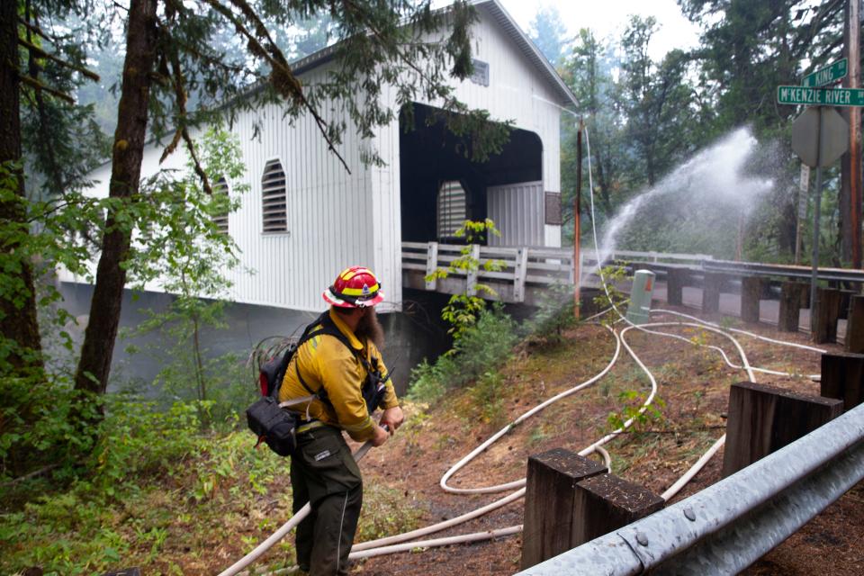
The Lookout Fire burning north of McKenzie Bridge crossed over the border Linn County shares with Lane County and has grown to 8,609 acres, according to a Saturday update.
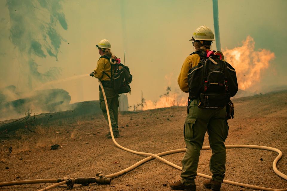
According to a Saturday update, a shift in weather was set to cause an increase in fire activity, with the most active part of the fire in the north and northeast.
On Saturday, crews were focused on holding the fire line and will use strategic firing operations to strengthen fire lines, according to the update. Retardant drops were set to be used in key areas to assist crews on the ground. Just over 900 personnel are assigned to the fire.
The fire started Aug. 5 north of McKenzie Bridge. A heavily forested area and rugged terrain originally made it difficult for crews to get to the fire and it has rapidly spread over the past week.
Both Linn County and Lane County Sheriff’s Offices are coordinating efforts with Lookout Fire Command and the Incident Management Team. The evacuations for both counties changed Friday afternoon.
The Lane County level 3 "go now" evacuations include:
The area south of Highway 126 to the McKenzie River from the east end of McKenzie River Drive to the McKenzie River Bridge just east of Taylor Road
Taylor Road
North Bank Road
All areas north of Highway 126 between Blue River Reservoir Road and Drury Lane
Mona Campground
Lookout Campground
H.J. Andrews Headquarters
The area west of Highway 126 from Scott Road north into Linn County
The Lane County level 2 evacuations include:
Paradise Campground
Forest Service Road 302
Highway 126 from the Highway 242 junction to Scott Road.
Belknap Springs Road S.
The area east of Highway 126 from Scott Road north into Linn County.
The Lane County level 1 evacuations include:
Highway 242 to Forest Service Road 220
Yale Lane
Camp Yale Road
Forest Service Road 2643 southeast to the 445 spur
Areas south of Highway 126 from Blue River Reservoir Road east to Foley Ridge Road.
McKenzie River Drive.
Linn County level 3 evacuations include:
Olallie Campground
Trail Bridge Reservoir & Campground
Trail systems and roadways north of the Linn County line and west of Highway 126.
Then from Highway 126, the evacuation order extends north to the intersection of National Forest Service Road 730 and Highway 126 (entrance to the Carmen-Smith Hydroelectric facility).
Tamolitch Falls/Blue Pool and Smith Reservoir are both in the level 2 evacuation notice from Linn County.
Sahalie Falls has also been added to the closure area near the fire in the Willamette National Forest.
Other areas under level 2 evacuation orders in Linn County:
The area from the east side of Olallie Campground east to the Willamette National Forest Boundary.
North along the boundary to Ice Cap Campground and Trailhead
Then west to encompass Lakes End Campground and trail system
And south with the intersection of National Forest Service Road 730 and Highway 126 (entrance to the Carmen-Smith Hydroelectric facility).
The level 1 Linn County evacuation zone includes all areas around Clear Lake, and Clear Lake Campground:
Areas north of Ice Cap Campground
The order extends east to the Willamette National Forest boundary
Then north in line with Highway 20.
As of Saturday morning, no structures have been burnt by the Lookout Fire.
An emergency closure issued for the Lookout Fire area expanded in the Willamette National Forest on Wednesday for public and firefighter safety.
An interactive map of Linn County and Lane County can be found on both sheriff's office websites.
Lookout Fire shelter information
A shelter for evacuees from the Bedrock and Lookout fires was opened by the Red Cross at Lowell High School, 65 Pioneer St. A non-emergency line for the Bedrock and Lookout fires can be reached at 541-682-2055 for evacuation information.
For large animals or livestock sheltering, shelter is available at the Lane Events Center at 796 W. 13th Ave. in Eugene. Owners need to call or text Lane County Animal Services at 541-285-8227 before getting to the center and need to leave a message including the number and type of animals.
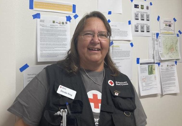
American Red Cross shelter coordinator Donda King said 90% of the more than 20 people at the shelter on Friday evacuated from the Lookout Fire.
“A lot of them have gone through previous fires," King said. "If it wasn’t here it was down in California."
"It’s sad talking to them," she said. "I can’t imagine going through it one time."
The shelter has enough donations, but is looking for a partner to provide propane and gas vouchers. Money donations can be made by calling 1-800-red-cross (1-800-733-2767) or at redcross.org. “It’s the funds that help us purchase the meals and the supplies that they need,” King said.
Communities look for support following Lookout Fire evacuations
For the communities under the fire’s evacuation order, similarities between the Lookout Fire and the Holiday Farm Fire just three years earlier are too close for comfort.
“I lost my business, my home in Blue River,” Chris LaVoie, the community outreach coordinator of McKenzie Community Partnership said. “I can’t tell you the amount of anxiety that I've been feeling … we've got a lot of people that pre-evacuated, even if they weren't in the zone, it's just because the last one is so hard. It was so devastating.”
The 2020 Holiday Farm Fire burnt more than 173,000 acres, including more than 500 homes and businesses. McKenzie River communities have been rebuilding ever since.
The McKenzie Community Partnership has spent three years trying to support different projects and approaches to recover structurally and economically from damage.
This time, the organization is trying to start efforts as soon as possible.
“We're gearing up to try to figure out how we can support people before, instead of after,” LaVoie said.
Those looking to help anyone displaced by the Lookout Fire can find a donation fund on the MCP website.
“A few years and still very little has come back,” LaVoie said. “The consultants that came through after the last fire told us, ‘you know, the first year, people are usually really good about helping after the fire. After that, they forget.’ And we're all still struggling from that.”
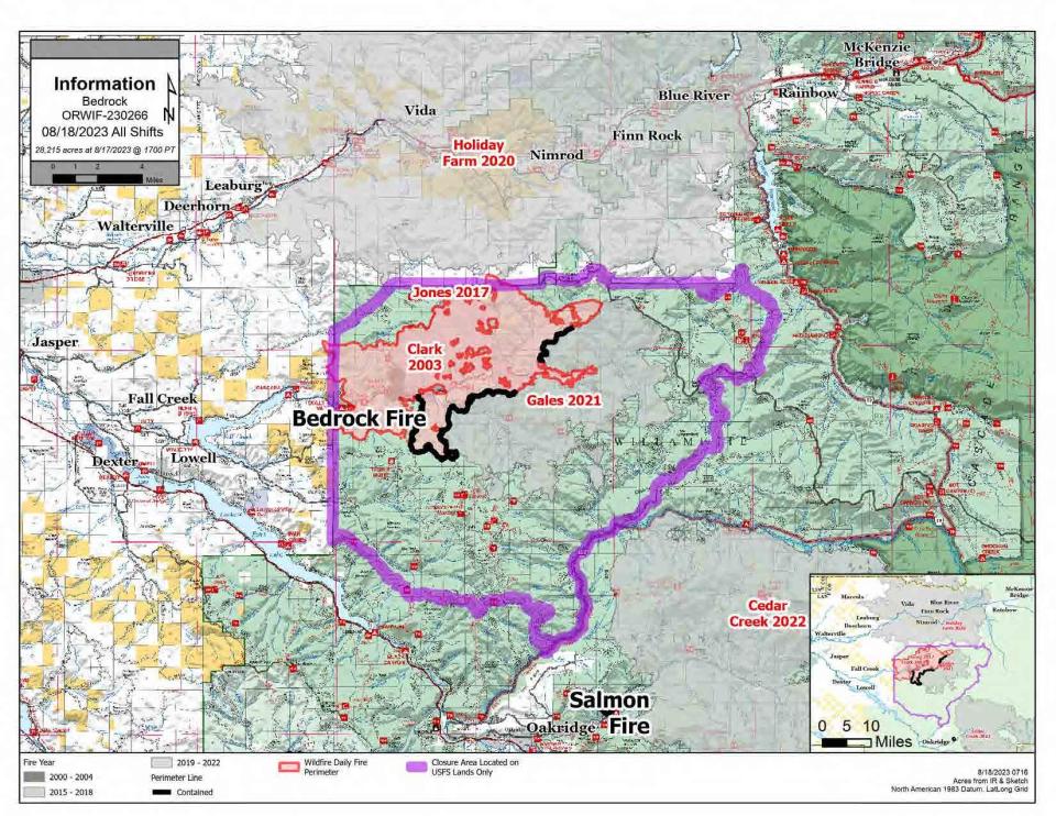
Bedrock Fire crews work on strengthening containment lines
Still growing steadily, the Bedrock Fire grew to 28,215 acres by Saturday morning. A little under 1,000 personnel are now assigned to the fire.
With containment of the Bedrock Fire at 30%, the fire is quickly nearing a full month since it first sparked at the Bedrock Campground on July 22. Its cause is under investigation.
According to a Saturday update, six hotshot crews were able to conduct five tactical firing operations on Friday along road systems and successfully secured sections of the fire on the southwest and northwest perimeter.
Helicopters were also used for dropping water to cool fire activity late Friday afternoon and evening.
Firefighters faced challenges on the northwest perimeter with active fire behavior on Friday night.
Crews on Saturday were set to continue to work on the western edge and hold and secure areas where firing operations have been conducted, according to the update.
Evacuations near Fall Creek were announced by the Lane County Sheriff’s Office. The following areas are under a Level 3 “go now” evacuation notice:
Peninsula Road east of Timber Creek.
Big Fall Creek Road east from the intersection with Peninsula Road.
A Level 2, “be set” warning was also announced for these areas:
Big Fall Creek Road east of Winberry Creek Road east of Winberry Creek Road to Peninsula Road.
Peninsula Road along the south of Fall Creek Reservoir to Timber Creek.
Winberry Creek Road east of milepost 4.0.
The two emergency closures issued for the Bedrock Fire and 95% contained Salmon Fire in the Willamette National Forest are also still in place and can be found here.
A shelter for evacuees from the Bedrock and Lookout Fires was opened by the Red Cross at Lowell High School, 65 Pioneer St. A non-emergency line for the Bedrock and Lookout fires can be reached at 541-682-2055 for evacuation information.
For large animals or livestock sheltering, shelter is available at the Lane Events Center at 796 W. 13th Ave. in Eugene. Owners need to call or text Lane County Animal Services at 541-285-8227 before getting to the center and need to leave a message including the number and type of animals.
According to a Saturday update, management of the Bedrock Fire will transition from NW Incident Management Team 12 to Pacific Northwest Team 2 on Sunday morning.
Wiley Creek Fire mop-up efforts continue
Mop-up efforts are continuing for the 245-acre Wiley Creek Fire, and the fire was reported to have reached 50% containment as of Saturday morning. The fire is burning 9 miles southeast of Sweet Home.
All evacuations issued for the area were lifted Linn County Sheriff's Office.
Fire crews saw minimal fire activity on Friday night, according to an update. Crews were set to continue fire suppression on Saturday, with mop-up and patrolling of containment lines.
Fire activity for the past week has started to slow and the fire is being held far inside the containment lines.
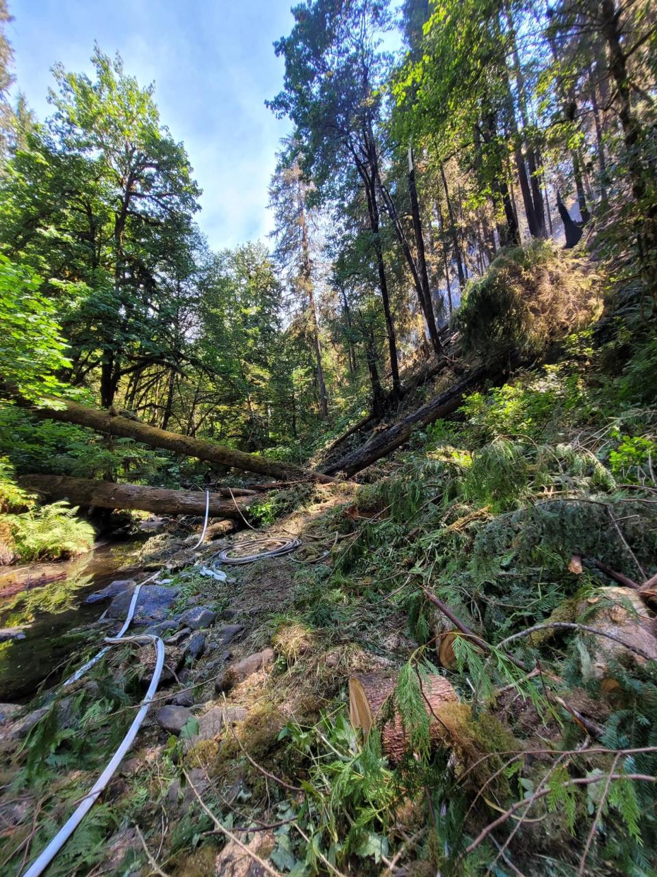
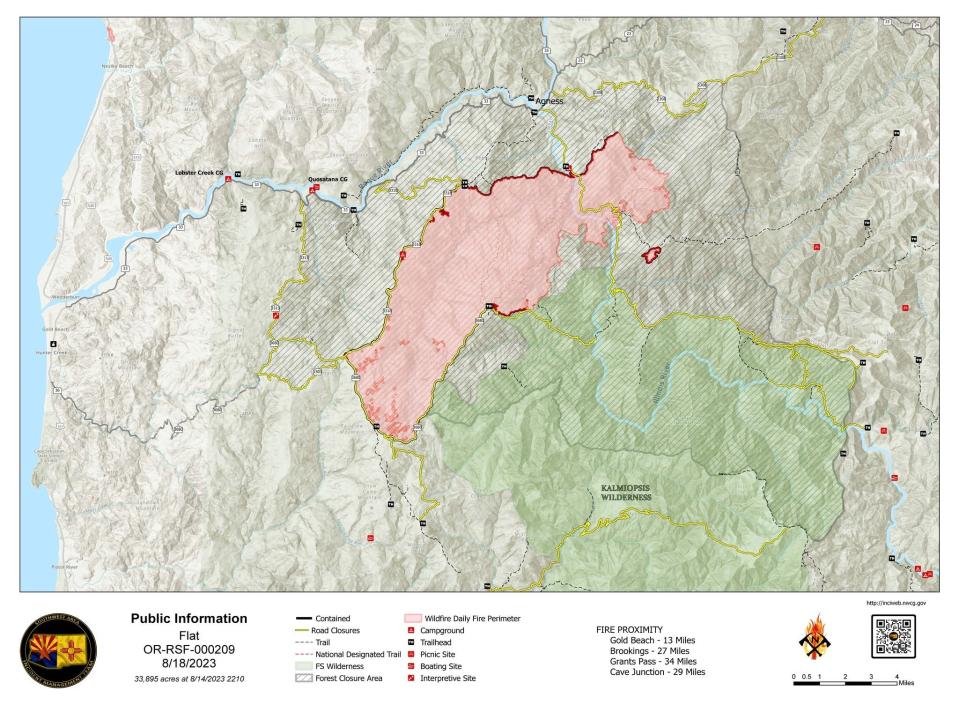
Crews continue containment efforts for Flat Fire
Containment of the 33,895-acre Flat Fire was reported at 58% Saturday morning. Just under 500 personnel are working on the fire.
A level 1, “get ready” evacuation warning from the Curry County Sheriff's Office is still in place for part of the Flat Fire.
The Rogue River-Siskiyou National Forest’s closure is still in place for the fire area. That includes part of the Illinois River, roads, trails and campgrounds. The full closure list can be found on the Forest Service’s website.
Crews have finished constructing handlines in the Pistol River drainage down to the 364 road, according to a Saturday update, and heavy fuels are being decked and removed.
Firefighters were set to work on the proposed handline to tie the 364 improvements to the existing line.
Air resources remained available to support initial attack efforts as needed, according to the update.
The fire has been listed as “human-caused” after starting on July 15 at Oak Flat Campground. No other information has been released.
Southwest Incident Management Team 3 took command of the fire Friday morning.
Abigail Landwehr is an outdoors journalism intern for the Statesman Journal. She can be reached at alandwehr@gannett.com
This article originally appeared on Salem Statesman Journal: Oregon wildfires: Lookout, Bedrock fire updates; how to help evacuees

