Oregon wildfires: Salmon, Bedrock, Lookout and Wiley fires burning in Willamette forest
This story was updated at 11 a.m. Thursday, Aug. 10
For the latest fire updates, find our new story here.
Four fires are burning in the Willamette National Forest, including the Bedrock, Salmon, Lookout and Wiley fires.
A community meeting will be held Thursday at 6 p.m. in the Oakridge High School auditorium. Fire teams will be answering questions on the Salmon and Bedrock fires.
Additional fire restrictions in the Willamette National Forest went into effect Tuesday, as fire danger is very high across the forest. More on restrictions about campfires, smoking and other fire-related activity can be found on the U.S. Forest Service website.
Here is the latest on wildfires burning around Oregon.
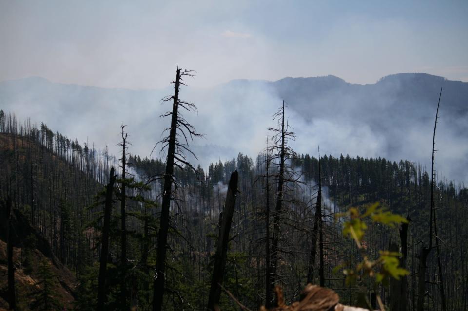
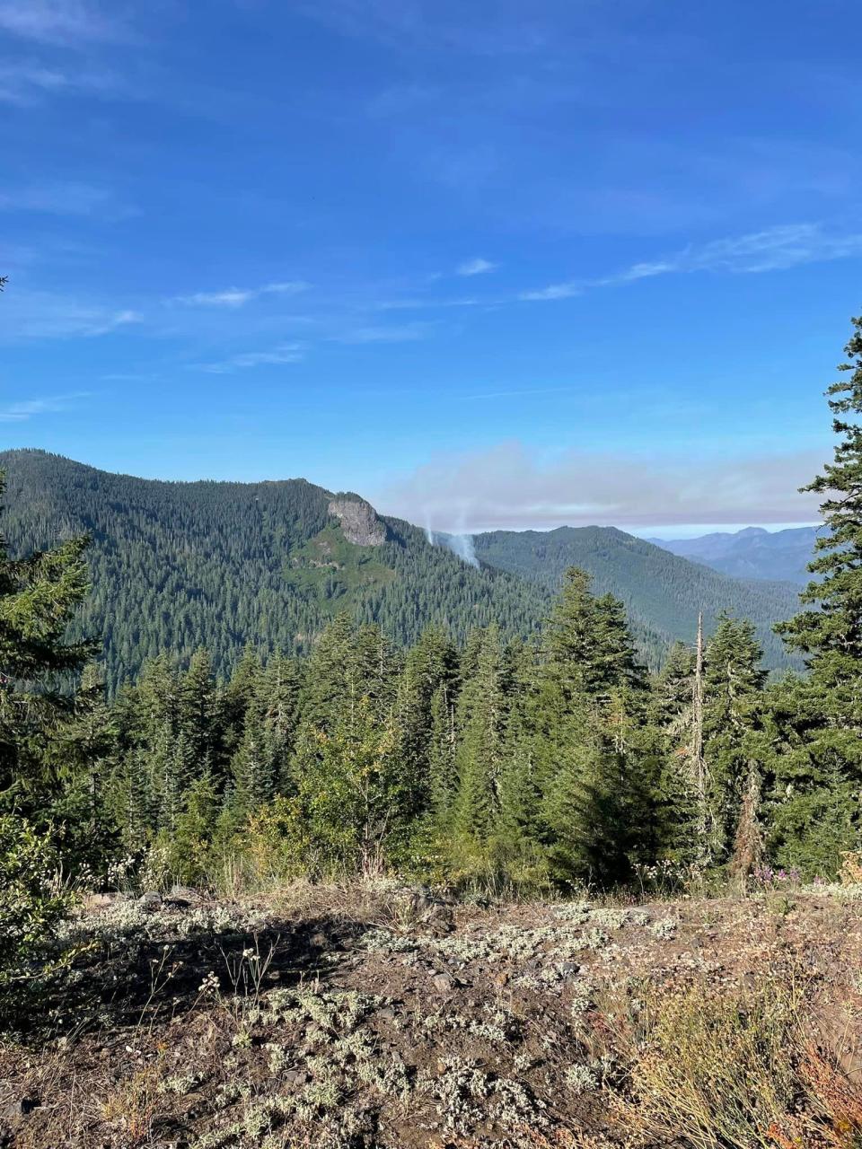
Salmon and Bedrock fires burning east of Eugene
Both growing in the Willamette National Forest, the Salmon and Bedrock fires now sharing management and firefighting resources. They're located east of Eugene and near Oakridge. Both could impact air quality in Central Oregon.
The 15,178-acre Bedrock Fire has burned over the course of three weeks, while the Salmon fire was sparked Sunday afternoon, just 3 miles east of Oakridge. The Salmon Fire has grown to 135 acres and prompted an emergency closure order on the Willamette National Forest. The order went into effect immediately on Tuesday for public and firefighter safety.
The Salmon Fire also prompted a level 1 evacuation warning for the Oakridge area on Sunday.
As of Wednesday morning, the “be ready” evacuation notice from Lane County Sheriff's Office was still in place. That warning covers areas north and east of the town, including:
High Prairie.
McFarland Road.
Westoak Road.
Oakridge north of Roberts Road.
Oakridge east of Salmon Creek.
Associated side streets.
Map: Salmon Fire evacuation areas
The Bedrock Fire’s blaze began at Bedrock Campground on July 22. An emergency closure was issued, including all recreation sites — trails, campgrounds and trailheads — upstream of Fall Creek Reservoir.
An emergency closure was also issued for the Salmon Fire and there are temporary flight restrictions over both fire areas. The cause of both fires is still under investigation.
A community meeting will be held Thursday at 6 p.m. in the Oakridge High School auditorium. The fire teams will be answering questions on the Salmon and Bedrock fires. A recording of the virtual meeting Wednesday night can be watched on the Bedrock Fire Facebook page.
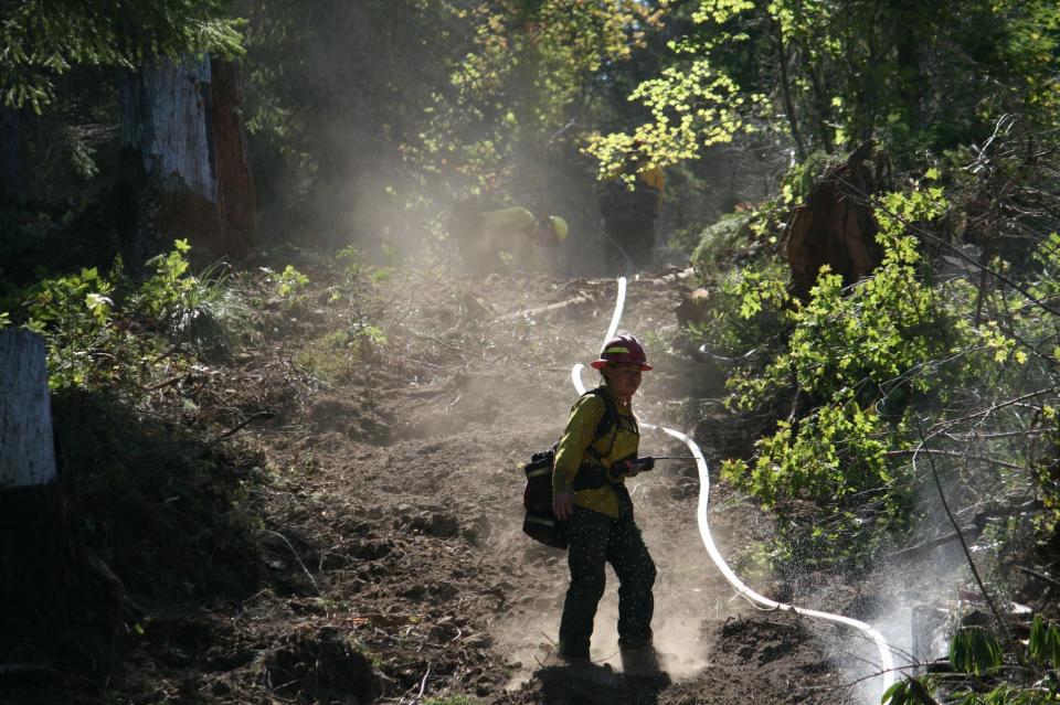
Tactical firing operations continued on the north flank of the Bedrock Fire Wednesday, as crews worked to strengthen control lines. Firing operations will continue for the next several days to burn and connect parts of the fire line.
Crews planned to start mop-up efforts Thursday on the Salmon Fire, as Wednesday operations were successful in securing the fire. The fire has had minimal growth in the past 24 hours, according to an update from the fire team.
"Smoke from the area fires will continue to impact air quality," an update from the fire team on Wednesday said.
Still, most nearby towns will see good conditions Thursday, according to the Air Quality Index forecast. The two towns that are forecasted to have moderate air quality:
Smoke in La Pine will reach unhealthy levels, then improve to moderate quality in the afternoon.
Eastward of Highway 58 and Oakridge will see smoky conditions in the late morning and unhealthy levels in the afternoon. Those conditions will clear in the evening.
Additional level 1 evacuation warning added with current level 2 for Wiley Fire
The Wiley Fire is the third fire to be reported in the Willamette National Forest, growing to 165 acres by Thursday morning.
Reported Monday evening, the fire is approximately 1 mile south from the end of Harris Road, off Whiskey Butte Drive and 6 miles east of Sweet Home. A level 1, "be ready" evacuation area was added around the current level 2 warning by the Linn County Sheriff's Office on Wednesday night. Areas covered in the level 2 notice are the same, including:
The intersection of Highway 20 at Whiskey Butte Drive then continuing down Whiskey Butte Drive.
Cedar Creek Road, extending south to Wiley Creek Road.
From the intersection of Cedar Creek Road and Wiley Creek Road, east along the south boundary of the Willamette National Forest area to Swamp Mountain Road.
Along Swamp Mountain Road north to Highway 20.
The Wiley Fire also prompted a temporary closure order for Green Peter Reservoir for fire suppression efforts Tuesday.
Map: Linn County evacuation areas
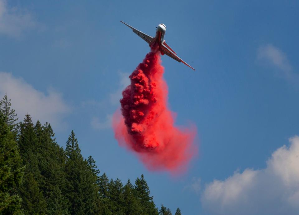
Burning on steep terrain, multiple aircraft are assigned to the fire. Because scooper planes will be using Green Peter Reservoir to scoop water, recreational boating is closed on the reservoir until Aug. 25, according to the notice from the Oregon State Marine Board, the Linn County Sheriff’s Office and U.S. Forest Service.
“Firefighter safety continues to be our top priority,” Incident Commander Chad Calderwood said in Wednesday's update. “With steep terrain, snags, and high fire activity we are strategically attacking this fire while making sure our firefighters are not put in a dangerous situation.”
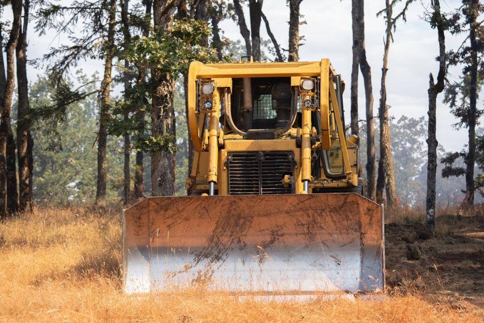
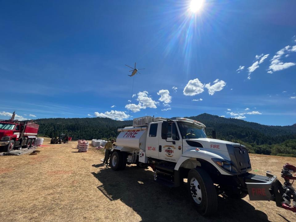
Hand crews, aircraft, contract loggers and other resources are part of Thursday's efforts to secure more fireline around the perimeter.
"Current resources continue to work to keep the fire perimeter south of Wiley Creek and away from communities," a Thursday update from the fire team said. "Weather conditions are expected to worsen over the weekend, potentially creating challenges to firefighting efforts... we urge the public to help by actively practicing wildfire prevention so that resources do not become strained."
A number of agencies are responding including the Forest Service, Oregon Department of Forestry-South Cascade, Cascade Timber Consulting, Giustina Resources and Sweet Home Fire District. More air help and resources have been ordered to support the fire.
Lookout Fire burning in old-growth experimental forest
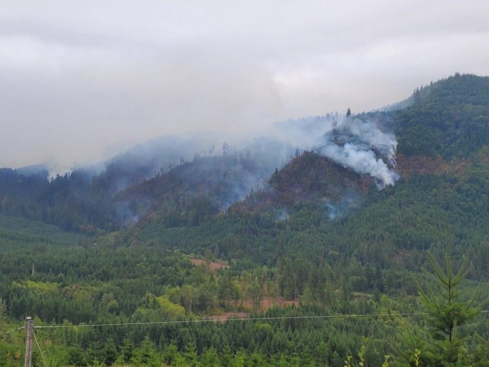
A fourth fire burning in the Willamette National Forest, the Lookout Fire, has grown to 15 acres. The cause of the fire has been determined to be lighting and naturally occurring.
The fire started near the McKenzie Ranger District Saturday afternoon as one of three fires. The first two were contained by ground crews but the Lookout Fire was not found until late Sunday morning.
The fire sits on a 60% slope and between a heavily forested area. It's also within the H.J. Andrews Experimental Forest, an area used for collecting research on forest and stream ecosystems.
Because of the canopy and rough terrain, getting access to the fire from the air or the ground has been hard for crews. The hike for firefighters is about 3 miles uphill, with 1,400 feet of elevation gain to get to the fire. Crews are scouting ways to shorten access to the fire by ground.
Still, a mile of safety line through underbrush allowed crews to get to the fire. Helicopters have dropped 50,000 gallons of water on the perimeter to slow its growth, and crews made a small handline from the bottom.
"Multiple locations were evaluated for aerial access to assist in the direct attack strategy," according to an update from the fire team Thursday. "Multiple options are being considered and prepared for indirect attacks as well. These strategies were determined to be the best balance of protection for the values at risk and firefighter safety."
Saftey precautions for firefighters were also increased Wednesday. Medical personnel, an ambulance and a short-haul helicopter are on standby for any medical emergencies for crews.
Nevada Team 1 took command of the fire early Tuesday morning.
While no closures have been listed, the fire area is a no-fly zone. The fire team also added that the public should watch for fire traffic when driving on Highway 126 and Forest Roads 1506 and 1507.
All Priceboro Fire evacuation levels lifted
Reported to be at 65% containment, all evacuation levels issued for the Priceboro Fire were lifted Tuesday by the Linn County Sheriff's Office.
The 309.5-acre started 8 miles northeast of Eugene outside of Harrisburg on Aug. 4. More than 210 fire personnel from state departments and local fire districts worked on suppressing the fire over the course of several days.
The cause is under investigation.
Flat Fire containment at 44%
Containment efforts by crews continue on the Flat Fire, the largest current Oregon wildfire, now at 33,817 acres. Containment grew to 44% by Thursday morning.
Burning 2 miles southeast of the town of Agness, the fire ignited at Oak Flat Campground July 15 and has been determined to be human-caused.
Water and retardant drops were used to reduce fire activity on Tuesday. Similar efforts on Tuesday were meant to limit any chances of the fire's spread growing in the Indigo Creek area.
Smoke could be more noticeable from hotspots in the southwest part of the fire, but all areas are within the fire perimeter crews said.
"Structural protection resources remain on duty in the Agness area," an update from the fire team Wednesday said. "Firefighters are ready to respond if there are any changes in the fire."
Additionally, areas affected by firefighting efforts will be prepared by stabilization crews for future rain. Fire lines will also be maintained during that work.
At least 718 personnel are assigned to the fire. The U.S. Forest Service asks that with increased fire traffic, anyone on the roadways should use headlights and slow down.
Abigail Landwehr is an outdoors journalism intern. She can be reached at alandwehr@gannett.com
This article originally appeared on Salem Statesman Journal: Oregon wildfire updates: Salmon, Bedrock fires pool resources

