Oregon winter storm updates: Warmer days but freezing nights, maybe some freezing fog
10:21 a.m. Wednesday: One last dose of snow before warm up
Salem and Portland could see one last dose of snowfall Wednesday night into Thursday morning before the weather shifts back to a more typical rainy pattern in the Willamette Valley with snow in the Cascade Range.
For a full weather update, see the latest story here.
More: 'Last hurrah?' More snow forecast for Salem and Portland before slight warmup
3:45 p.m. Tuesday: Warmer days, freezing nights
Snowmen in Salem fell over in the warmth of Tuesday afternoon, but their lives could be preserved a few more days.
The Willamette Valley got another one to three inches of snow early Tuesday, according to the National Weather Service, but most of it was gone by the time people woke up and temperatures rose to 35 degrees.
The area is not safe yet, however.
According to the NWS, cold air was forecast to hit Salem the next few nights, which will bring a pattern of water on roads refreezing overnights and pose dangers to drivers when the sun goes down.
“Going to be kind of cold, mid-20s, unless you’re over by the coast or down south somewhere, but in the primary valley here, 25ish or so for lows, so we’ll say mid-20s for lows,” said NWS meteorological technician Gerald Macke.
“Upwards of a half an inch of snow, minimal accumulation everywhere because I see a lot of standing water out there.”
Macke said Salem’s going to be stuck in a warming and cooling pattern through the weekend when the weather is finally forecast to remain above freezing overnight.
Daytime highs are forecast to get well above freezing with 40 degrees for a high on Thursday.
The nights, however, are forecast for the 20s.
“This is a warming day for us. A lot of warm air coming in,” Macke said. “We’re going to start off below freezing. You might get an inch or two in the morning, but then by like late morning or noonish, it should actually switch over to rain and you’ll probably get a decent amount of rain in the afternoon before it tapers off.”
With the skies predicted to clear in the next few nights, there are more dangers than the black ice that has vexed drivers the past few nights: Macke said the area could see freezing fog, which leaves a layer of ice over everything.
Fewer than 1,000 customers of power companies in the Willamette Valley were without power Tuesday afternoon, down significantly from the over 6,000 who were without Monday afternoon.
Roads on the valley floor were generally clear of snow and ice and traffic was moving. The only slowings reported by the Oregon Department of Transportation in the valley were at higher elevation, such as Santiam Junction and the coast range.
Check here for the latest updates on weather and traffic conditions you might encounter this week.
Follow storm coverage by Statesman Journal reporters here.
Get outdoors: These 30 Oregon winter adventures include snowy waterfalls, hot springs & rainforest
3:14 p.m. Monday: Utilities prepare for new round of freezing storms
So far, the Christmas weekend snowstorm has been far less impactful than the ice storm of February 2021 in terms of power outages.
As of Monday afternoon, just over 6,000 homes in Western Oregon were without power due to storms that brought from a few inches to over a foot in the valleys and foothills. Most of the outages were in southwest Oregon, near Roseburg, and near Mount Hood and Government Camp.
During the 2021 ice storm, more than 300,000 homes and businesses lost power in Western Oregon — often for an extended period.
Previous coverage: Rare ice storms bring gridlock to Salem and Willamette Valley
The current threat of power outages isn't over. Subfreezing temperatures, multiple rounds of low elevation snow and "locally breezy conditions" this week could bring additional outages, said Pacific Power spokesman Drew Hanson.
"However, none of these weather systems are expected to be as impactful as what occurred over the Christmas holiday. That said, any weather system that moves through the service territory always brings the potential for outages."
PGE spokeswoman Andrea Platt said it came down to how much stress was put on branches that could fall onto power lines.
Both stressed that people should be prepared for outages by having an emergency kit, extra blankets, generators or other items to keep families warm if the power goes out.
-Zach Urness
2:20 p.m. Monday: Highway 22 closed west of Detroit
The eastbound lanes of Highway 22 are closed five miles west of Detroit following a crash, according to the Oregon Department of Transportation.
The highway has been closed at milepost 46 since 12:45 p.m. Monday.
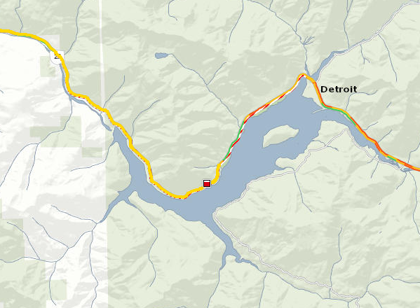
ODOT is requiring chains between milepost 41 and 66.23.
Drivers are advised to find alternative routes.
–Bill Poehler
12:15 p.m. Monday: Drive to Oregon ski areas takes longer, but conditions 'outstanding'
Oregon's ski areas received 18 to 30 inches of new snow over the Christmas weekend, resulting in excellent ski and snowboard conditions.
Matthew McFarland, manager for Hoodoo Ski Area on Santiam Pass east of Salem, said that snowy and slick roads meant it was taking people quite a bit longer to reach the ski area, but that they were seeing a fairly full parking lot by 10 a.m.
He said that during a holiday week typically, it was strongly suggested people arrive before 9 a.m. to get a parking spot. He said that would likely become the case as roads become easier to drive and people shovel out from their homes in the Willamette Valley.
Night skiing starts at Hoodoo on Monday.
"We're seeing good numbers, it's just taking people longer to get here," he said. "As the week progresses, I think people are going to want to get here earlier and earlier to have the best experience possible, or wait until around 1 p.m. for night skiing."
(Updates continue below)
Have you been wondering how much snow the region got? Here is a graphic showing the widespread nature of the snow via the NOAA Operational Hydrologic Remote Sensing Center (NOHRSC) for the last 3 days. We have overlaid some numbers to give a range of snowfall for some areas. pic.twitter.com/CYbP4o887J
— NWS Portland (@NWSPortland) December 27, 2021
12:10 p.m. Monday: Oregon's mountain snowpack moves well above average
Oregon's snowpack increased substantially over the past few weeks, with mountain snow going from way below average earlier this month to well above average as of Dec. 27.
As of Monday, Oregon's snowpack is 126 percent of normal.
The map, seen above, looks at the amount of snow water equivalent — the amount of mountain snow generally — versus the median amount of snow at this time in the range of years from 1991 to 2020.

Over the weekend, Oregon's mountains got up to 27 new inches of snow around Mount Hood to 18 inches of new snow on Santiam Pass.
11:20 a.m. Monday: Looking back at Salem's biggest snowfall days
Salem got a lot of snow over the Christmas weekend but it doesn't stack up to the heaviest snow days ever recorded in the capital city.
The largest single day of snowfall was recorded on Feb.1, 1937, when McNary Field got 25 inches of snow, according to National Weather Service data.
The rest of the five snowiest days in Salem's recorded history — which goes back to the late 1890s — includes:
2: Dec. 10, 1919: 17.5 inches of snow
3: Feb. 19, 1993: 12 inches
4: Jan. 15, 1930: 11 inches
5: Jan. 21, 1943: 10.8 inches
-Zach Urness
11 a.m. Monday: Snowfall totals from weekend around Salem, Willamette Valley, mountains
Snowfall totals over the Christmas weekend brought some large numbers in Salem and in the surrounding foothills and mountains.
Most of the Salem and Keizer area recorded from 2 to 5 inches of snow Saturday into Sunday, with another 2 to 3 inches coming Sunday and overnight into Monday, to bring totals so far to around 4 to 8 inches across the greater Salem area.
Dallas recorded 8 inches over the weekend and likely added another 3 to 5 inches, to bring around a foot of snow overall.
The numbers got even larger in the mountains, with Santiam Pass adding around 18 inches of new snow over the weekend and into Monday, while Mount Hood Meadows Ski Area got 27 inches in 24
To see a full list of observed snowfall totals from the weekend, just follow this link to the National Weather Service page. Meteorologists said adding 2 to 3 inches to the observed totals in the valley, and 4 to 7 inches in the higher elevations and foothills, would get a close to accurate mark as of Monday morning.
"The amount of snow that feel really changed from location to location," NWS meteorological technician Gerald Macke said.
-Zach Urness
10:18 a.m. Monday: Forecast calling for long freeze, more snow tonight, late in week
The cold air keeping temperatures near freezing in the Willamette Valley, bringing snow and slick roads, is expected to stick around for a while, according to the National Weather Service in Portland.
That likely means another 1 to 2 inches of snow in the Salem and Willamette Valley area overnight, with a bit more in the higher elevations.
That snow is likely to stick around at least through late in the week, if not longer.
Wednesday appears clear and cold — meaning snow will remain. But the big question centers on Thursday and Friday, when new moisture is set to arrive.
Temperatures Thursday and Friday are expected to rise somewhat in the Willamette Valley, but it remains unclear if that will mean a rain-snow mix or all snow, said NWS meteorological technician Gerald Macke.
"Thursday and Friday is the one to watch out for," he said. "We don't have a good handle on it yet but will start digging into it today and tomorrow, once we get past this current system.
"It will warm up somewhat, but it's unclear how the snow on the ground could impact temperature — potentially keeping in cooler than it would normally be."
Long-term, temperatures are expected to stay in the 30s all this week, into the weekend and beyond.
"I wouldn't imagine that it will stay this cold for two weeks — that would be very unusual — but there's not a lot of light at the end of the tunnel in terms of it warming up soon," he said.
--Zach Urness
9:36 a.m. Monday: Around 6,700 without power in Oregon
Around 6,000 customers are without power in Western Oregon due to the winter storm, according to data from various utilities.
PGE reported 2,241 without power, largely in the Mount Hood and Government Camp area.
Pacific Power reported over 2,600 without power, although that only included 120 in the Salem area while the vast majority were in the Roseburg and Southern Oregon area.
Consumers Power Inc. reported 1,857 outages, mainly in Lincoln County where 1,239 homes were without power.
--Zach Urness
7:55 a.m. Monday: Next snow to arrive Monday evening
A winter weather advisory issued by the National Weather Service details the next system expected to bring snow across the Willamette Valley. Officials say snow will likely arrive Monday evening into Tuesday morning, decreasing by afternoon.
A total of around 1 to 3 inches is projected for Salem and across most of the area. Most of the snow is expected late tonight and early Tuesday morning.
A break in the snow Monday will still leave area roadways slippery with black ice possible after temperatures dropped below freezing early morning.
Temperatures are expected to peak at around 32 degrees today.
Closures, delays: Mid-Willamette Valley closures and delays for Monday
🧊 Be careful of ice on the roads, even if the roads are cleared of snow. Black ice is difficult to see and is most dangerous early in the morning due to freezing temperatures at night. pic.twitter.com/Q6sMdiy7TU
— OregonOEM (@OregonOEM) December 27, 2021
More snow forecast through Thursday
The National Weather Service is forecasting two more snowstorms over the Salem area through Thursday.
“We’re thinking Tuesday there’s a fair chance for a weaker snowstorm, it says less than a half an inch," said NWS meteorological technician Gerald Macke. "And then Thursday, we’ll do it again with some low-elevation snow, not a lot again, probably less than a half of an inch.”
Overnight lows were expected to be in the 20s the rest of the week. And the snow that fell could hang around because daytime highs are forecast to barely and briefly edge above freezing through Thursday when it is predicted to finally rise to 40 degrees.
Macke said road conditions could be dangerous for the next few days, with black ice a major concern.
“Beware at night because this stuff, when it melts, it will definitely refreeze and it will be a lot smoother and shinier and slippier than when it fell the first time,” he said.
Significantly more snow fell outside of Salem.
"You don’t have to go far to get twice as much as you got in Salem," Macke said.
Silver Falls State Park had 10 inches of snow by Sunday afternoon and the foothills of the Cascade Mountains got up to a foot, he said.
“If you go toward Willamina, Grande Ronde, that way, six inches is real common out there," Macke said.
–Bill Poehler
Salem plows out of the snow
Most major roads around Salem were cleared Sunday as crews from the city and the Oregon Department of Transportation plowed with a vengeance.
The city of Salem's road conditions map offers information on priority and secondary snow routes. The information is based on the amount of traffic received.
The map can be filtered and zoomed in and out to find information about your area.
It can be found at: https://www.cityofsalem.net/Pages/current-road-conditions.aspx
The city said it will plow, sand and add deicer to city streets throughout Sunday night.
Drivers were asked to:
Reduce speed and leave extra distance
Use caution on sharp curves and expect longer stopping distances
Give snowplows room and only pass if necessary
Clear your vehicle of snow and ice
Carry a shovel and sand or kitty litter for emergency traction assistance
Keep an emergency supply kit in your vehicle that includes a blanket, food, and water
–Bill Poehler
Warming shelters open in Salem and Willamette Valley
Several warming shelters will be open Sunday night throughout Salem and nearby, according to Mid-Willamette Valley Community Action.
The shelters are:
Salem First Presbyterian, 770 Chemeketa Street NE, Salem, 7 p.m. to 7 a.m.
Safesleep, 1910 Front Street NE, Salem, 7 p.m. to 7 a.m., Women only.
Union Gospel Mission, 777 Commercial Street NE, Salem, 5 p.m. to 7 a.m., Men only.
Polk County Warming Center, 437 D. Street, Independence, 7 p.m. to 7 a.m.
Seed of Faith Outreach Ministries, 853 Medical Center Drive NE, Salem, 7 p.m. to 7 a.m.
InsideOut Refuge Warming Center, 1910 Front Street NE, Salem, 9 p.m. to 8 a.m., Families, single females and couples.
Santiam Outreach Community Center, 280 NE Santiam Boulevard, Mill City, will remain open until temperatures reach 34 degrees.
–Bill Poehler
This article originally appeared on Salem Statesman Journal: Weather updates: Warmer days but freezing nights, maybe some freezing fog

