Over 80 million Americans under heat-related warnings, advisories: Monday weather forecast
More than 80 million Americans are under heat-related weather notices Monday morning as triple digit temperatures were set to impact residents from Texas to California, according to the National Weather Service.
Meanwhile, both coasts will face extreme weather, with a chance of flooding in the East and dangerous heat levels in the West.
The Midwest will also see continued effects of wildfire smoke, with air quality alerts in the northern high plains, Midwest and Great Lakes.
Here's what you need to know about Monday's weather forecast.
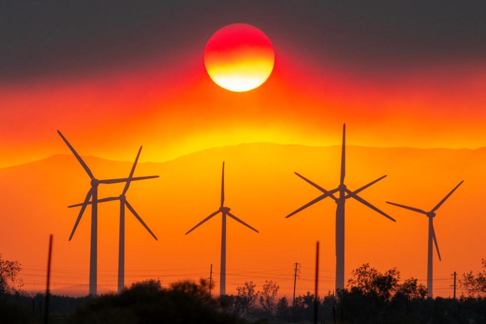
Heat warnings blanket Southwest
Over 80 million people remain under excessive heat warnings or heat advisories, according to the weather service.
Heat advisories, watches and warnings have impacted nearly 100 million people, or almost a third of Americans, over the past 30 days as summer temperatures kick in across the country. Temperatures in some desert areas were predicted to soar past 120 degrees during the day and remain in the 90s overnight.
This week, forecasted temperatures in the Southwest range up to 100-110 degrees, even reaching 115 in southern California, Nevada and Arizona.
The National Weather Service warns that temperatures will reach dangerous levels and are potentially deadly for anyone without effective cooling and/or adequate hydration.
Heat advisories, excessive heat warnings and excessive heat watches were in place in the following states Monday morning:
California
Nevada
Arizona
New Mexico
Louisiana
Texas
Arkansas
Mississippi
Alabama
Oklahoma
Florida
Flooding in the Northeast
Despite heavy rains early last week in the Northeast, more rain is predicted to come to the region.
High moisture in the air combined with a slow-moving cold front from the West will cause heavy showers and storms in the Mid-Atlantic and Northeast, according to the National Weather Service.
The soil in the Northeast is already highly saturated with water following heavy flooding in Pennsylvania, New York and Vermont last week, according to the National Weather Service. This increases the risk of flash flooding in those areas.
The Weather Prediction Center (WPC) has issued a moderate risk of flash flooding for the New England area. Residents should be cautious of impassable roadways, overflowing creaks and possible mudslides.
States from Virginia to Maine are all included in the slight risk area. High winds may also increase the risk of tornadoes.
Bucks County, Pennsylvania, flooding leaves 4 dead, 3 missing
At least four people are dead and three others are missing, including a 9-month-old boy and his 2-year-old sister, after they were swept away by fast-rising floodwaters in Pennsylvania on Saturday, officials said.
"It's very possible" there could be more victims, Bucks County Coroner Meredith Buck told the Bucks County Courier Times, part of the USA TODAY Network.
Wildfire smoke continues
In the Great Lakes, Midwest and northern high Plains, air quality alerts are still in place due to a lingering concentration of Canadian wildfire smoke.
The concentration of smoke may be unhealthy for sensitive groups in this region.
More rain in the Great Plains
The Southern and central high Plains as well as the middle and lower Mississippi Valley will see showers and thunderstorms into Monday morning, resulting in a slight risk of flash flooding.
There is also a risk of hail in central Kansas.
US weather watches and warnings
National weather radar
Contributing: Jo Ciavaglia, Michele Haddon, Liam Price, J. Staas Haught
This article originally appeared on USA TODAY: National weather forecast today: Heat warnings, advisories in SW

