Parking ban set for Worcester as region braces for snow
Just when the last patch of snow in the front yard was gone, a new bed of snow is expected to cover the grounds, streets, roofs and cars of Central Massachusetts.
Even as sunny skies and mild temperatures prevailed Monday, the region was bracing for a nor’easter set to arrive early Tuesday morning that could bring snow, heavy winds and frigid temperatures.
In Worcester, a parking ban is due to go into effect at midnight. City Hall and other municipal buildings will be closed Tuesday, and trash and recycling collection will be delayed by a day. The public schools have canceled classes on Tuesday.
It’s still winter in New England, even though Worcester had a record-breaking temperature of 57 degrees just Saturday.
But the storm may not be as severe as first expected. By Monday afternoon, the National Weather Service was forecasting 4 to 6 inches to fall in Worcester, a significant change from earlier in the day, when it was projecting anywhere from 10 to 18 inches.
That was due to a southward shift in the storm's projected path. Areas south of Worcester were expected to get more snow, and areas to the north were expected to get less.
[#Snow Forecast] A short duration but high impact #winter storm impacts MA, RI & CT Tuesday. Heaviest snow occurs approximately 9 AM to 3 PM, except 12 PM to 5 PM for #CapeCod. Snowfall rates of 1-2" per hour will be common during this time. Travel will be very difficult. #MAwx pic.twitter.com/7t4pAw2OOR
— NWS Boston (@NWSBoston) February 12, 2024
In Central Massachusetts, the heaviest snow is expected to fall in Worcester and points south, while northern portions of Worcester County are expected to get somewhat less.
“It’s going to be a wet snow, so it’s going to be a little on the heavy side,” Dunham said. “We’re looking at wind-gusts up to 30 to 35 mph. Being a heavy, wet snow that’s going to stick to tree branches and what not, I would not be surprised to see some power outages.”
National Grid said it is preparing for the storm by securing additional crews and personnel.
“National Grid is closely monitoring the weather forecast and we have crews and personnel in place across Massachusetts ready to respond to any impacts this storm may bring," said Tim Moore, vice president of electric operations. "We'll be ready to restore service as quickly and safely as possible. The predicted heavy snow may make roads difficult to travel and strong winds could have an impact on our restoration efforts. Our crews will work to restore the power systems as soon as it is safe to do so."
The storm will arrive in Southern New England in the early morning hours of Tuesday, with snow starting in the Worcester area between 5 and 6 a.m., Dunham said.
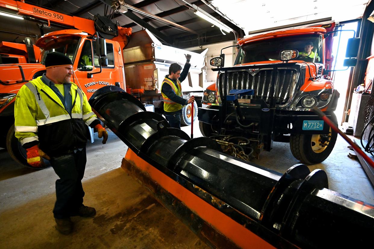
Jay J. Fink, Worcester's commissioner of public works and parks, said crews would assemble at midnight and will be plowing by the time the morning commute starts.
“If you don’t have to work and you don’t have to be on the road, please, do your best to stay off them,” Fink said.
By the time the city starts plowing the streets, Fink said, there should be at least 300 contracted trucks and pieces of equipment out on the streets, supplemented by 50 trucks and equipment form city forces.
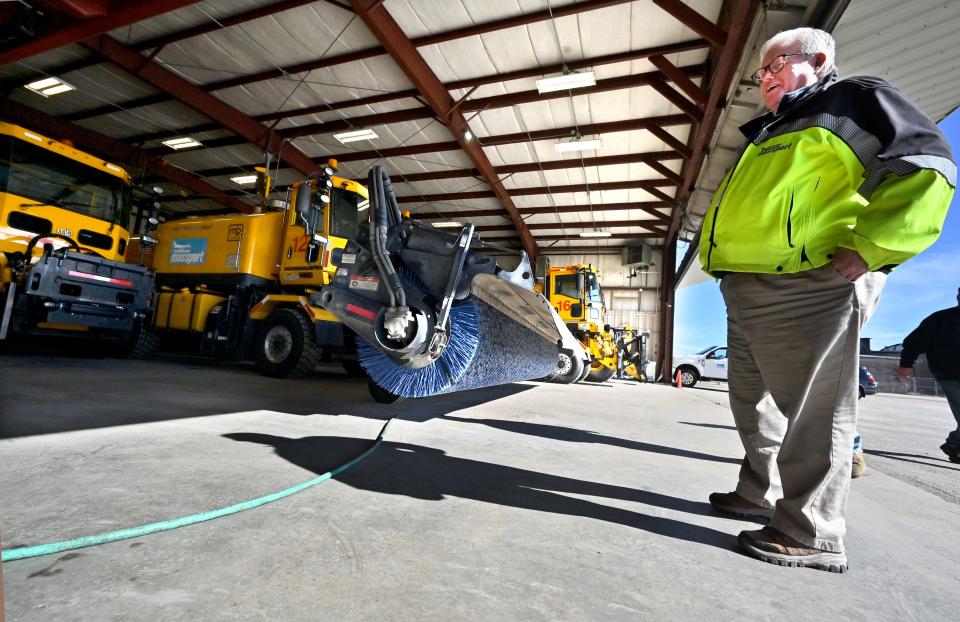
Andrew Davis, airport director of the Worcester Regional Airport, said his cleaning crew started the snow removal planning process 24 hours in advance, long before the first flake was set to fall.
“A key part of preparation for a storm is planning and communication,” Davis said. “We can't control the weather but we can certainly control the conditions on the ground.”
Davis said the runway-clearing process requires three to four “multi-task vehicles” working in tandem. These vehicles consist of a 24-foot-wide plow in front, a horizonal circular broom in the middle and a blower in the rear that blows air at 450 mph, he said.
“These vehicles can go up and down and clear a runway in less than 13 minutes,” Davis said, “These vehicles can do it reliably, safely and have the runway down to bare pavement, in time for any airplanes to get in, in time.”
Davis said crews could be at it for 72 hours, even in the case of a 12-hour storm.
“The storm’s not over when the snow ends because we not only have the cleanup to do including moving piles, but oftentimes, even though the snow stops, the wind will shift,” Davis said. “And, the next thing you know, we get drifting going on, which we have to chase the drifts. And that can go on for another six, eight, 10, 12 hours into the next day.”
The current JetBlue schedule at the Worcester Municipal Airport doesn’t include flights Tuesday and Wednesday, Davis said.
Only a few days earlier Saturday, the city reached a new record-breaking high temperature of 57 degrees, breaking the previous high for Feb. 10 of 56 degrees, set last year. It was so warm over the weekend that the Worcester Common Skating Oval Ice Skating Rink had to be closed because the ice was melting.
So far, Worcester has seen 31 inches of snow, about a foot less than normal, Dunham said. Tuesday’s storm could make up the gap.
This article originally appeared on Telegram & Gazette: Parking ban set for Worcester as region braces for nor’easter

