Part of U.S. 1 in Melbourne remains closed following Friday's storms, with more bad weather on the way
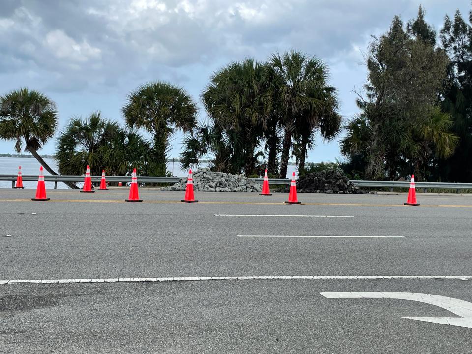
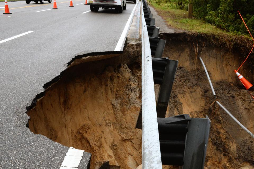
MELBOURNE — All northbound lanes of U.S. 1 remained closed today near the Nissan dealership in Melbourne following erosion along the riverbank from Friday's storms, according to the Florida Department of Transportation.
Heavy rain eroded part of the road Friday and left a drainage pipe damaged, FDOT said. Traffic heading north on the road, also known as South Harbor City Boulevard, was being redirected through a southbound lane, according to Melbourne city officials. Traffic was being redirected through the southbound lane just north of Cherry Street in Melbourne.
Lane closures will remain in place along U.S. 1 until further notice, according to FDOT. The department will monitor the situation today as more storms threaten the area, officials said.
Brevard County saw more than four inches of rain Friday, with more falling during the night, leaving the ground saturated, according to the National Weather Service station in Melbourne. Brevard County is under a severe thunderstorm watch until 7 p.m. tonight.
Friday's storms: Erosion closes part of U.S. 1 in Melbourne; intermittent storms expected over weekend
Space activity this weekend: NASA set for SLS moon rocket's major test at Kennedy Space Center this weekend
Storms were expected to develop early during the afternoon, with the possibility of strong to severe storms increasing slightly later in the day, NWS said. While all of East Central Florida was at risk for strong storms, counties facing the highest chance of strong and severe storms included Brevard, Indian River, St. Lucie, and parts of Orange and Osceola.
Lightning strikes, brief tornadoes, 1-to-2-inch hail and wind gusts of about 60-70 mph were a possibility this afternoon.
Soon after sunset, the chance of rain was expected to drop, with storms moving toward the coast and then offshore into the night hours, NWS said.
Finch Walker is a Breaking News Reporter at FLORIDA TODAY. Contact Walker at 321-290-4744 or fwalker@floridatoday.com. Twitter: @_finchwalker
Support local journalism. Subscribe today.
This article originally appeared on Florida Today: Melbourne road closure: Storms leave part of U.S. 1 shut down Saturday

