Parts of the metro-east remain under a thunderstorm warning. Here’s the latest weather info
The worst of the weather appears on its way out of the metro-east.
According to Ben Herzog, a meteorologist with the National Weather Services of St. Louis, the rain and thunderstorms should be out of the area by 11 a.m. Wednesday.
“The rain in the metro-east will continue to taper off over the next few hours,” he said Wednesday morning. “The winds will remain a bit gusty through the afternoon, but those will taper off close to sunset. The worst is probably past this area.”
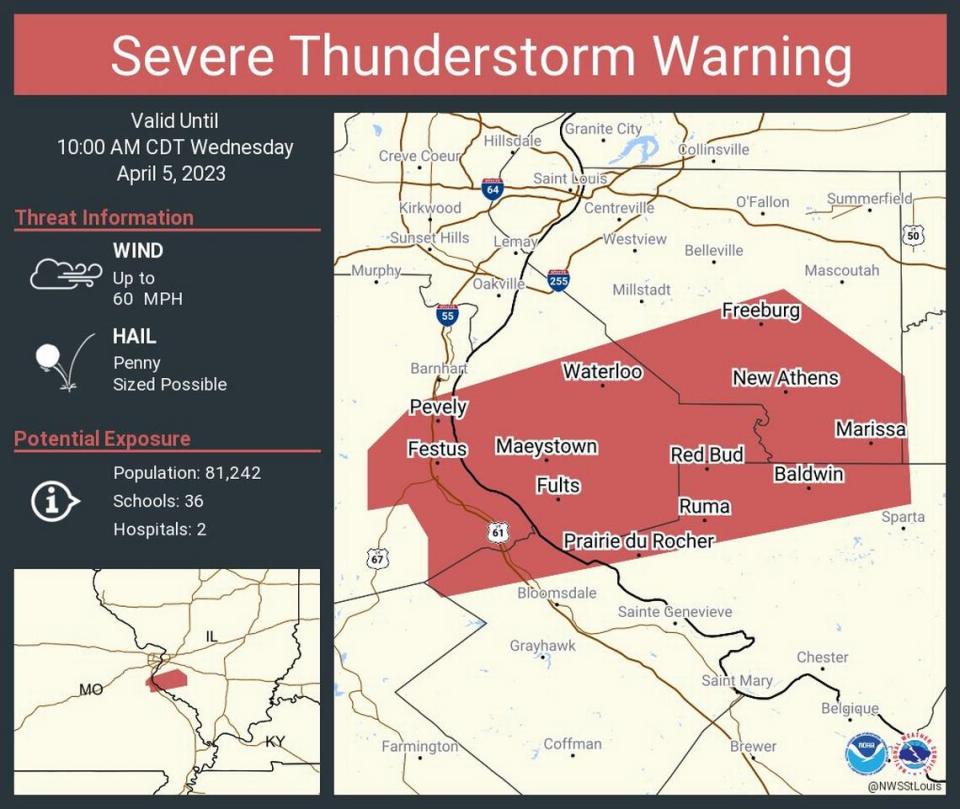
Parts of Monroe, Randolph and St. Clair counties remain under a thunderstorm warning until 10 a.m. Specifically, that includes Valmeyer, Waterloo, New Design, Freeburg, Smithton, Red Bud, Belleville, Baldwin, New Athens and Marissa, according to the NWS.
Herzog said wind gusts from now until noon will be around 30 miles per hour before dropping to 25 mph in the afternoon and then 20 mph by late afternoon/sunset.
Herzog also said there’s no threat for tornado development.
“The severe threat is completely out of the area now,” he noted.
Herzog also does not expect any flash flooding.
“We’re going through the last round of the heaviest rain right now,” he said. “I can’t rule out some ponding in some areas, but flash flooding is not particularly likely.”
Moving forward through the rest of the week/weekend and Easter, Herzog said the forecast appears dry.
“Everything looks quiet,” he said. “That’s good news — no rain in tghe forecast between now and Monday. High temperatures should gradually climb. It’s going to be a little cooler tomorrow than we have had the past couple days. But Friday’s high will be in the 60s, Saturday in the upper 60s and Sunday right around 70 degrees.”
The National Weather Service recommends keeping plugged into the forecast as it develops at www.weather.gov. Their Facebook page is www.facebook.com/NWSStLouis.