Winter weather advisory ends early as southeast Wisconsin avoids major disruptions
A winter storm system brought ice and snow to southern Wisconsin on Friday, causing slippery stretches on highways but no major disruptions.
As of 3 p.m., the Wisconsin Department of Transportation noted fast or slightly slower traffic speeds on Interstate roads in the southeast corner of the state, as a winter weather advisory expired three hours early. Beyond the occasional disabled car and closed lane, it appears the area avoided any major slow-downs on highways.
Good winter driving conditions were reported Friday afternoon along I-94 between Milwaukee and Waukesha, I-41 in between the two cities and I-794 south of Milwaukee's downtown.
Highways with some slick driving conditions were reported in the suburbs of northern and southern Milwaukee County and on roads extending further north. Good winter driving conditions were reported in Kenosha and Racine counties.
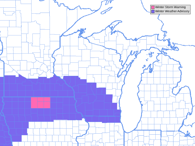
A winter weather advisory had been issued for parts of central and southern Wisconsin until 6 p.m., but the National Weather Service ended the advisory early.
By 11 a.m., the National Weather service reported nearly three inches of snow in West Allis and two-and-a-half inches further inland in Big Bend and Pewaukee. Another two-and-a-half inches were reported as far north as Germantown and as far south as Franklin by around noon.
Five-and-a-half-inches were reported in Madison before 10:30 a.m., according to the weather service.
Earlier this morning, snow started in southwestern Wisconsin at around 3 a.m. The rain started turning to snow at around 7 a.m. in Madison and reached the western and southern edge of the Milwaukee metro area after 9 a.m., said Tim Halbach from the National Weather Service.
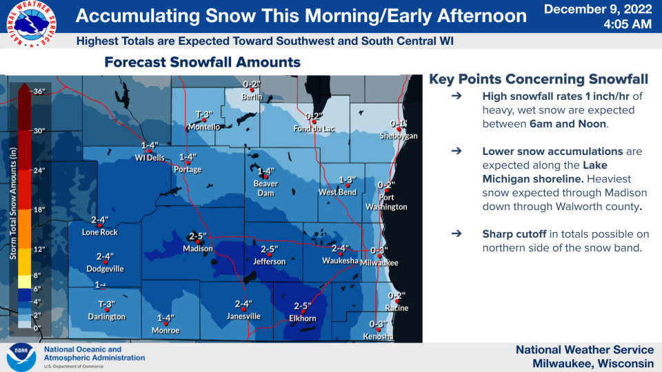
The heaviest snow was forecast southwest and central Wisconsin, including Madison, which could see 2 to 5 inches of snow total, according to meteorologist Rebecca Hansen at the National Weather Service.
Communities near Lake Michigan were expected to see rain or a wintry mix.
"We are going to be dealing with potentially warmer temperatures along the lake, which could result in some rain instead of snow," Hansen said. "And then temperatures look to warm a little bit as we head into the afternoon so we can see a transition to rain or a wintry mix in general for the area."
The further inland or the further south you travel, the more likelihood of snow, Hansen said. She forecasted 1 to 2 inches of snow for communities west and south of Milwaukee, including Racine and Kenosha.
According to its "hazardous weather outlook," the National Weather Service says "the greatest amounts (of snow) are expected along and south of a line from the Wisconsin Dells to Watertown to Waukesha."
"If you are headed out make sure you give yourself extra time and take it slow in the snow," Hansen said. "Roads will be slushy."
The Milwaukee area typically sees more than 10 inches of snow by the end of December, but there hasn't been a measurable snowfall so far this month.
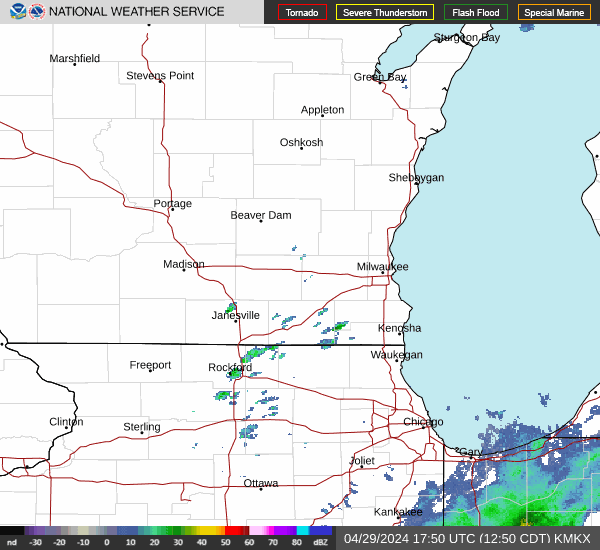
Milwaukee weather radar
Can't see the image? Click here.
Elliot Hughes of the Journal Sentinel contributed to this report.
Contact Drake Bentley at (414) 391-5647 or DBentley1@gannett.com. Follow him on Twitter at @DrakeBentleyMJS.
Our subscribers make this reporting possible. Please consider supporting local journalism by subscribing to the Journal Sentinel at jsonline.com/deal.
DOWNLOAD THE APP: Get the latest news, sports and more
This article originally appeared on Milwaukee Journal Sentinel: No major disruptions after first measurable snowfall in Milwaukee area

