Pascack Valley flooding issues to be focus of studies expected to begin this fall
- Oops!Something went wrong.Please try again later.
Westwood and surrounding municipalities will begin preparing studies this fall to help figure out ways to stop the chronic flooding that has plagued the area.
The two studies, one that looks at systems used in other reservoirs across the country and another that will employ a drone to find clogged waterways, were outlined in a meeting recently with Westwood Mayor Raymond Arroyo, state Sen. Holly Schepisi and a professor from Stevens Institute of Technology, who talked about the next steps in the process. Both studies are anticipated to begin in the fall.
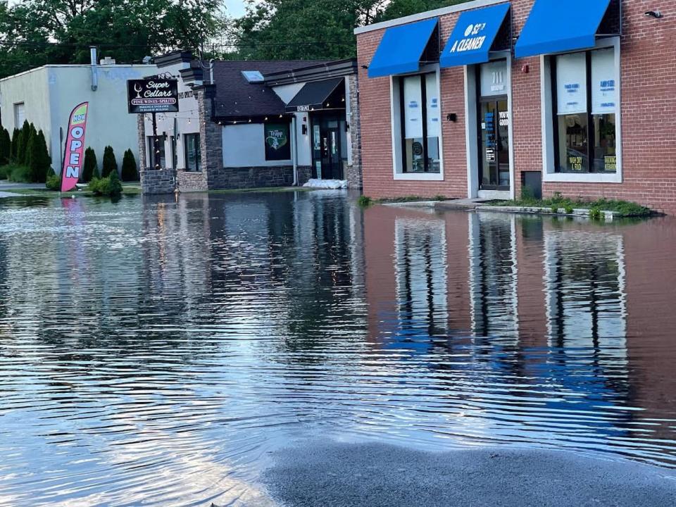
In recent years, flooding has become commonplace near Westwood and Hillsdale, which are close to the Woodcliff Lake Reservoir, not only during major storms but during smaller rain events.
“Now there are certain areas in Hillsdale, Westwood and River Vale that are flooding all the time, even if it’s minor rain events,” Schepisi said. “It’s become psychologically as well as financially devastating for some of our residents.”
The flooding and resulting property damage for their residents caused members of the Pascack Valley Mayors Association to call on Veolia Water, the utility that manages the Woodcliff Lake Reservoir, to keep water levels at 91 feet last year. But the plan did not get backing from the Department of Environmental Protection, which said “reservoirs in Bergen County and their related water supply infrastructure are not designed to mitigate floods."
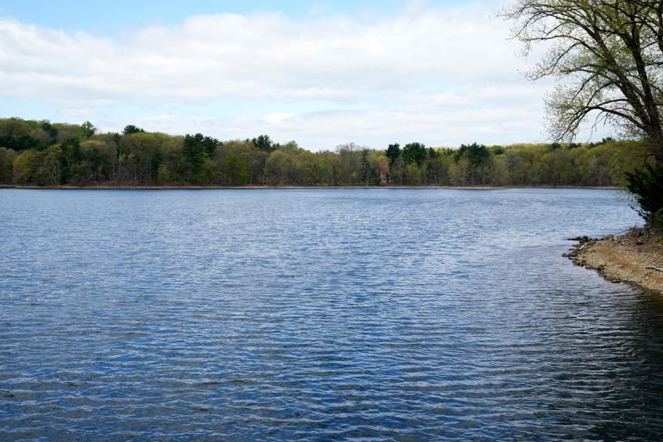
Veolia has four dams in the Hackensack River watershed for reservoirs that supply water to 870,000 residents in Bergen and Hudson counties.
Now the mayors are continuing to search for ways to address the flooding issues facing many residents in their towns through new studies.
Weather forecast study
The first study, which Schepisi said has received funding from the Assembly and the Senate, would investigate systems in place in New York's Catskills and in some areas of California that accurately forecast weather so water levels can be lowered in reservoirs ahead of time to reduce flooding.
Although the study is still being finalized with the university, it would have Marouane Temimi, an associate professor in the Department of Civil, Environmental and Ocean Engineering at Stevens Institute of Technology, conduct the study and see how the system could apply to the Woodcliff Lake Reservoir.
NJ flooding is getting worse: Saturation Point series traces impact, inspects solutions
“We would like to study the current scenario and the way the reservoir is being managed right now,” Temimi said. “Then, we could propose a new method to manage the reserve that could rely on the weather forecast to optimize the management of resources.”
Temimi said it’s “always challenging to forecast weather,” but the National Oceanic and Atmospheric Administration, a government agency that forecasts weather, has made great progress in improving the quality of predictions. The organization can run as many as 30 variations of models to predict the probability of weather more accurately, Temimi said.
Schepisi said the method would ensure that water supply demands were not negatively affected while also using new technology to get accurate forecasts and release water reliably ahead of a storm event.
Arroyo, the Westwood mayor, said the study is “expected to prove that the twin objectives of operating the reservoirs to maintain adequate reserves and reduce the instances of downstream flooding are not mutually exclusive goals.”
Schepisi, a Republican, has a bipartisan bill pending in the state Senate, co-sponsored by Paramus Democrat Joseph Lagana, that would authorize local emergency management offices to order the reservoir to be lowered in response to bad weather. Schepisi believes the studies will help create a strong argument for the legislation and move things forward.
Drone study
A secondary study will involve having Westwood’s engineer use a drone to identify current waterways where there are significant silt and blockages. Schepisi hopes the results of the study will allow the towns to coordinate with the county, Veolia and DEP to clean out these water arteries to increase flow.
Arroyo said the idea to use drones to provide a visual record of stream conditions is something the borough started to think about last year.
Boswell Engineering, Westwood's engineering firm, has contracted with Washington Township to perform the study, which would identify “choke points, significant deadfall, eroded stream banks and silt-formed sandbars,” Arroyo said. He said these obstructions have redirected waterflow from streams into homeowners’ backyards and have also “compromised infrastructure, like bridges and sewer lines.”
The mayor said River Vale and Washington Township are on board and have received council approvals to proceed with the studies. Arroyo said he also has spoken with Hillsdale Mayor John Ruocco, whose council is expecting to formalize its own approval for the project in September.
Arroyo is hoping to get as many towns as possible near the Pascack and Musquapsink brooks to participate “to get a comprehensive understanding of the problems that are present in each town.” The cost for the project will vary from town to town due to different stream banks, with participating towns already budgeting funds.
Debra Vial, a spokeswoman for Veolia, and Arroyo both confirmed that some funding will be provided by Veolia for the drone project. Vial said Veolia “cares deeply about the safety of our communities” and will support the drone study to find brooks and rivers that may be clogged with debris.
Vial said the flooding issue in the region is complex, noting that a storm from two weeks ago caused a flood in Westwood but the reservoir's gauging station “did not reach even minor flood stage.”
“There are many reasons an area floods, including clogged or inadequate storm drain systems, development in watersheds, and streambeds that are filled with debris and have not been properly cleared,” she said. “These are all issues facing communities in this area.”
Vial said the reservoir system is regulated by the Department of Environmental Protection and that its dams pass stormwater in a “more controlled way instead of allowing water to surge downstream.”
Since “droughts and weather forecasts are unpredictable," Vial said, Veolia's regulators consider "every drop of water precious." She added that when the state told water suppliers to lower water levels several feet during Hurricane Sandy years ago, the amount of predicted water “never materialized” and caused a shortfall.
“While these dams are indeed providing some reduction in peak flow rates during storm events, they were built for water supply, not as flood control measures,” Vial said. “The homes that were allowed to be built in floodplains can still be affected by weather events.”
Stephanie Noda is a local reporter for NorthJersey.com. For unlimited access to the most important news from your local community, please subscribe or activate your digital account today.
Email: noda@northjersey.com
Twitter: @snoda11
This article originally appeared on NorthJersey.com: Two studies to begin in fall to address Pascack Valley flooding issues

