Pasco unveils a new voter district maps after ‘technical anomalies’ were questioned
The city of Pasco has unveiled a new redistricting map that will effect city council representation for the next 10 years.
This comes after the city’s previous map was mired with “technical anomalies” or discrepancies between the U.S. Census block geography data altered by the 2020 census and the older data provided by Franklin County and Pasco.
The problem was raised during a public hearing on Nov. 7.
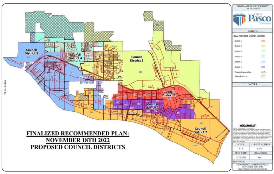
After fixing the discrepancies, the city was required under state law to republish the map with its revised boundaries.
The Pasco City Council plans a second reading and likely the final passage of the plan on Monday, Dec. 5. The city is encouraging residents to get their public comments on the map in before then.
There don’t appear to be any changes in populations between the first draft and this latest iteration — and the city will still keep three voting districts where the majority of the voting-age population is Hispanic.
Those are District 1 (58.6% are Hispanic and of voting age), District 2 (51.6%) and District 6 (58.6%).
The new map also includes recently-annexed parts of the city, although they will not make up the population totals because they were only included after the 2020 U.S. Census was finished.

