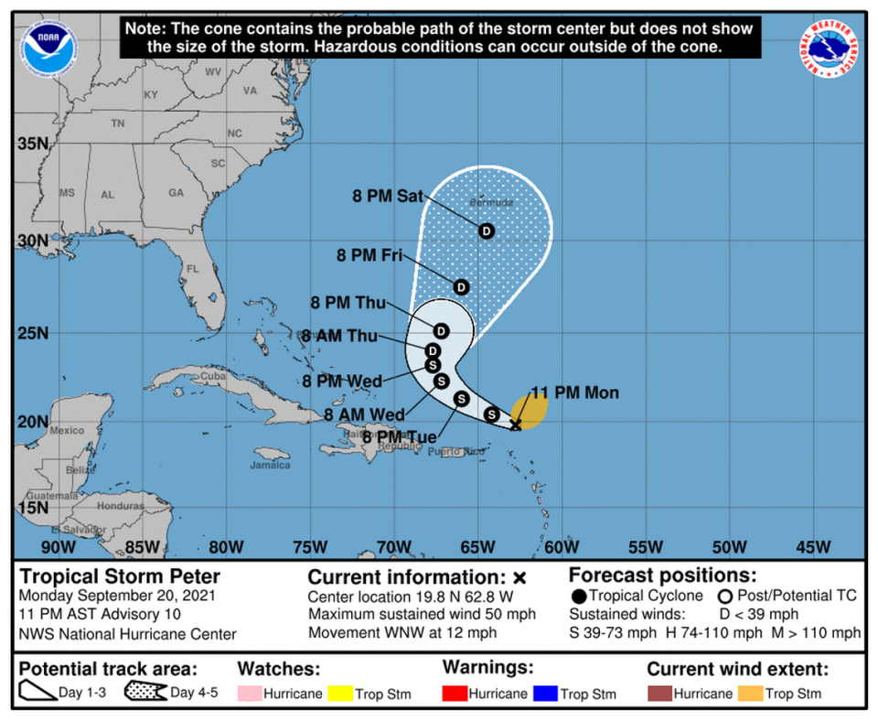
Peter and Rose are in the Atlantic, and another system is forecast to be a depression
As Tropical Storms Peter and Rose continue to move across the Atlantic on Monday, forecasters are also eyeing two other systems, one of which could become a tropical depression by the end of the week.
The disturbance that could turn into a depression this week was producing disorganized showers and thunderstorms in the far eastern Atlantic early Monday, several hundred miles southeast of the Cabo Verde Islands, according to the National Hurricane Center.
It’s expected to move west across the Atlantic at 10 to 15 mph. As of the 8 p.m. update, it had a 40% chance of formation in the next 48 hours and a 80% chance of formation through the next five days.
The other disturbance, the remnants of Tropical Storm Odette, was a couple hundred miles southeast of Newfoundland. While it could acquire some subtropical characteristics this week as it moves over the warmer waters of the north-central Atlantic, its formation chances remained at 30% through the next five days and 10% for the next two days, according to the hurricane center.
Neither of the tropical storms is expected to affect Florida.
Where is Tropical Storm Peter going?
Peter was moving toward the west-northwest near 12 mph with maximum sustained winds near 50 mph with higher gusts. It was about 110 miles north of the Northern Leeward Islands, as of the National Hurricane Center’s 11 p.m. Monday advisory.

“Based on the latest track, intensity, and wind radii forecasts, no tropical storm watches or warnings are required for the northern Leeward Islands, Virgin Islands, or Puerto Rico at this time,” forecasters wrote. “However, locally heavy rain is possible on Monday and Tuesday when Peter is expected to pass to the north of these locations.”
Peter is expected to keep moving west-northwest for the next couple of days and should pass of the Leeward Islands early this week, forecasters said.
It should weaken back into a tropical depression by the time it turns to the northwest, likely on Wednesday, according to the hurricane center. By Saturday, it should be near Bermuda.
Tropical Storm Rose forecast

Tropical Storm Rose is moving northeast over the eastern Atlantic with maximum sustained winds near 50 mph with higher gusts. It was about 775 miles west-northwest of the Southernmost Cabo Verde Islands, as of the 11 p.m. advisory.
While some slight strengthening will be possible Monday, forecasters expect Rose will slowly weaken back into a tropical depression, and eventually into a remnant, when it’s out in the open waters of the eastern Atlantic this week.
Miami Herald staff writer Carli Teproff contributed to this report.

