Pisgah National Forest fire continues to grow as rain falls on WNC; what's the forecast?
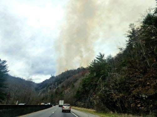
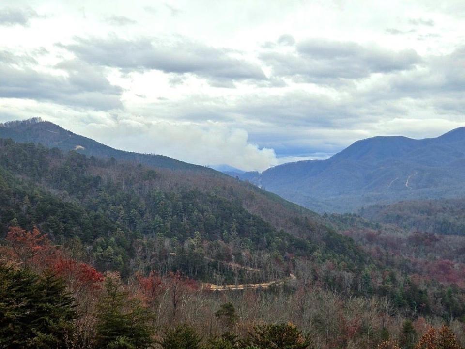
ASHEVILLE — A wildfire in the Haywood County area of Pisgah National Forest grew another 148 acres Nov. 21 over the previous day, yet officials say fire behavior remains minimal despite strong winds, with much-needed rain helping abate the flames.
The Black Bear Fire burning near Interstate 40 reached 1,888 acres Nov. 21, with no increase in containment from the previous day’s 42%, according to a Nov. 21 news release from the North Carolina Forest Incident Management Team.
The area remains under a hazardous weather outlook and wind advisory from the National Weather Service, with isolated heavy rainfall possible throughout the day and into the night of Nov. 21. Winds are expected to reach 20 to 30 mph, with gusts up to 55 mph in higher elevations, according to NWS.
After finishing the handline from Groundhog Creek drainage east of the fire, crews have completed all primary containment line preparation, according to the release.
“Despite winds last night, fire behavior was minimal and containment lines were not tested by the fire,” the release said. “Today will bring breezy conditions and rain, further moderating fire behavior. While flames may not be visible, fuels will continue to smolder, and smoke will be visible.”
Last update: Black Bear Fire grows forcing more closures, high wind advisory threatens further spread
The incident team said fire behavior Nov. 21 is expected to be minimal, with surface fuels not being conducive for active fire. However, scattered heavy fuels, such as log ends, snags and stump holes, will retain heat and may be a source of ignition once the area dries.
As of Nov. 21, there are 195 personnel assigned to the fire. Nov. 21 will be the last operational day for the Southern Area Blue Incident Management Team on the Black Bear Fire, as they’ve reached the maximum number of consecutive days they can work, after immediately transferring to the Pisgah Forest fire from the Collett Ridge Fire, according to the U.S. Forest Service. The National Forests in North Carolina will assume command of the incident on Nov. 22.
See a map of fires burning across Western North Carolina at https://data.citizen-times.com/fires.
Fire in Great Smokies: Update: Wind stokes wildfire in Great Smoky Mountains National Park, closures in effect
No structures have been damaged or threatened, and no injuries have been reported as of Nov. 20, according to spokesperson Meredith Hollowell for the National Forests in North Carolina.
The N.C. Forest Service previously said the fire started from a vehicle collision Nov. 16 near the Tennessee border, but Hollowell told the Citizen Times that the cause is still undetermined.
“The National Forests in North Carolina Law Enforcement Officers conducting the investigation expect to wrap it up by the end of the week,” Hollowell said.
Weather outlook
Much-needed rain has finally made its way across the mountains, with WNC seeing light-to-moderate rain through the afternoon of Nov. 21. But according to meteorologist Clay Chaney with NWS, less rain is expected where the fire continues to smolder in Haywood County.
“Waynesville has had about a quarter of an inch, but closer to where the fire is, they’ve had about two tenths of an inch,” Chaney told the Citizen Times. “They are kind of in a rain shadow, so they could end up seeing less than some of the surrounding areas. We’re looking at upwards of an inch forecasted there.”
Asheville has received close to a quarter-inch, with about 1.5 inches of rain expected with this storm system.
“The main ban along the cold front that is moving in will push through between 5-6 p.m., and that could bring the heaviest rain,” meteorologist Clay Chaney with NWS said.
WNC drought worsens: Pisgah National Forest fire still 0% contained; parts of WNC worsen due to 'extreme' drought
Pisgah hunting fatality: App State grad dies in Pisgah National Forest hunting accident, no foul play suspected
Despite recent rain, WNC still lags behind normal rain totals for November and the rest of the year. The Asheville area is 2.25 inches below normal levels for the month and about 13 inches below for the year, Chaney said.
“The last time we’ve come close to an inch of rain was back on Sept. 10 when we had .89 inches,” Chaney said. “The last time we received an inch of rain was Aug. 27.”
Fire-related closures
There might be reduced visibility and increased driving hazards due to periods of torrential rain with gusty winds Nov. 21, the release said.
On Nov. 19, the U.S. Forest Service issued an emergency closure of the Appalachian Ranger District of the Pisgah National Forest and Unaka Ranger District of the Cherokee National Forest in Tennessee, including entering or being present in the area on all roads and trails. This order is effective through Dec. 31 or until its rescinded by a forest service official.

Roads and trails within the closure area include:
Cold Springs Creek Road
Browns Gap Road
Harmon Den Mountain Road
Groundhog Road
Hickory Ridge Road
Skiffley Creek Road
Chestnut Orchard Road
Carmichael Tract Road
Snowbird Road
Appalachian Trail From I-40 to Max Patch
Groundhog Creek Trail
Rube Rock Trail
Campsite closure: Backcountry campsites for 9 NC state parks closed due to increased fire risk
The Great Smoky Mountains National Park closed most park roads as well as Elkmont and Cades Cove campgrounds Nov. 20 until further notice due to hazardous weather conditions.
Burn bans are still in place through WNC. The Blue Ridge Parkway has banned backcountry campfires, while the Great Smoky Mountains National Park has banned all campfires and charcoal use throughout the park. Backcountry campsites are closed in nine N.C. state parks.
For fire updates, visit ncforestservice.gov/fire_control/sit_report.htm or follow the N.C. Forest Service on Facebook at facebook.com/NCForestService.
Ryley Ober is the Public Safety Reporter for Asheville Citizen Times, part of the USA Today Network. Email her at rober@gannett.com and follow her on Twitter @ryleyober
This article originally appeared on Asheville Citizen Times: Black Bear Fire grows in Pisgah with inch of rain, no containment adds

