Wintry weather creates arduous driving on higher-elevation B.C. routes
An Arctic front passing through Western Canada is delivering snowy highway conditions and unsettled weather across the B.C. South Coast.
Travellers are advised to keep a close eye on the forecast and adjust their driving to the changing road conditions. Special weather statements are in place for parts of the province.
SEE ALSO: Picturesque B.C. glacier is undergoing dramatic changes, what it means for us

Tuesday overnight to Wednesday
A very rainy low impacting southern Vancouver Island and the Lower Mainland will linger into Wednesday, with rain, wet snow and mixing all on the table.
Freezing levels remain unusually low for this time of year, hovering at and below 600 metres this week.
Higher-elevation driving routes along Vancouver Island, including roadways extending outside the Lower Mainland, could continue to accumulate some wet snow through Wednesday morning's commute. Snow was reported in Cumberland and along Highway 19 across Vancouver Island.
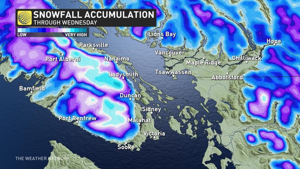
Areas close to the border, between Abbotsford and Osoyoos, will see the heaviest snow overnight Tuesday. Snowy conditions in the Interior, specifically around Eagle and Rogers Pass, will have eased by Wednesday morning.
This could make the road surfaces slippery, so if you haven't switched to your winter tires, yet, now may be a good time to do so.
DON'T MISS: B.C.'s famous golden larches make mountains sparkle in fall
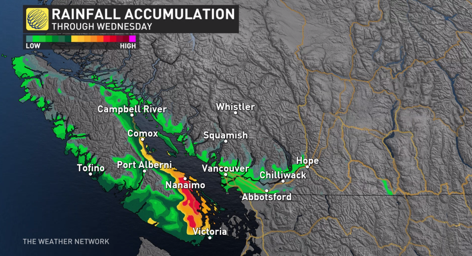
Heavy rain for parts of the South Coast
Snow won't be the only form of precipitation in B.C. over the next 24 hours.
Heavy rain is expected to persist near Nanaimo and southwestern Metro Vancouver, with local totals exceeding 50 mm through Wednesday morning before conditions begin to ease.
Showers will then be possible for southern Vancouver Island Thursday, but overall, a mostly dry pattern through the end of the week and weekend with colder-than-normal temperatures.
A milder pattern is expected next week, while a potentially wetter pattern could return as we get into the first week of November.
Check back to The Weather Network for more forecast information and updates on your weather in B.C.
Thumbnail courtesy of DriveBC.ca.

