Poor travel expected as snow squalls push through parts of southern Ontario
The lake-effect machine is in full gear in southern Ontario this weekend.
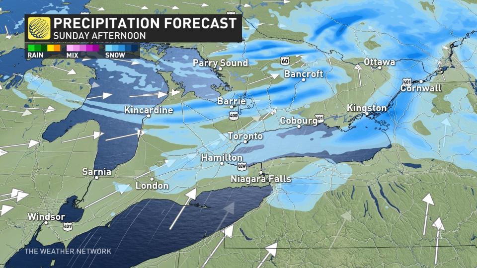
Widespread snow squall warnings are in effect east of Lake Huron and Georgian Bay, as well as for portions of the Niagara Peninsula and the Kingston and Cornwall areas. There are also winter weather travel advisories for parts of the Niagara region and areas along the Lake Erie shores.
DON'T MISS: Record warmth melts Great Lakes ice to historic February lows
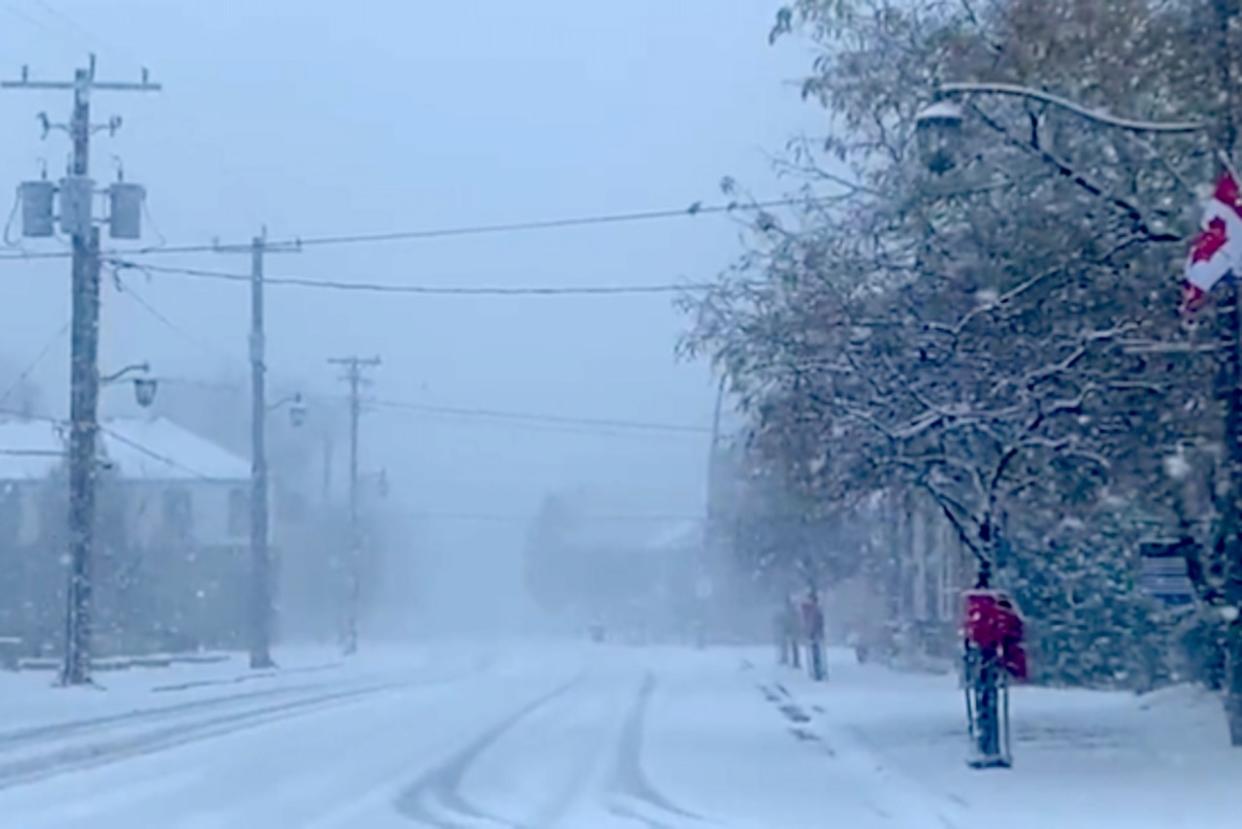
Just a reminder that snow squalls cause weather conditions to vary considerably. Changes from clear skies to heavy snow within just a few kilometres are common. Visibility will be suddenly reduced to near zero at times in heavy snow and blowing snow.

Be prepared to adjust your driving with changing road conditions. Calm conditions can give way a sudden whiteout in a matter of seconds when driving at highway speeds.
On Sunday morning, localized whiteouts are forecast east of Georgian Bay as frontal squalls kick up along a cold front associated with the low-pressure system aiming toward Quebec.
The southwest winds also align with Highway 401 east of Cobourg, producing bands of heavy snow through Prince Edward County and Kingston, making for locally hazardous conditions continuing on Sunday. A reported 12 cm of snowfall was documented near Kingston as of Sunday morning.
Plan ahead to avoid areas at risk of snow squalls this weekend, and prepare for extensive delays if travelling through the snowbelts.
No significant snowfall totals are in the forecast for the Golden Horseshoe, but winds will continue gusting to 60 km/h across the region on Sunday.
By Sunday afternoon, a couple of potent snow squalls are migrating off Georgian Bay, creating tough travel conditions as they sink south. A meagre 1-2 cm of snowfall is possible across the GTA late Sunday.
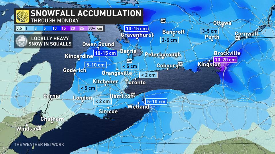
Snowfall totals by the end of Sunday should amount to 15-20 cm across many of the traditional snowbelt areas, which is a gift to ski resorts that have been hurting for decent snows this season.
RELATED: Why the Great Lakes produce some of the world's heaviest snows
The weather on Monday looks perfect for folks hoping to visit the ski resorts and hit the slopes to celebrate Family Day. High pressure will dominate the region by the start of the week, allowing for sunshine with some periodic clouds through the day.
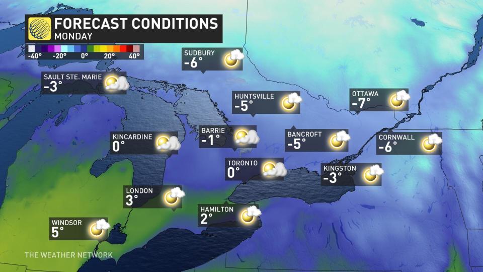
Temperatures will remain below freezing for central and eastern Ontario, with highs around the freezing mark in the Greater Toronto Area and a bit milder to the southwest.
The next chance of active weather will be into Thursday, but it will be mild enough for showers across parts of southern Ontario with snow farther north. The good news is the system isn't expected to be disruptive, but will become more organized as it pushes across Atlantic Canada.
Stay with The Weather Network for all the latest on your forecast across Ontario.

