Potent winter-like storm threatens 30 cm of snow, ice in northern Ontario
A major, wintry storm is headed for northern Ontario to end this week, while the south is getting a fall reboot with much colder temperatures this weekend and some lake-effect snow. A strong Colorado low will bring everything from snow to freezing rain and ice pellets across the north, most likely to threaten travel for a long stretch of the Trans-Canada Highway. Some areas may see 30+ cm of snow after all is said and done, along with blustery winds which could result in dangerous whiteout conditions. More on timing and impacts, below.
MUST SEE: A snowstorm and tropical system set to collide over Eastern Canada
Thursday night through Saturday: Potent winter-like storm takes aim
A strong warm front will do a side shuffle across northeastern Ontario Thursday and Friday, producing a 20°C divide over the width of Lake Superior.
Rain began for the region and will continue throughout the day on Wednesday. A developing Colorado low will track along the same boundary, with the rain persisting on Thursday as well.
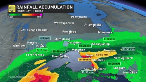
By Thursday evening, the rain will transition to snow in northwestern Ontario and into freezing rain and snow for sections of the northeast.
Right now, the heaviest band of snow is forecast through Lake Nipigon, Geraldton, Kapuskasing and into western Quebec, where 20-40 cm may fall.
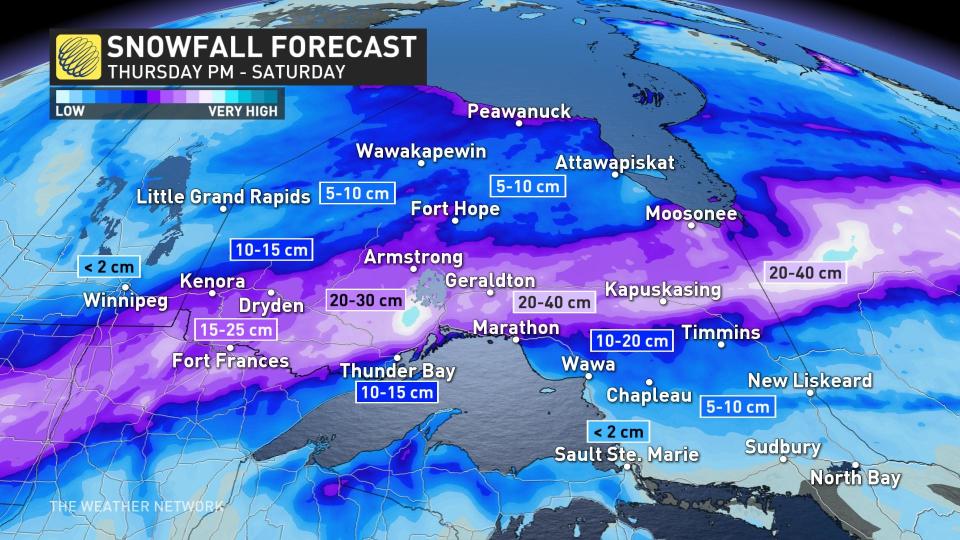
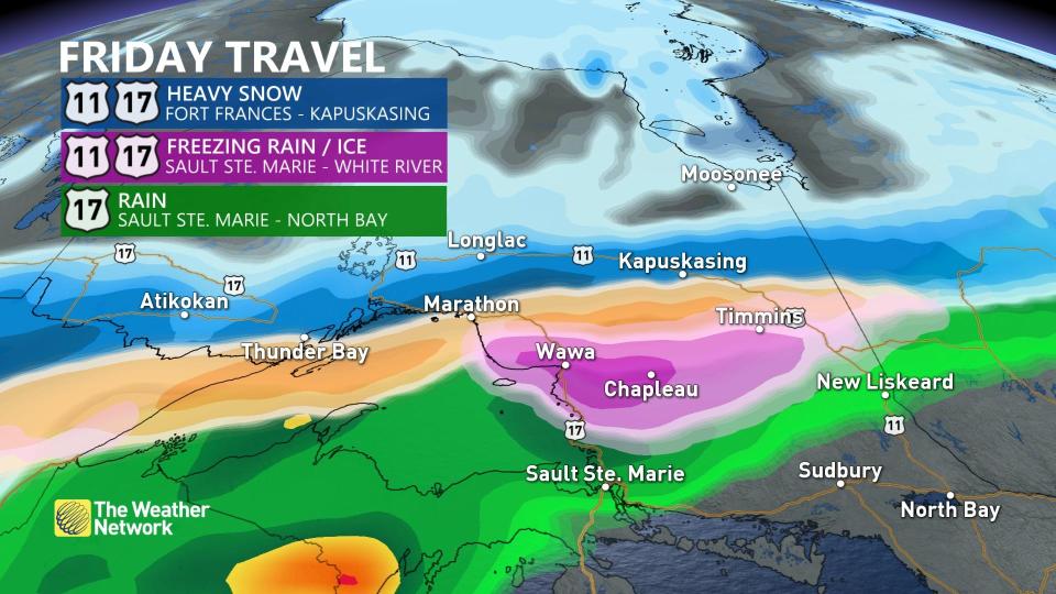
Extensive blowing and drifting snow are also likely with the windy conditions that accompany the system, which threatens whiteouts and possible road closures.
The freezing rain threat will be south of the heaviest area of snow, bringing the greatest risk to Wawa, Chapleau, and Timmins. There is the potential for some areas to reach and even exceed two centimetres of ice accumulation on untreated surfaces. This will also make for dangerous road conditions, especially it being the first major freezing rain event of the season.
Additional snow showers are expected into early next week as colder than seasonal temperatures are set to dominate through the end of November.
The warming trend across the south will continue to bring daytime highs into the mid- to upper-teens across much of southern Ontario through Friday, but with a major pattern change expected to begin this weekend as well.
Be sure to check back for the latest weather updates across Ontario.

