Potential for heavy rain, hail in Fond du Lac, Sheboygan, and Fox Cities as afternoon thunderstorms move into eastern Wisconsin today
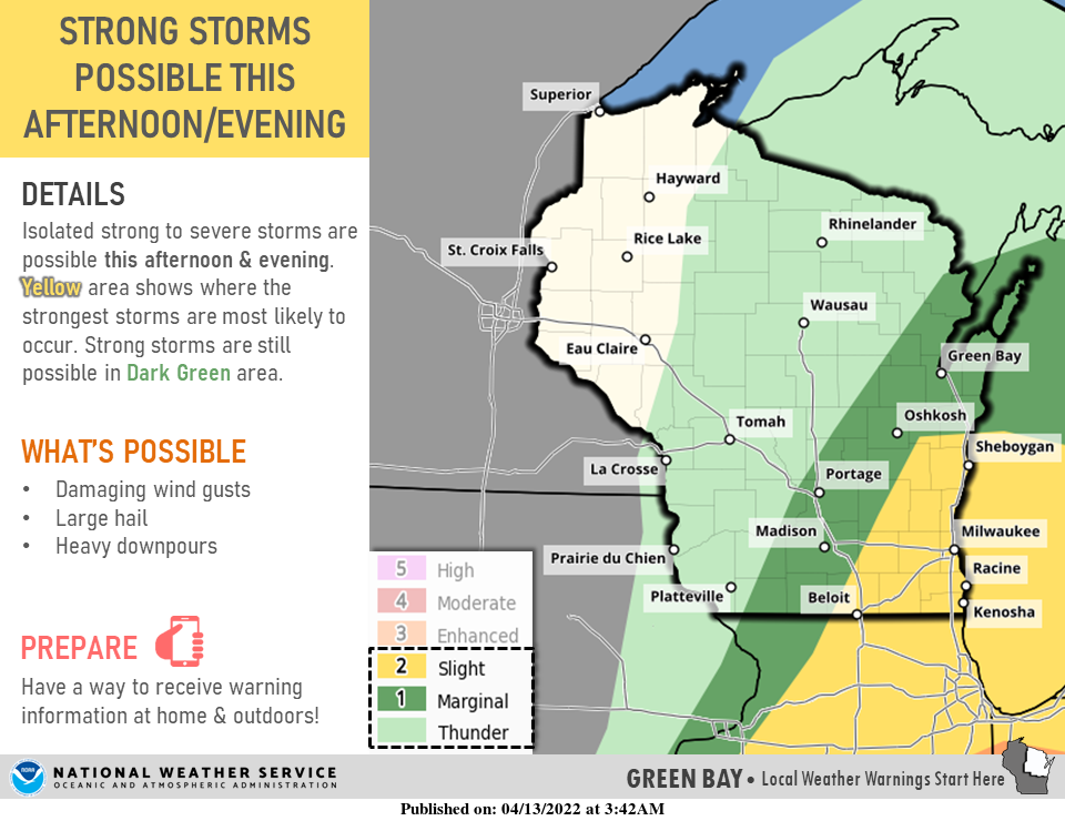
A second storm system will move into eastern Wisconsin this afternoon, possibly producing strong winds and hail, according to the National Weather Service.
This is the second day in a row that severe weather has raked Wisconsin. On Tuesday afternoon and evening, severe thunderstorms hit central and northeastern Wisconsin, producing hail in some areas.
Today, the strongest storms, with the chance for winds up to 60 miles per hour and hail, are most likely to happen near Sheboygan and Fond du Lac from 1 to 7 p.m. today. However, residents of the Fox Valley also should be on the lookout for severe weather, according to the National Weather Service.
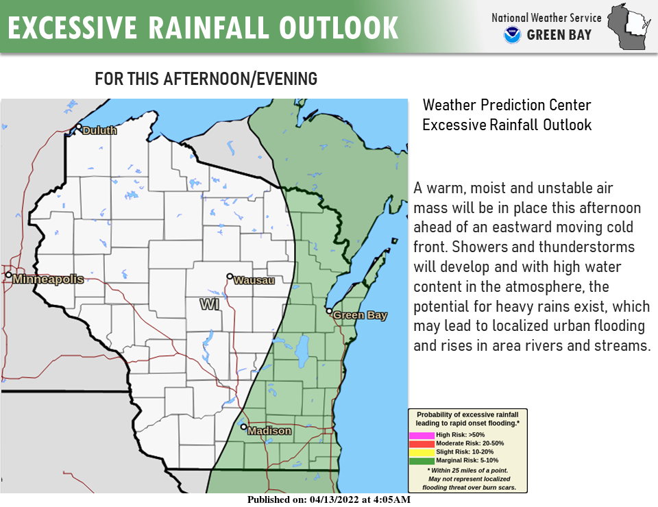
There's also the potential for heavy rains that could lead to localized flooding, as well as high winds with gusts up to 45 mph.
After a warmer day today, with highs in the 60s, the temperature is expected to drop for the next several days, with highs in the 40s to the end of the week.
Storms around this time of year aren't unusual for Wisconsin, according to Mike Cellitti, meteorologist with the National Weather Service in Green Bay. "Many times, we've had severe weather ramping up in May or June, but it's happened in April before," he said.
Tuesday night storms tracked across Wood County, Fox Valley
Strong storms in southeastern Minnesota spilled over into Wisconsin Tuesday evening and overnight, pushing through Wood County and up into the Fox Valley. Rainfall ranged from about half to three quarters of an inch.
At about 5:30 p.m. Tuesday, a severe thunderstorm passed over northern Appleton and De Pere, bringing golf-ball-sized hail that lasted for about 10 to 15 minutes, according to Cellitti.
More: Watch a hailstorm hit Appleton
Wisconsin weather radar

Can't see the radar? Click here.
Contact Rebecca Loroff at (920)-907-7801 or rloroff@gannett.com.
This article originally appeared on Appleton Post-Crescent: Severe weather possible for eastern Wisconsin Wednesday afternoon

