UPDATE: 'Small' tornado touched down in Barnstable during powerful storm
Editor's note: This story was updated at 8:15 p.m. Tuesday to include information about the tornado that touched down about noon.
A tornado touched down in the vicinity of Marstons Mills during Tuesday's powerful storm. "Witnesses described a chaotic event, observing airborne fence posts and branches, according to a National Weather Service public information statement.
The National Weather Service issued the statement shortly after 7 p.m. Tuesday, confirming that a "small EF-0 tornado touched down in the town of Barnstable, near the village of Marstons Mills, at 11:52 AM. The storm tracked ENE from Evergreen Drive for approximately four minutes before lifting over Joe Thompson Road, at approximately 11:56 AM."
According to the statement, the "damage was most concentrated near the center of the track at the intersection of Race Lane and Osterville-West Barnstable Road."
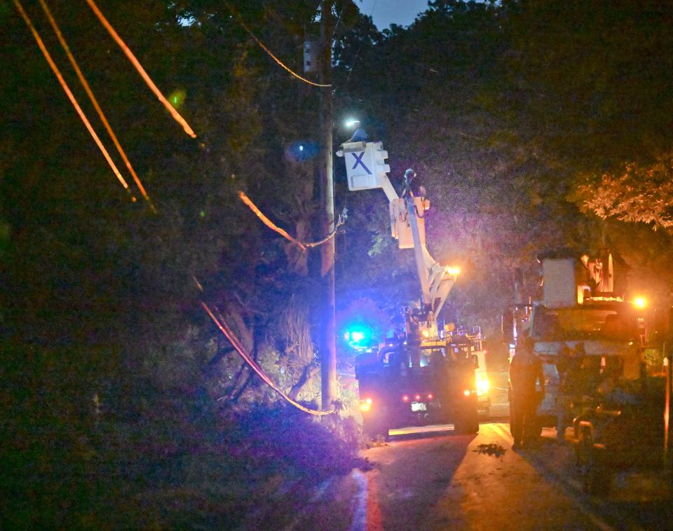
The National Weather Service reported that primary damage indicators of the tornado included a downed electrical pole, an uprooted hardwood tree and strewn debris that included fence posts, smaller trees and branches.
A tornado also touched down in Mattapoisett, just off-Cape, according to the National Weather Service Boston/Norton office. At about 1:30 p.m., the office issued the following statement on Facebook and Twitter:
"(Confirmed Tornado in Mattapoisett) A survey team has confirmed a tornado in Mattapoisett, MA around 1130 AM. The survey team is still investigating damage, and a more detailed statement on EF-rating, start & end times will be sent later today upon damage survey completion."
According to the National Weather Service, the "Enhanced Fujita Scale or EF Scale...is used to assign a tornado a 'rating' based on estimated wind speeds and related damage."
Andrew Loconto, a meteorologist at the National Weather Service Boston/Norton office, said radar-estimated rainfall from the storm ranged from about 1.5 inches in Yarmouth to around three inches in Mashpee and Falmouth. Loconto said the most powerful part of the storm passed over western and central parts of Barnstable County.
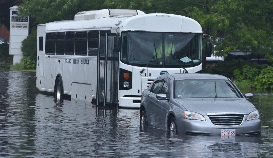
The rain cause flooding and traffic trouble around the Cape. Sean Finn, a Massachusetts state police trooper reached by phone at the South Yarmouth barracks, said officers were dealing with flooded roadways, accidents, disabled vehicles and significant traffic backups after the storm.
Shortly after 1 p.m. on Wednesday, the Eversource outage map indicated that several hundred Cape customers had lost power during the storm.
The silver lining to the tumultuous weather is that the forecast heading into the weekend promises sunny days and warm temperatures.
Here is the Hyannis forecast from the National Weather Service:
Wednesday: Mostly sunny, with a high near 82. West wind around 14 mph.
Wednesday night: Mostly clear, with a low around 68. West wind 7 to 10 mph.
Thursday: A slight chance of showers after 2 p.m. Mostly sunny, with a high near 82. Southwest wind 7 to 11 mph. Chance of precipitation is 20%.
Thursday night: A chance of showers and thunderstorms. Mostly cloudy, with a low around 67. Breezy, with a south wind 14 to 21 mph becoming west after midnight. Chance of precipitation is 50%.
Friday: Sunny, with a high near 81. West wind 11 to 15 mph.
Friday night: Mostly clear, with a low around 65. West wind 7 to 10 mph.
Saturday: Sunny, with a high near 80. Southwest wind 6 to 11 mph.
Eric Williams, when not solving Curious Cape Cod mysteries, writes about a variety of ways to enjoy the Cape, the weather, wildlife and other subjects. Contact him at ewilliams@capecodonline.com. Follow him on Twitter: @capecast.
Thanks to our subscribers, who help make this coverage possible. If you are not a subscriber, please consider supporting quality local journalism with a Cape Cod Times subscription. Here are our subscription plans.
This article originally appeared on Cape Cod Times: Cape Cod weather: Thunderstorms flood roads, cause power outages

