All-time December rainfall records in Quebec in peril with incoming storm
A rare December storm is set to bring some of the heaviest rainfall totals in Quebec's recorded history during December.
While the month began with a hefty dose of snow, for much of southern Quebec, an impending storm set to sprawl across the region will bring considerable rainfall –– potentially enough to smash all-time December records.
Going somewhere? Check out the current highway conditions before heading out!
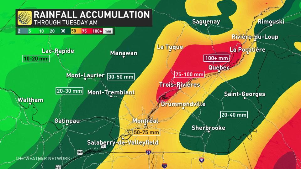
Some regions, particularly near Quebec City, are facing projected amounts of 100 mm or more. Montreal won't be quite as bad, but could still see a hefty total for December, with 50 mm of rain or higher on the table. Those amounts will certainly raise the prospect of localized flooding, especially in areas that still have a decent snowpack.
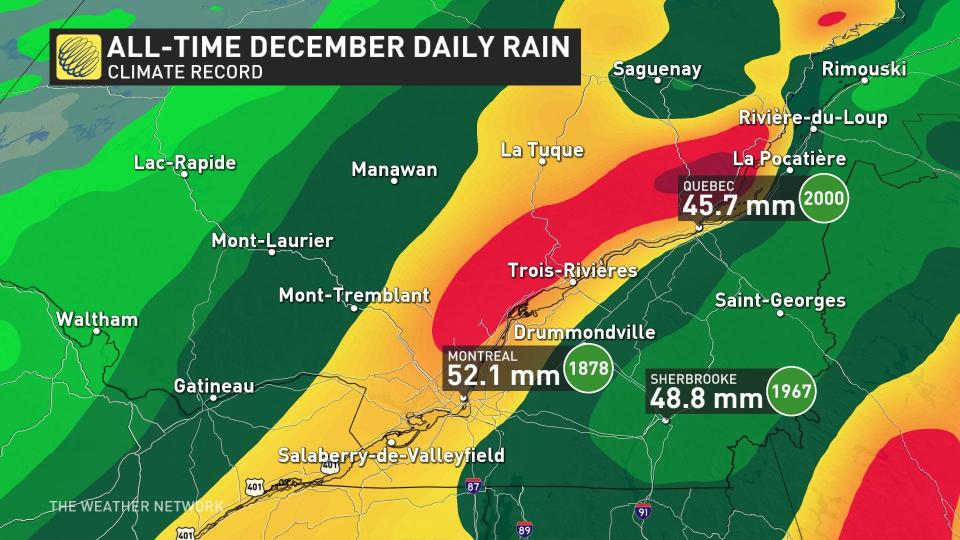
Quebec could set records for highest rainfall totals ever in December
Usually, the atmosphere is much cooler in December and not capable of carrying so much moisture. But temperatures on Monday surge to more than 15 degrees above seasonal across Quebec.

WINTER 2024: El Niño will play a critical role in the weeks ahead
Keep in mind, seasonal for Dec. 1 is roughly -4°C for the Eastern Townships, so temperatures will spill upwards of 20°C above normal. A couple of readings of 15°C or 16°C are possible through Monday afternoon –– more typical of early October.
We’re also projecting Quebec City’s warmest day in December history with a high of 14°C, 20 degrees higher than the average high for this time of year (-6°C).
The December daily rainfall records hover between 40-50 mm, and that’ll be quite achievable throughout the day on Monday.
The threat of flooding is enhanced due to rapid snowmelt, as 18 cm of snow remains on the ground in Quebec City, with much higher amounts at elevation.
Projected rainfall amounts highlight regions north of Quebec City pushing more than 100 mm or more, with the Montreal area comfortably above 50 mm when all is said and done.
Regardless of snowpack on the ground, the risk of localized flooding will certainly be higher in areas that see heavy rainfall.
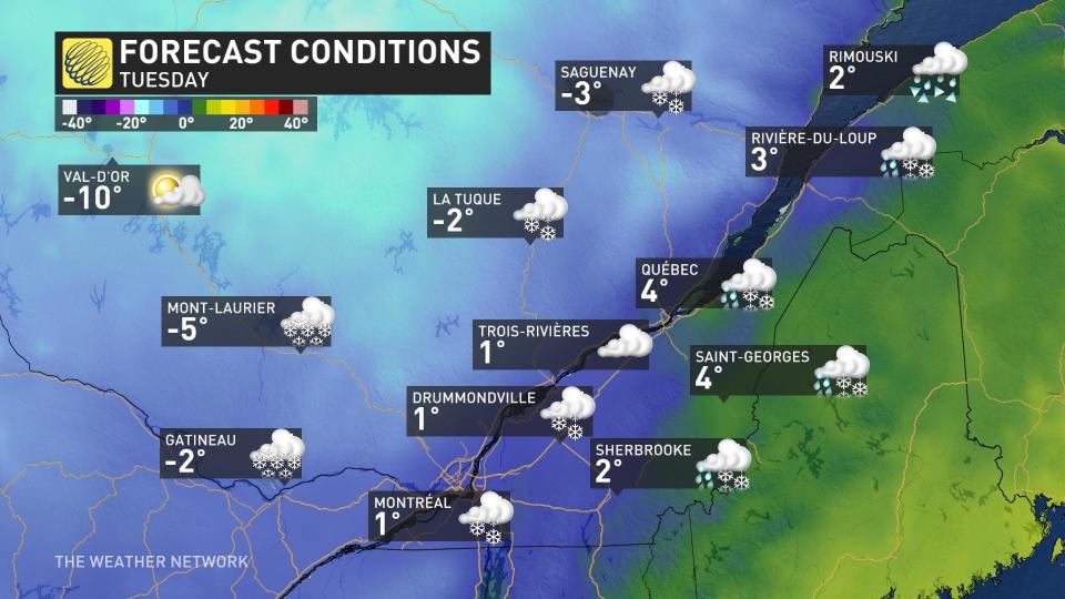
After the heavy rainfall wraps up Monday night, cooler air wraps in behind the system –– pushing temperatures a little closer to the realm of seasonal.
Mild weather will return for Wednesday with some sunshine. Temperatures could be near or above seasonal through next weekend across southern Quebec, but it also includes a chance for quick doses of colder weather for the region, even extending west into eastern Ontario.
At this point, the odds of white Christmas are quite low across the province. However, it is still too early to completely rule out a white Christmas for parts of the region –– it could still be cold enough around Dec. 23-25 for a system that we can’t yet see to bring a coating of snow.
Stay with The Weather Network for the latest on your forecast across Quebec.

