Quebec faces thunder, then snow, as potent storm arrives Sunday
Quebec will bear the brunt of a dynamic storm brewing south of the border, with conditions going downhill late Sunday and disruptive weather continuing into the day Monday.
Precipitation will start out as rain Sunday—complete with a risk for thunderstorms creeping into Metro Montreal.
Cold air wrapping around the storm will force rain to change over to snow for most of southern Quebec on Monday, with some areas seeing hefty totals by the end of the day.
WINTER 2024: El Niño will play a critical role in the weeks ahead
Brewing storm threatens Quebec with a little bit of everything
A low-pressure system trekking across the Great Lakes will drag milder air into Quebec through Sunday. Temperatures are likely to come in warmer when you wake up Sunday morning than they were when you went to bed on Saturday evening.
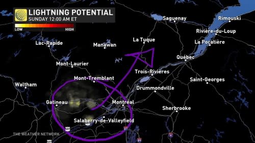
This push of air will arrive with widespread rain sliding north of the border during the overnight hours. We could even see some rumbles of thunder crossing the Ottawa River and approaching Metro Montreal after midnight—not exactly something you’d expect in the middle of December.
It’s a different system developing on Sunday that will cause the most problems across Quebec late Sunday and into Monday.
DON'T MISS: Montreal's recent snowstorm was a 'rare' event. Let's uncover why
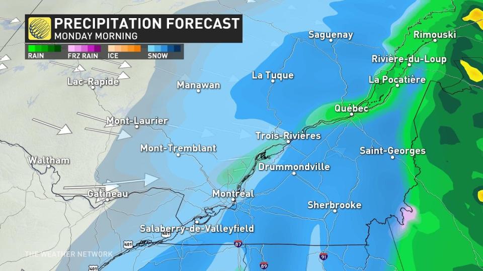
A low-pressure system developing over New England on Sunday will bring a renewed round of heavy precipitation into Quebec. The precipitation will start as rain at first, but cold air filtering in behind the storm will allow the rain to transition over to snow by early Monday morning.
The heaviest swath of snow will follow the heart of the storm as it tracks through eastern Quebec and the Maritimes. We’ll see widespread totals of 15-20 cm throughout the Eastern Townships, southern portions of the Gaspe, and up toward Saguenay.
Metro Montreal will likely see 5-10 cm of snow through Monday, with more possible east into Monteregie.
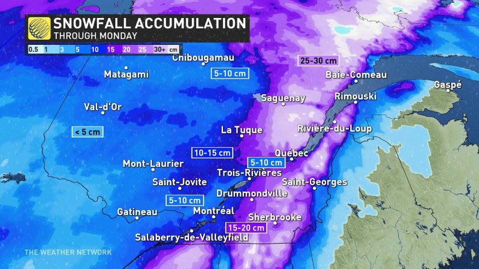
Folks around Quebec City will see snowfall totals vary greatly depending on elevation. Higher elevations may see 10-15+ cm of snow, while the capital city itself stands to receive as little as 5-10 cm from this storm.
Anyone planning to travel through Quebec on Monday—especially during the morning commute—should plan for rapidly changing conditions as temperatures fall and rain gives way to snow. Slick roads and delays are likely as the wet snow piles up through the day.
Going somewhere? Check out the current highway conditions before heading out!
Header image courtesy of Mark & Alia Geres in Cantley, Quebec.
Stay with The Weather Network for the latest on your forecast across Quebec.

