Quick-hitting snow may whiten Great Lakes, central Appalachians into Thursday morning
A quick-hitting storm may drop just enough snow to create slippery travel from the Great Lakes to the central Appalachians into Thursday morning.
While this will not be a blockbuster storm for the area, it can drop just enough snow to create travel difficulties for motorists.
During Wednesday, the snow spread from northern Wisconsin to part of the Lower Peninsula of Michigan.
The snow stayed north of Milwaukee and only a rain and snow mix is likely around Detroit.
Snow will then move into into Pennsylvania by Thursday morning, according to AccuWeather Chief Meteorologist Elliot Abrams.
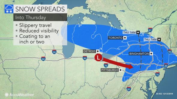
People heading to work and school on Thursday morning from Buffalo, New York, to Erie and State College, Pennsylvania,should be wary of slick spots on any untreated roads and sidewalks.
This includes along stretches of interstates 76, 80, 81, 86, 90 and 99.
Download the AccuWeather app to get the latest snowfall forecasts for your area.
A rain or snow shower can reach New York City around midday Thursday, with the northern and western suburbs at greatest risk for a slippery coating of snow for part of the morning rush and lunchtime hours.
Any snow can end as a period of freezing drizzle, further heightening the risk of slippery travel.
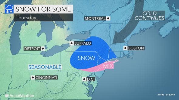
Outside of any lingering patches of freezing drizzle, precipitation will largely wind down by Thursday night. Still, anyone out and about should be wary of lingering icy patches.
Enough mild air will move in ahead of the next storm for it to be mainly a rain event across the region at the end of the week and this weekend.
