Update: George Flagg Parkway reopens after being closed Tuesday for flooding
Update: George Flagg Parkway reopened Wednesday morning after Raccoon River levels fell and Des Moines Public Works Department staff members cleared debris.
Original story:
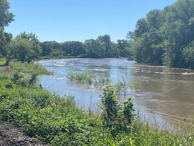
Flooding on the Raccoon River has forced the closure of bike trails and roads near Des Moines' Water Works Park.
A flood warning was issued Tuesday morning for the Raccoon River at Fleur Drive in Des Moines. Des Moines closed George Flagg Parkway between Southwest 30th Street and Park Avenue. Southwest 30th Street was also closed from George Flagg Parkway to Southwest 28th Street.
The Bill Riley Trail in Water Works Park was also flooded.
The Raccoon River had a depth of 12.3 feet there Tuesday morning and was expected to crest at 12.6 feet Tuesday afternoon, according to the National Weather Service. Flood stage is 12 feet.
The flood warning will expire at 1:45 a.m. Wednesday, according to the weather service. The area is on the bike course for Sunday’s Ironman North American Championships, but the closure is expected to last just 48 hours and should not affect the race.
More: Farmer's Almanac predicts Iowa weather to be 'hotter and rainier than normal' this summer
Flooding on Fleur Drive is just the latest sign Des Moines emerged from the drought which gripped the state last year. Tuesday morning the Raccoon River had a flow of 15,600 cubic feet per second, 389% above normal. On June 7, 2021, the Raccoon River was running at just 500 cubic feet per second and had a depth of about 1-foot.
Des Moines got 1.8 inches of rain Sunday and about one-tenth of an inch Monday. Boone got four inches of rain Sunday and Ames got 3.8 inches. As that water flows downstream it is creating minor flooding in the Des Moines metro area.
Beaver Creek near Grimes is expected to rise to 12.4 feet Tuesday, just 1.6 feet below flood stage. The Des Moines River at Southeast 6th Street is expected to rise to 22.7 feet Tuesday, 1.3 feet below flood stage. The Saylorville Lake Reservoir normally has a level of 836 feet, but was at 837.88 feet Tuesday morning.
Bike trails in Johnston north of Interstate Highway 80/35 and in the Beaver Creek Natural Resource Area are closed because of flooding.
Due to the high water and more rain expected this week, the trail under Merle Hay bridge north of I-80/35 is closed.
There are also several inches of water over the trail in the Beaver Creek Natural Resource Area. Trail users are encouraged to use extra caution pic.twitter.com/TlsU8O7a8V— City of Johnston, IA (Official) (@cityofjohnston) June 6, 2022
More thunderstorms are in the forecast Tuesday night into Wednesday morning. Southwest and south-central Iowa have the greatest chances to see severe thunderstorms, which may include damaging wind gusts, large hail and heavy rainfall, between 5 p.m. and 1 a.m., according to the NWS.
Chances for precipitation in Des Moines gradually increase throughout the evening to about 51%.
Additional rain showers are possible Thursday, Friday and Saturday, according to the weather service.
Philip Joens covers public safety, city government and RAGBRAI for the Des Moines Register. He can be reached at 515-443-3347 at pjoens@registermedia.com or on Twitter @Philip_Joens.
This article originally appeared on Des Moines Register: Roads near Water Works Park in Des Moines re-open after flooding.

