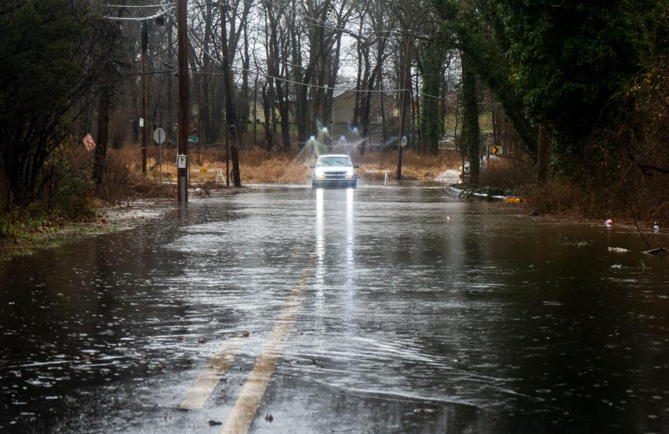
Flooding and road closures across the region. When will rain clear out of Bucks County?
Another day of cold, driving rain is on tap for Bucks County residents Monday, as the remnants of a storm slowly passes through the Delaware Valley, shutting down roadways and threatening floods.
As a result, the National Weather Service in Mount Holly has issued a flood watch for Bucks County and many points in Delaware and New Jersey that will last until 6 p.m.
"Rainfall totals of 2.0 to 5.0 inches are expected, with the heaviest rain continuing for a time this morning. Flooding is ongoing in several areas given the excessive rainfall on already saturated ground. The steadiest rain this morning should end as some showers into this afternoon," the NWS said.
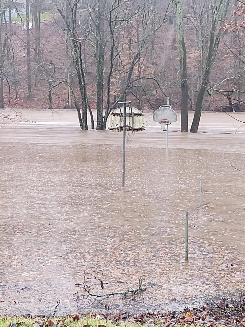
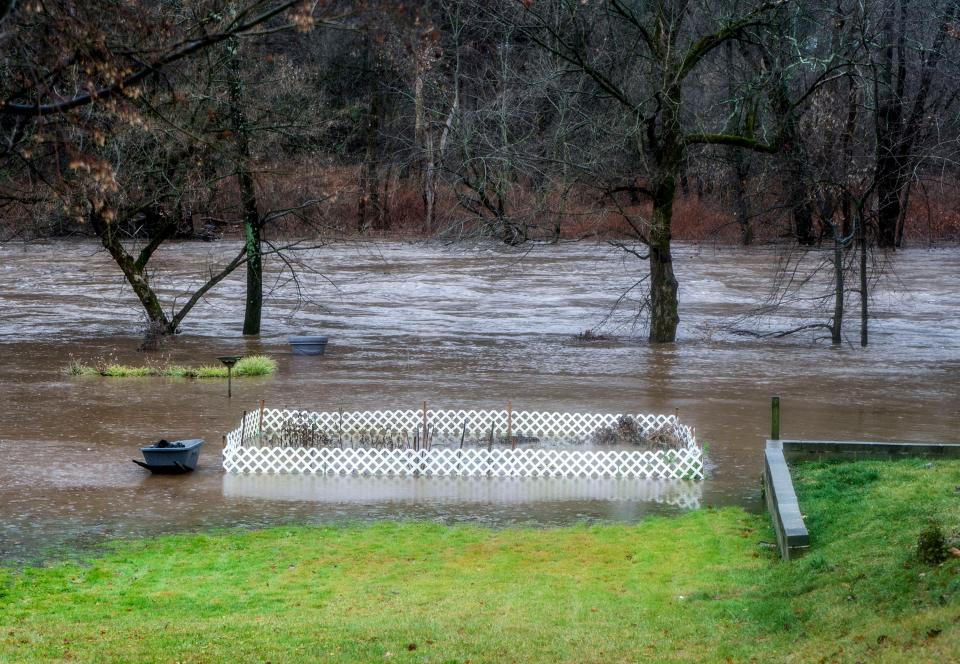
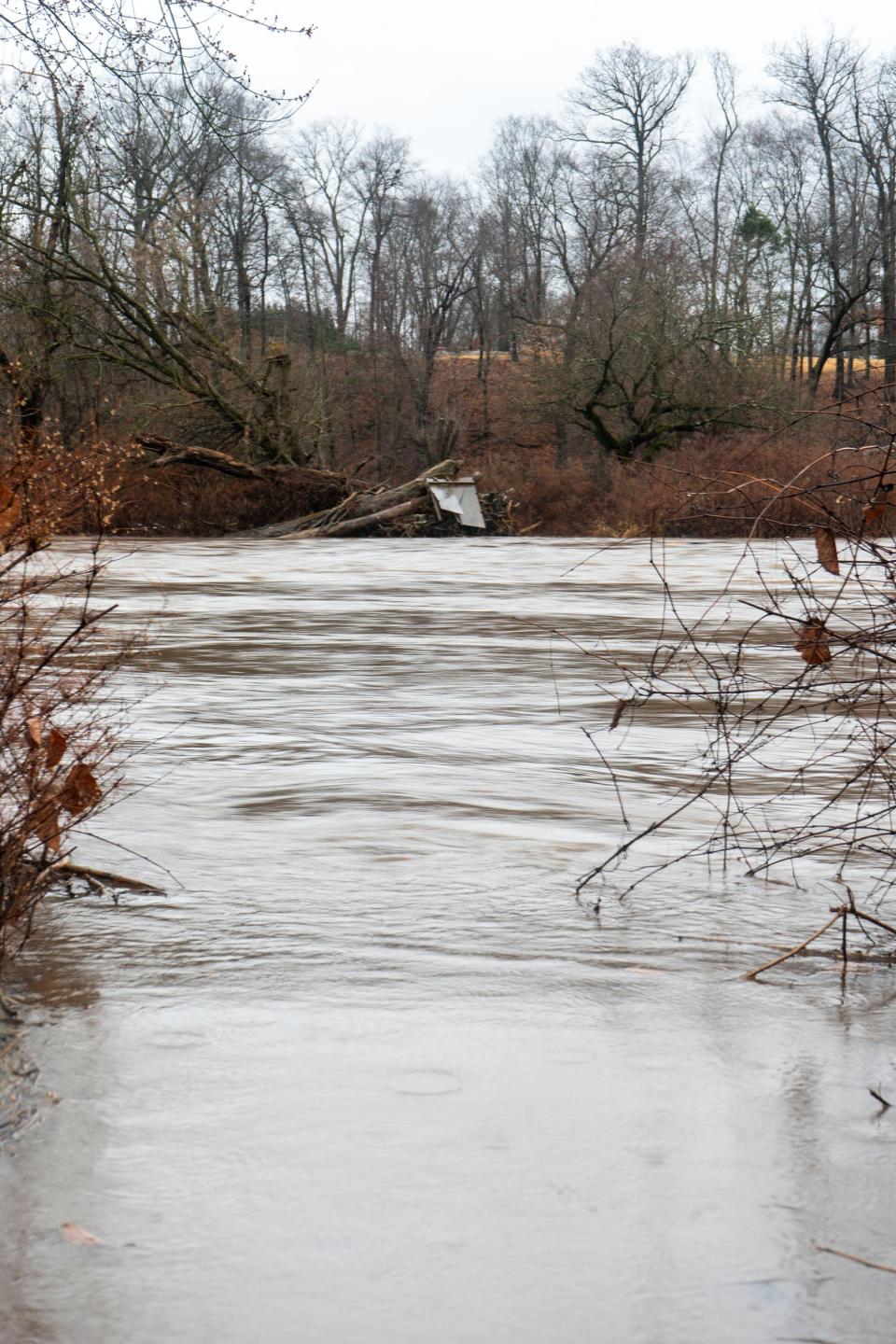
As of 2 p.m. the Neshaminy Creek near Langhorne was more than four feet above flood stage, which is 9 feet,. according to the National Weather Service in Mount Holly. Major flood occurs at 14-feet along this stretch of the creek.
The Neshaminy Creek near Penns Park peaked early Monday morning at nearly 18-feet before falling to 16-feet by 1:30 p.m. Monday. Flood stage in that part of the creek is 13 feet.
The National Weather Service predictor map anticipates that the Delaware River will continue rising into Tuesday but remain below flood stages at Washington Crossing and the New Hope-Lambertville Bridge. The river could hit the minor flooding stage of 20-feet in the Trenton area sometime on Tuesday night.
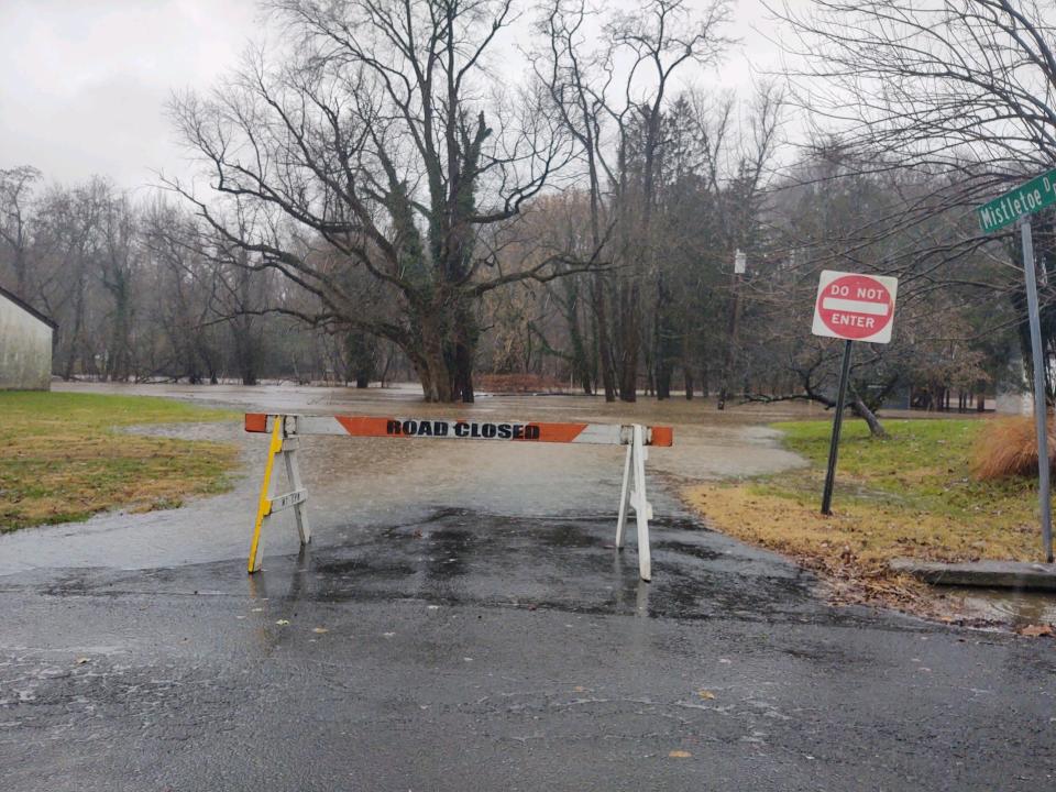
Weekend rain leads to road closures in Bucks County
The Doylestown Township Police Department released an advisory Monday morning warning drivers of several road closures due to the rainfall.
"Due to the heavy rain our area is experiencing, several roadways in the township have become impassable and thus closed due to rising water. Please use caution this morning on the roadways and please do not disregard road closed barricades," read the alert.
The road closures include:
Rickerts Road between Pine Run Road and Ferry Road
Intersection of Pine Run and Chapman roads
Almshouse Road between Lower State and Upper State roads
Shady Retreat Road between Burpee and Iron Hill roads
Pebble Hill Road between Sugarbottom and Wilkshire roads
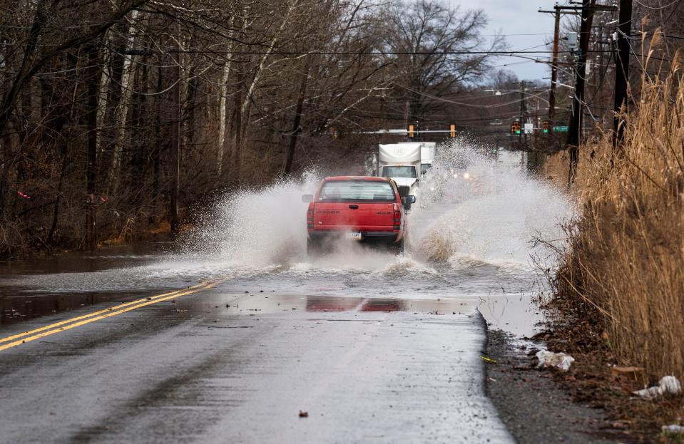
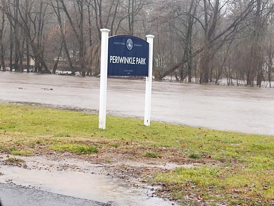
Police close roads in Middletown, Northampton, Upper Makefield; Neshaminy Creek surpasses flood stage
Police departments throughout Bucks County took to social media to warn of closed roads.
In its post, the Middletown Township Police Department noted that several of its roads were closed.
Bridgetown Pike is closed between 413 and Langhorne Yardley Road; 413 is closed at Bridgetown Pike; and Trenton Road was closed between Woodbourne and Oxford Valley but is now open," read Middletown police department's post in part.
Middletown police said there may be other road closures as the day, and will provide updates, and advises residents and drivers to report any flood related issues by calling 215-949-1000 or 911.
The Northampton Township Police Department also warned of closed roads.
"Sackettsford Road will be shut down from Old Jacksonville Road to the township line (toward Rushland Road); Almshouse Road between Hatboro Road to Spencer Road is closed; and Buck Road at Stoneyford Road (toward Newtown Township) is closed," read a portion of the post.
Similarly, Upper Makefield Police released a list of road closures in a post on Facebook as well.
The closures, according to the police department, are:
Eagle Road at Stoneybrook Road
Pineville Road at Thompson Mill Road
Stoneybrook Road between Slack and Shannon roads
River Road south of Jonathan Way
Brownsburg Road East at the bridge just east of Stoneybrook Road
Taylorsville Road between Woodhill Road and Rt. 532
River Road between Barlow Ridge Road and Lookout Park
"The following roadways are closed due to wires and or trees down: River Road just north of Mt. Eyre Road; Lurgan Road between Brooks Bend and Bowman’s Tower; Brownsburg Road West in the area of Colts Neck Drive; and Windy Bush Road in the area of Round Hill Road," the post continued.
Upper Makefield police confirmed in a subsequent post that Brownsburg Road West at Colts Neck, and Taylorsville Road between Woodhill Road and Rt. 532 have since reopened.
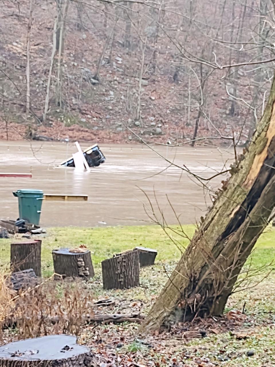
Water rescues performed Monday morning throughout Bucks County
Bucks County Administration spokesperson James O’Malley said there were several water rescues early Monday morning.
“It was a busy morning for 911 and emergency services. They received at least 10 calls for water rescues this morning, which are calls of cars being stuck in the water and those types of things, but no serious injuries,” he said. “Those calls came in between 3:30 a.m. and 7 a.m., and the calls spanned the county.
“Four were in Bensalem and one in Tullytown.”
Statewide flood relief group on the way: PA creates flood mitigation task force. What it will do, and what it means for homeowners
O’Malley also confirmed that there have been no calls for evacuations in the county.
He said it was the county’s duty to coordinate resources if a particular municipality or township is getting overwhelmed, but so far, the county has not received any requests for assistance.
Still, O’Malley warned that water levels are continuing to rise in the Delaware River and Neshaminy Creek, which is expected as the storm moved north.

Hazardous weather outlook continues through Monday night; conditions clear after
A hazardous weather outlook has been declared for Bucks County as well, with the National Weather Service warning that flooding is possible, especially in urban and poor-drainage areas and near vulnerable small creeks and streams.
Alex Staarmann, meteorologist with the National Weather Service in Mount Holly, said the bulk of the rain should move out this afternoon.
"Then there will probably be some lingering showers early in the afternoon, but it should be dry for the rest of the afternoon," Staarmann said. "There will be some gusting winds from the west with temps falling through the 40s and eventually into the 30s overnight.
"Tuesday will be mostly dry with a stray flurry or sprinkle, but nothing too impactful."
The full forecast from the National Weather Service:
Monday: Rain, mainly before 1 p.m. Temperatures falling to around 48 by 5 p.m. Breezy, with a southwest wind 10 to 15 mph becoming northwest 15 to 20 mph in the morning. Winds could gust as high as 35 mph. Chance of precipitation is 80%. New precipitation amounts between a quarter and half of an inch possible.
Monday overnight: Partly cloudy, with a low around 33. Southwest wind 10 to 15 mph.
Tuesday: A slight chance of rain and snow showers before 10 a.m., then a slight chance of rain showers between 10 a.m. and 1 p.m. Partly sunny, with a high near 42. Breezy, with a northwest wind 10 to 20 mph, with gusts as high as 30 mph. Chance of precipitation is 20%.
Tuesday overnight: Mostly clear, with a low around 26. Northwest wind around 10 mph, with gusts as high as 20 mph.
Give A Christmas impact: Give A Christmas helps families, seniors and children in Bucks County
Wednesday: Sunny, with a high near 46. Northwest wind around 10 mph, with gusts as high as 20 mph.
Wednesday overnight: Mostly clear, with a low around 28.
Thursday: Sunny, with a high near 47.
Thursday overnight: Mostly clear, with a low around 25.
Friday: Mostly sunny, with a high near 42.
Friday overnight: Partly cloudy, with a low around 27.
Climbing Mt. Kilimanjaro together: Bucks County father-and-son duo attempt to summit Mt. Kilimanjaro
Delaware River approaching flood stage; flood warning, watches extended in Delaware, New Jersey
The Delaware River at Trenton was approaching flood stage as of midday Monday.
At noon on Monday, the weather service reported the water level of the Delaware River at Trenton to be 15.54 feet.
The flood stage at the Delaware River at Trenton is 20 feet.
According to the weather service's model, the Delaware River at Trenton will reach 19 feet on Tuesday, before topping out at 19.9 feet on Wednesday. Water levels of the Delaware River at Trenton are then expected to decrease through the rest of the week.
The hazardous weather outlook for New Castle, DE will last through Monday evening, as will the flood watch designation.
"Flooding is ongoing in several areas given the excessive rainfall on already saturated ground," read a portion of the flood watch alert. "The steadiest rain this morning should end as some showers into this afternoon.
The flood warning designations for New Castle, Delaware and Gloucester County, New Jersey, will last through at least Monday afternoon. The flood warning designations means flooding of rivers, creeks, streams, and other low-lying and flood-prone locations is imminent or occurring.
The weather service also noted the south branch of Pennsauken Creek at Cherry Hill is nearing flood stage.
Staff writer Jo Ciavaglia contributed to this story
This article originally appeared on Bucks County Courier Times: Bucks County weather calls for more rain, flurries and cold temps

