Raw conditions continue in B.C. as rain, snow wash ashore
Slugs of heavy precipitation will wash over Vancouver Island and the South Coast over the next couple of days as multiple systems move into British Columbia.
DON’T MISS: The return of mosquitoes always happens sooner than you think. Get equipped to face it with these defenses
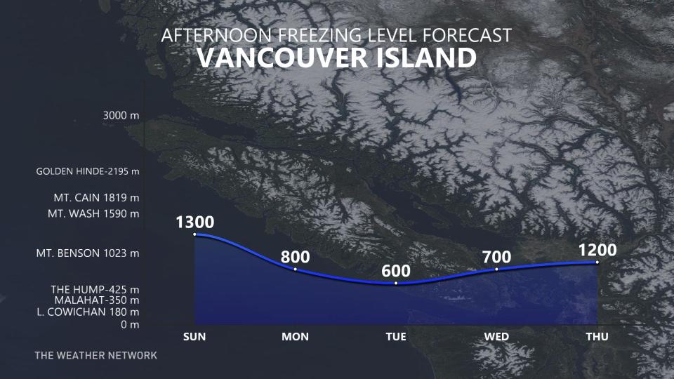
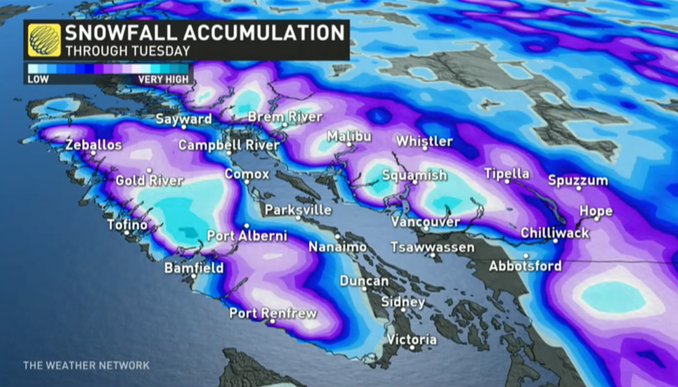
Forecasters expect heavy alpine snow to develop as freezing levels will hover within the 1000- to 1500-metre range.
Snow levels will drop well below 1000 metres on Monday and Tuesday, bringing the potential for some mixing for several lower elevation locations – such as the Simon Fraser University area and inland sections of Vancouver Island throughout Monday and into Tuesday morning.
Historically, it's not that common for April and May snow outside of the mountain passes along the South Coast and Interior region.
However, places such as Abbotsford and Cranbrook have recorded accumulations as late as April 29 and May 27, respectively.
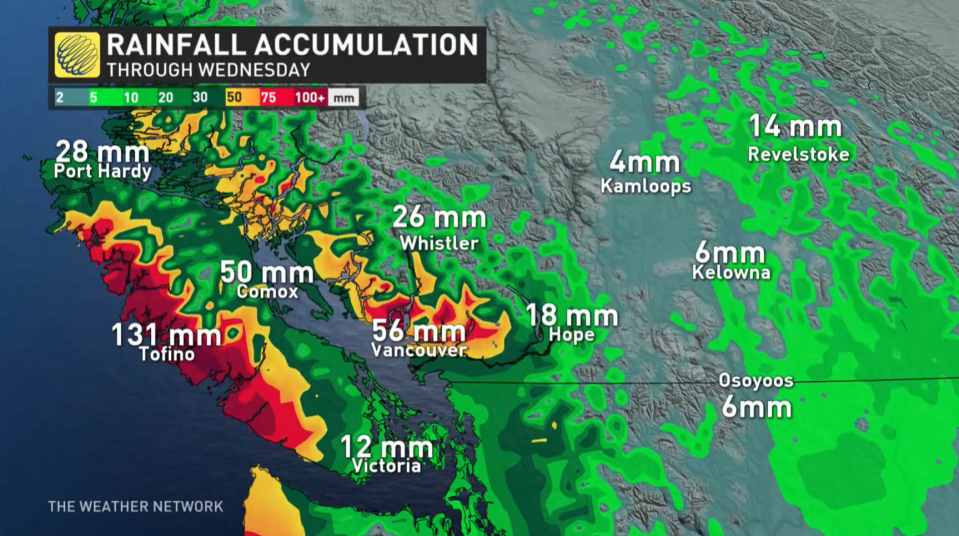
Rainfall totals of 30-50 mm will be common across the Lower Mainland, with totals well above 50 mm where terrain influences the precipitation.
MUST SEE: Uncertainty swirls around 2023 hurricane season as El Niño looms
Throughout April, temperatures have been about 2-3 degrees below seasonal for daytime highs in the first couple weeks of April for Vancouver.
Those looking for a warmup soon will be very disappointed by the forecast.
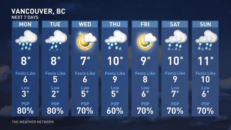
There is no hope for warmer weather in the next seven days. Not only that, but cooler-than-seasonal temperatures are expected to dominate through late April.
Fear not, however.
Despite the ups and downs, seasonal temperatures steadily climb in the weeks ahead as summer draws ever closer.
Thumbnail courtesy of Jaclyn Whittal/The Weather Network
Check back for the latest on conditions across British Columbia.

