Respite in store Sunday but rain record set at Camarillo Airport
9:20 a.m. Sunday
Forecasters at the National Weather Service expected only a few light showers during the day with rain and mountain snow returning Sunday night into Monday. Decreasing showers were forecast Monday afternoon into Tuesday morning.
Dry weather was predicted the rest of Tuesday and the entire week.
But high surf will continue across local beaches through at least the middle of the week, forecasters said.
The weather service also reported that Saturday's rains broke one-day daily maximum amounts in several cities. Included was 1.43 inches reported at the Camarillo Airport, breaking an old record of 1.03 inches set in 1990. Other records fell in Los Angeles, Long Beach and Paso Robles.
Saturday report
Showers were back Saturday, and so was the mess.
A series of storms expected to douse Ventura County through Tuesday aren't particularly heavy, forecasters say. But with the region already waterlogged by intense rain that fell Monday and Tuesday, the incoming system quickly flooded roads, causing closures and accidents.
10 p.m. Saturday roads update
With Saturday's rain mostly over, roads had largely cleared out. Police and sheriff's watch commanders said some local streets had issues with flooding but calls for service weren't especially high.
Remaining closures as of 10 p.m. included:
Highway 126: Traffic slowdowns east of Fillmore had mostly eased up after the route was earlier reduced to one lane in each direction due to mud in westbound lanes, according to the California Highway Patrol.
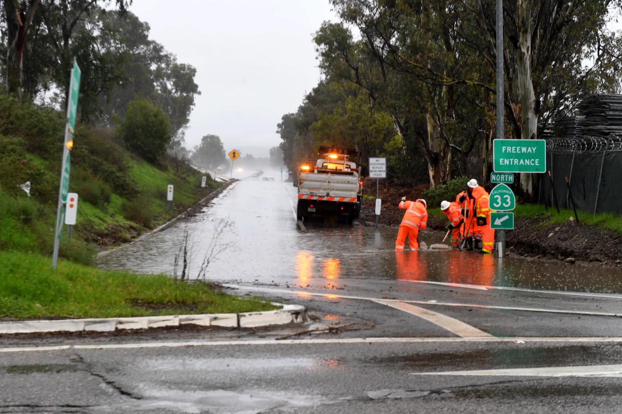
Highway 33 north of Ojai has a hard closure in place at Fairview Avenue near Meiners Oaks.
Highway 150 from around Santa Ana Road, near Lake Casitas, to the Ventura County line near Carpinteria has remained closed since Monday and Tuesday's rains damaged the route.
In Santa Barbara County, Highway 154, also called San Marcos Pass, remains closed from Foothill Road in Santa Barbara to Highway 246 in Santa Ynez.
8 p.m. Saturday update
The main front of the first of two weekend storms has passed through the area as of Saturday night, said meteorologist Kristen Stewart with the National Weather Service office in Oxnard.
Some post-frontal showers will continue through the night, with isolated areas seeing a tenth to a half-inch of additional rain and an occasional shower on Sunday.
By late evening Sunday, the second storm — weaker than Saturday's — will come through the area, Stewart said. For coast and valley areas, a half-inch to an inch of rain is expected. Foothills and mountains could see 1-2 inches.
Sunday's storm will also be colder, with low temperatures early in the week dropping into the low-to-mid 40s.
By Monday night, snow levels could drop as low as 3,500 to 4,000 feet, with light snow possible on the Grapevine section of Interstate 5 over Tejon Pass. Freezing levels could drop lower on Tuesday if moisture lingers, with snow possible down to 3,000 feet.
Models show little activity later in the week, Stewart said, so the county may get a break after the second storm moves through.
7 p.m. Saturday update
The National Weather Service released two-day rainfall totals for weather stations in Ventura, Los Angeles, Santa Barbara and San Luis Obispo counties as of 4 p.m. The top 10 sites on the list were in SLO and Santa Barbara counties, with the highest total, 5 inches, at Rocky Butte in San Luis Obispo County.
In Ventura County, totals included:
Nordhoff Ridge, 2.24 inches
Lake Piru, 1.94
CSU Channel Islands, 1.65
Moorpark, 1.62
Matilija Dam, 1.58
Oxnard Civic Center, 1.57
Thousand Oaks, 1.57
Camarillo Airport, 1.42
Silver Strand Beach, 1.42
Santa Paula, 1.36
Simi Valley, 1.36
Ojai, 1.32
Fillmore, 1.28
Saticoy, 1.21
Westlake Village, 1.21
Piru, 1.17
Newbury Park, 1.07
Ventura, 1.06
La Conchita, 0.81
4 p.m. Saturday update
As of 4 p.m., impacts included:
Highway 126: Westbound lanes were closed by mud east of Fillmore, according to the California Highway Patrol, but traffic was moving in both directions as westbound drivers were being diverted into eastbound lanes. The CHP recommended avoiding the route.
Sanjon Road: Flooding was reported at the offramp from northbound Highway 101 around 2:40 p.m., the CHP reported.
Grimes Canyon Road: The route, also called Highway 23, was closed by mud around 3 p.m. near Waynes Way, north of Moorpark, and near Bardsdale Avenue, according to the CHP. The Waynes Way closure was cleared shortly before 3:45 p.m.
Highway 33 north of Ojai remained closed from Fairview Avenue near Meiners Oaks. The route into Los Padres National Forest has been closed since storms washed away part of the road earlier in the week. On Saturday morning, authorities added a hard closure at Fairview, meaning even residents were not being allowed access.
Highway 150 from around Santa Ana Road, near Lake Casitas, to the Ventura County line near Carpinteria has also remained closed since Monday and Tuesday's rains damaged the route.
W/B lanes of SR126 just west of Cavin are closed. W/B traffic is being diverted through the E/B lanes. SR126 remains open for now. Please consider staying home for non essential travel. If you have to drive, remember headlights on and slow down. @CaltransDist7 @fillmoresheriff pic.twitter.com/g5cblF0MhY
— CHP Moorpark (@CHPMoorpark) January 14, 2023
This story will be updated.
This article originally appeared on Ventura County Star: Rain record set at Camarillo Airport

