Southern Ontario's first Colorado low of the season spreads in rain, gusty winds
Fall is in full swing across Ontario as a Colorado low creeps toward the border in time for the weekend.
The low-pressure system south of the border will threaten widespread rains and a raw easterly wind off Lake Ontario for Saturday. The track of that storm is key, though, as a slight shift could alter expected rainfall totals for parts of the region.
While it looks like the worst of the conditions will remain stateside, it doesn’t mean the weekend will be completely spared, especially with a distinct autumn chill flowing in on northerly winds behind the storm.
RELATED: How a super typhoon will alter Canada's late-October weather
Southern Ontario's first Colorado low of the season threatens weekend plans
Areas: Southern Ontario
Timing: Friday through Saturday
Southern Ontario’s first Colorado low of the season is gathering steam over the American Plains as it brings flooding rains and severe thunderstorms to the region.
We’ll miss the worst of the weather north of the border, but the system is on track to impact outdoor weekend plans across southern Ontario heading into Saturday.
MUST SEE: How Colorado lows and Texas lows affect our weather in Canada
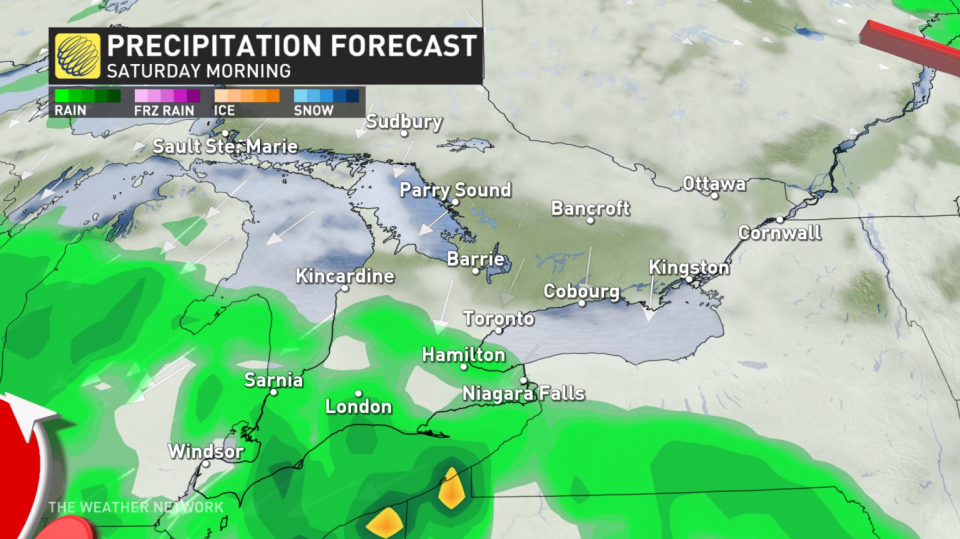
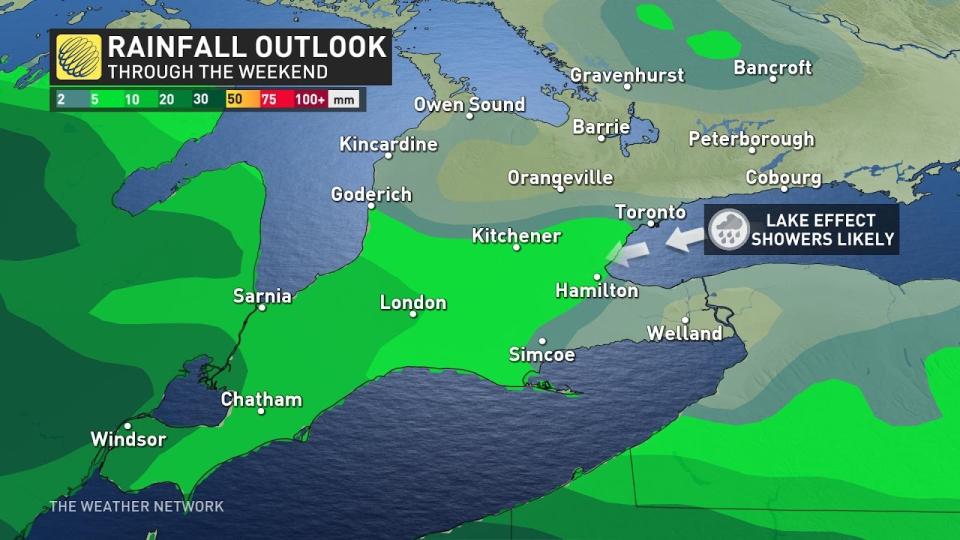
The most likely scenario keeps the heart of the storm south of the border, allowing its northern fringes to push showers into Windsor, Sarnia, and the Golden Horseshoe late Friday into Saturday. Rainfall totals will range from 5-25 mm for much of the region, with the heaviest totals likely in the southwestern corner of the province.
The GTA, however, is not completely in the clear with this peculiar setup.
High pressure over northeastern Ontario will put in the work to avoid persistent rains over the majority of southern Ontario.
WATCH: Hamilton facing excessive rain as winds shift off Lake Ontario
But the pressure difference between the high up north and the low down south will crank up the winds, with gusts of 40-60+ km/h likely across the region. These winds will peak on Saturday morning and afternoon.
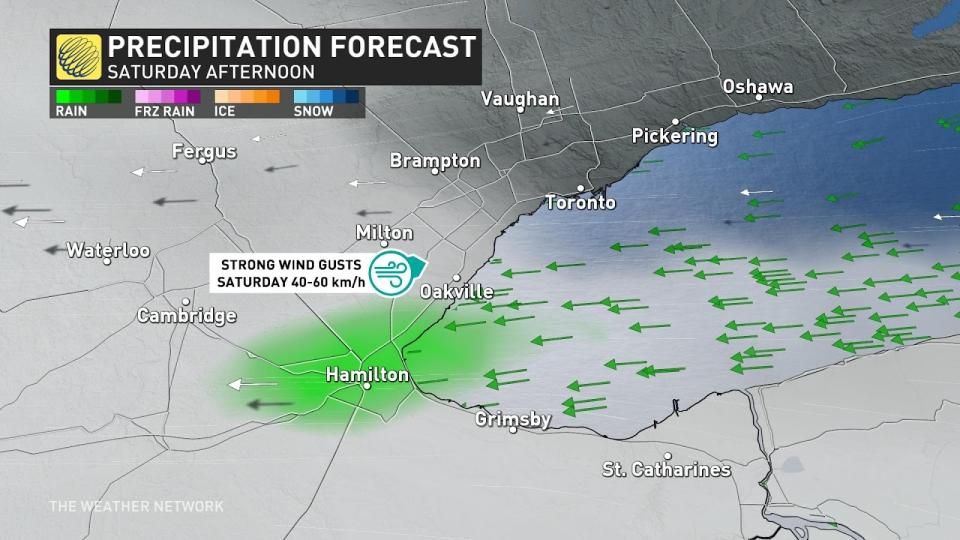
Cooler air blowing over warmer water is a recipe for convection over the lakes, and those easterly winds could bring some light lake-effect rain into the GTA on Saturday afternoon. The Hamilton area would be the most likely area to see this additional rainfall, which would clear up by the evening hours.
Conditions are expected to improve on Sunday with a chilly and mostly cloudy forecast.
Those easterly winds will feel brisk on the shores of Lake Ontario, but certainly not as brisk as the northerly air that follows. Temperatures will fall a few degrees below seasonal this weekend, bumping back into the mid-teens for a quieter work week ahead.
Visit our Complete Guide to Fall 2023 for an in-depth look at the Fall Forecast, tips to plan for it and much more!
The next surge of active weather in Ontario may arrive around or after October 20th courtesy of a super typhoon way out in the western Pacific Ocean.
The remnants of this typhoon will recurve into the northern latitudes through the weekend, setting off a domino effect in the upper-level pattern that may bring near- to cooler-than-seasonal temperatures through the end of the month. Forecasters are closely watching to see if it gets cold enough for our first lake-effect flakes of the season.
Stay tuned to The Weather Network for the latest forecast updates in Ontario.

