People urged to be ready as rain, wind storm hits N.B.
New Brunswick is getting a drenching on Wednesday, with more than 100 millimetres of rain and winds gusting to 80 kilometres an hour expected in some areas.
The worst of the rain isn't expected until Wednesday afternoon, but the storm will last until Thursday, followed by a rapid temperature drop.
The city of Saint John warned residents Wednesday afternoon to watch for flooding while driving and be aware of the risk for a flash freeze on Thursday.
According to CBC meteorologist Tina Simpkin, temperatures warmed overnight and are well above freezing with the exception of Charlo.
The drop in temperatures Thursday morning, said Simpkin, will be a "drastic change." She said the temperatures will go from 8 C to 0 C in three to four hours.
Periods of high winds for southern locations will begin Wednesday night, with the Fundy Coast expected to bear the brunt of it.

Environment Canada warned of strong rain and wind impacting southern New Brunswick on Wednesday. (Roger Cosman/CBC)
Wednesday afternoon, winds will range from 60 to 80 km/h, but Simpkin said winds of 90 km/h or more are expected through the night and into Thursday morning.
Saint John could see wind gusts up to 110 km/h early Thursday morning, according to Simpkin.
The Environment Canada warning says similar past storms have caused flash flooding, road washouts, road shoulder erosion and delays in transportation.
"Rainfall rates in excess of 10 mm per hour may occur over some locations. Significant runoff may occur due to frozen ground and as the rain combines with mild temperatures, leading to considerable snowmelt."
A total rainfall of 60 to 100 millimetres is expected, with higher amounts possible in some places.
For the majority of the province, besides southernmost and northernmost areas, 25 to 50 millimetres of rain is expected, with no wind warnings in place.
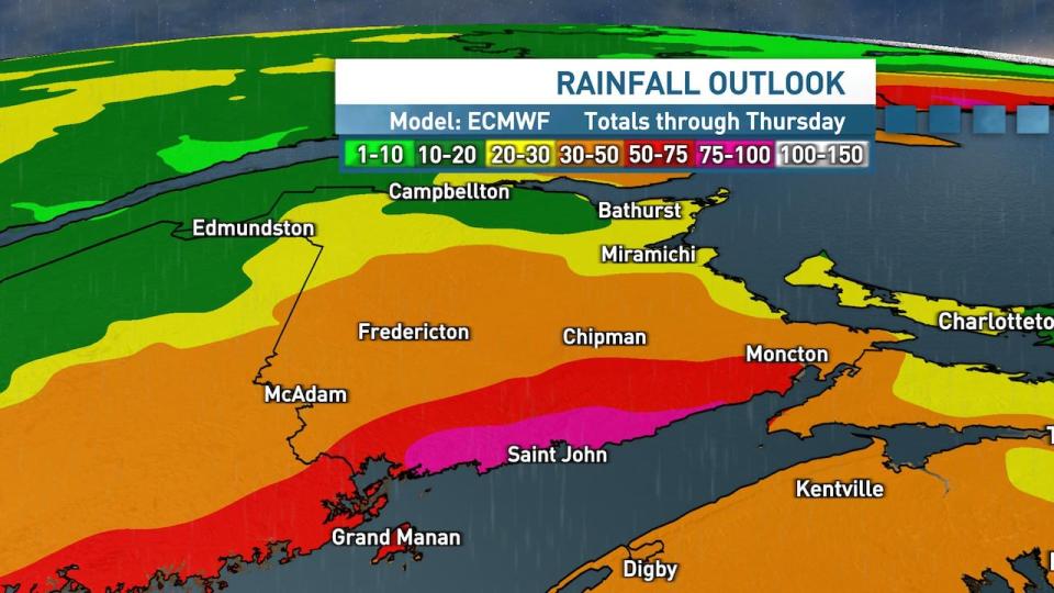
A map shows the rainfall totals for New Brunswick forecast through Thursday. Southern regions of the province are expected to see the worst in terms of rainfall. (Ryan Snoddon/CBC)
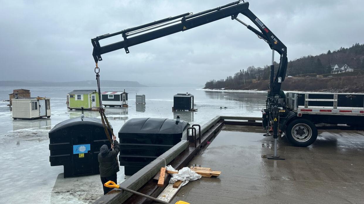
A press release from the province on Wednesday said ice fishing shelters must be removed from waterways by the first sign of thaw, or March 3 at the latest.
"We are expecting some unseasonably mild weather in the immediate weather forecast, so it is important to be cautious and not wait until it is too late to remove ice-fishing shelters," said Environment and Climate Change Minister Gary Crossman in the release.
Edmundston, Campbellton, Bathurst and the Acadian Peninsula regions won't see as much rain as other places, with only 15 to 25 millimetres predicted.
Geoffrey Downey of the New Brunswick Emergency Measures Organization said municipalities should be preparing for the weather that is coming in case they need to act.
He also urged residents to clear storm drains in their neighbourhoods and make sure their gutters are facing away from their home's foundation.
Downey said there is a need to be prepared year-round for storms with more extreme weather events happening back-to-back. He urged people to have supplies for at least 72 hours, but emphasized this is a minimum as power outages can sometimes last even longer than that.

