Rainfall estimates are in as a rainy week continues to flood South Florida cities
South Florida is getting soaked this week.
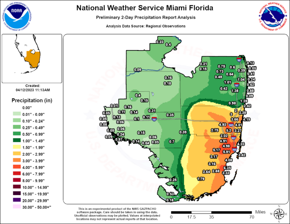
Fresh estimates from the National Weather Service’s Miami office show that some particularly hard-hit spots have seen more than six inches of rainfall from Monday and Tuesday alone. That doesn’t account for Wednesday’s downpour or the extra drizzling expected over the next few days.
The highest total so far appears to be 6.35 inches registered in Cutler Ridge, with the western edge of Miami in a close second at 5.91 inches.
South Broward is also getting hammered, with a maximum of 5.20 inches so far in Pembroke Pines and 4.93 inches in Davie.
Those totals jump even higher when you count Wednesday’s deluge.
A volunteer network of weather reporting used by the weather service show nearly three inches for some spots in Miami-Dade from Wednesday alone. The CoCoRaHS network map shows 2.89 inches of rain in Palmetto Bay on Wednesday, as of 3 p.m., and two inches in Cutler Bay.
So far, these totals aren’t yet at the level of the latest tropical storm to drench South Florida. Last May’s Tropical Storm Alex dumped a maximum of 15 inches of rain in Hollywood over four days, and 13 inches of rain near Biscayne Park.
Tropical Storm Eta, in 2020, dropped about five to seven inches of rain on Miami over just two days. That was enough to invade homes, swamp cars and turn parks into lakes.
But even at lower levels, it’s enough rain to overwhelm even the newest drainage systems in Miami-Dade, most of which are designed to handle a maximum of seven inches of rain a day.

