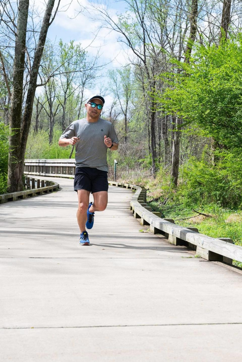
I ran from one end of Charlotte to the other using only greenways — or tried to, at least
Last month, I spent a total of about four hours running a total of nearly 30 miles — roughly from the top of north Charlotte to the bottom of south Charlotte.
Emphasis on the word roughly. There were, literally, multiple detours; and, figuratively speaking, a variety of bumps in the road.
Or, perhaps I should say, in the greenways.
The day is coming when the massive City of Charlotte/Mecklenburg County project known as the Cross Charlotte Trail (aka the XCLT) will seamlessly string together several greenways to create a looong, winding, 30-plus mile route from University City to Piper Glen.
Hit the trails: These Charlotte area greenway projects are in the works
Sure, most of those who will use the XCLT when it’s completed will just traverse a bite-sized portion at a time, like thousands already do every day on the existing parts of it. But the selling point, from the idea’s inception, has been this: When fully finished, if you want to go from one side of the city to the other in one day (or two, or 10), you’ll be able to.
It isn’t possible yet, as I said. Roughly eight miles are still in the development stages. Target completion dates on at least one section are three years away.
I’m notoriously impatient, though. I’m also a veteran of nearly three dozen marathons and a five-time Boston Marathon qualifier who has been excited about the prospect of an end-to-end jaunt for years. And so ... I recently set out to see how much of the XCLT was runnable (walkable, bike-able) as of right now.
The result? A run (or, more precisely, a pair of runs, since I decided to save my legs by spreading it over the course of two days) packed with surprises and pleasures, as well as a few pains.
Starting at the top of the trail
In the not-too-distant future, the northernmost tip of the XCLT will be the trailhead at North Tryon Street, just around the corner from PNC Music Pavilion.
Presently, however, that segment is still in the design phase. So if you go looking for it — like Charlotte Observer visual journalist Melissa Melvin-Rodriguez and I did — you’ll find a labyrinthine subdivision, an apartment complex, maybe a Walmart. But nothing resembling a greenway, yet.
So instead we drove 2 miles down the road and parked at what’s actually, currently, the XCLT’s northernmost point: Kirk Farm Fields near Tryon and East Mallard Creek Church Road.
After a quick stop in what’s one of the most disconcertingly hideous portable toilets in a city full of disconcertingly hideous portable toilets, we set off down the asphalt path that runs alongside the Mallard Creek, me in a pair of Sauconys and Melissa on an electric bike.
Taking the college campus tour
If you follow Mallard Creek Greenway from Kirk Farm Fields and make no turns at intersections, you can head west for miles, under Tryon; beneath I-85; along the gravel trail that cuts through University Research Park; onto the Clark Creek Greenway that cuts north.
Including offshoots, you can log more than a half marathon before returning to your car. That whole network of trails is also part of the XCLT.
But we wanted to make a beeline toward uptown, and to do that, we had to hook a left onto the Toby Creek Greenway just a few minutes into our jaunt. Just a mile from the start, Toby Creek reaches the most scenic, most fitness-focused section of the campus of UNC Charlotte.

Getting to the other side
Not quite 2 miles in, we arrived at the intersection where the on- and off-ramps for the westbound lanes of East W.T. Harris Boulevard meet University City Boulevard. This is where things start to get a little dicey. For a couple of reasons.
One, there’s not yet any signage (on this side of the street, anyway) indicating that the greenway continues on from here. An asphalt path off to the left heads up UCity Boulevard but leads nowhere. Across the street, the only thing in sight, really, is cookie-cutter development in the form of a Dunkin Donuts, an Arby’s, a Starbucks, an Orangetheory, etc.
I’ve run this route, so I knew to cross.
Just be sure to exercise caution: This is a busy intersection, with not-always-predictable stoplight patterns, and this road has the highest speed limit of any crossing anywhere on the existing sections of the XCLT.
Upon reaching the other side, you can look right to finally see the continuation of the greenway — and right in front of you, for the benefit of those coming up the trail from the south, a small “Greenway Continues” sign pointing in the direction from whence you just came.
Running into a dead end
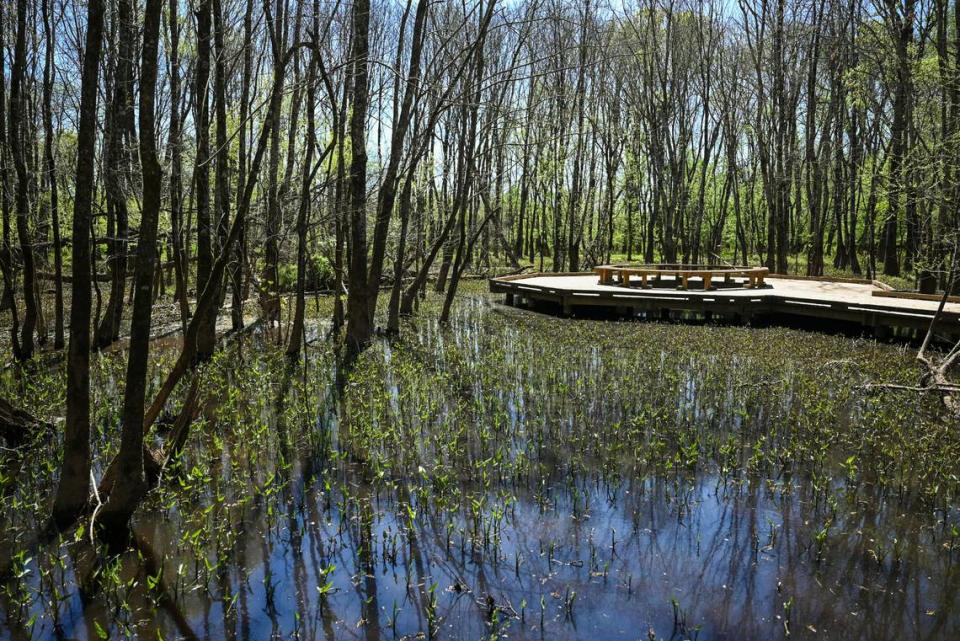
Around the 3-mile mark, after navigating gentle bends and concrete boardwalks through/over a pretty, peaceful swath of wetlands, we came to the street crossing at Rocky River Road West.
Just beyond that point, there’s a wooden boardwalk that curves up a hill that represents the steepest section of this stretch of Toby Creek Greenway. In fact, because the battery on Melissa’s borrowed e-bike wouldn’t power on (and because those bikes are so heavy), she had to get off and walk it to get to the top.
Within a few hundred yards from the crest of the hill, we were on the regular sidewalk that runs along Rockland Drive.
The trail went cold after that. I walked up Rockland far enough to see where it dead-ended; then jogged down Autumnwood Lane looking for, I don’t know, maybe a sign that excitedly trumpeted words like “Future Toby Creek Greenway Extension!” ... but found only a sleepy, woodsy neighborhood dotted with older single-family homes. (According to the XCLT website, relocation of utilities — a key hurdle to clear before the construction phase — will be completed this spring.)
I floated the idea of taking surface streets for 6 miles to get to the next completed part of the XCLT in NoDa, but with little conviction. Too much risk of encountering streets without sidewalks.
So we made the 3.5-mile return trip back to Kirk Farm Fields via UNC Charlotte, loaded the bike back in my SUV, and drove south.
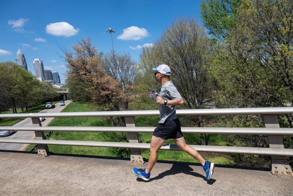
Passing by the center of the city
We picked up the path in what, for me, was uncharted territory.
We parked at Cordelia Park in Villa Heights, walked down the steep hill to North Davidson Street, and followed the signs for the Little Sugar Creek Greenway that pointed northeast not knowing where we’d wind up.
Within about three blocks we found ourselves on a pretty cool stretch covering a smooth asphalt path as wide as a residential street that cuts between Urban District Market and Seoul Food restaurant’s sprawling new complex. But then the equivalent of about three blocks after that, we spilled out onto the side of North Brevard Street and found a sign that indicated the trail continued north only in theoretical terms (i.e. with a dotted line on the legend that denoted “future greenway.”).
So, after taking in the nice view of the uptown skyline over the railyard, we found ourselves doing the retrace-our-steps thing again, back through Villa Heights, back past Cordelia Park.
At this point, logistical issues were starting to become a hindrance. I was coming up on double-digit miles; I was getting hungry and, um, had neglected to bring sufficient snacks; and I knew we had to be mindful of the fact that we, you know, kinda would need to eventually get back to our car, which meant we’d need to plan our attack smartly ... and plan to waste yet more time doubling back.
Fortunately, Melissa had some spare cashews that I scarfed down while looking out over the ramp that leads from U.S. 74 to I-277.
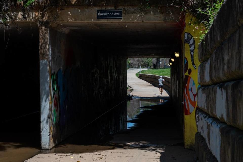
As for this stretch of the Little Sugar Creek Greenway, which was largely new to me, it’s breathtaking — full of hidden-gem urban green spaces and eclectic points of interest from tiny to huge.
I don’t want to spoil them. I just want to say this: The span of roughly three miles that runs from the trailhead above the railyard on Brevard to Midtown Park in the Metropolitan area are the most visually interesting 3 miles on the entire XCLT. And, FWIW, over the course of our two-day journey, this is where we saw the greatest concentration of people walking dogs. By far.
Diverting onto South Kings Drive
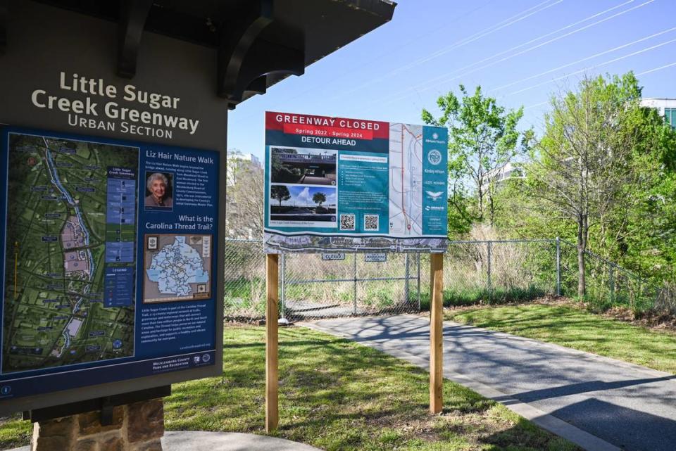
The portion of the Little Sugar Creek Greenway that dips under East Morehead Street and runs almost at creek level past Atrium Health’s main hospital to Freedom Park is famously one of the most active segments of greenway. It’s also infamous for flooding after astonishingly brief downpours that lead to exasperatingly long “temporary” closures.
Right now, it’s closed for the next full year. But hopefully that’ll mean much fewer closures are in its future.
A gigantic improvement project is underway, and the result — according to the city and county — will be a widened greenway, better flood control and a restored stream bank. Until then, however, there’s a detour that runs along Kings on regular ol’ sidewalk.
Christening the newest part of the LSCG
Freedom Park will always be the crown jewel of the county park system. It’ll always be one of the most attractive pit stops on the XCLT. But the brand-new section that starts a mile to the south is going to steal away a lot of attention this year.
Officially, the 1.5-mile Brandywine-to-Tyvola segment is not open. The concrete path that curves under Brandywine Road in the shadow of Park Road Shopping Center looks open, but we were met by three orange barrels and yellow “caution” tape at the next underpass — the one that dips beneath East Woodlawn Road.
Unofficially ... well, let’s just say no one seemed to be paying attention to the barrier (which, frankly, was quite easy to get around).
The one legitimate obstacle is a bit south of Woodlawn: On the day we were out there, heavy greenway construction was in progress. However, the affected stretch was maybe 100 yards, and because there’s a frontage road parallel to it, we were able to easily get around it and back onto the path that eventually leads under Park Road and connects with the existing, “officially open” part of the LSCG that begins at Tyvola Road.
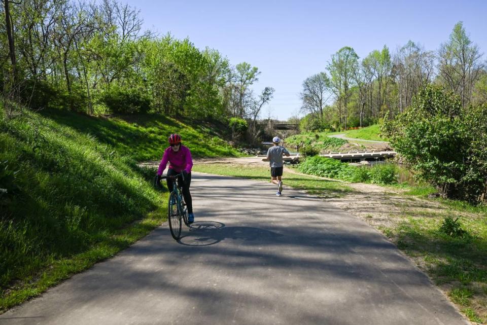
Cruising, but keeping a close eye out
The next 6 miles — which run from just north of Park Road Park to underneath I-485 (behind Carolina Pavilion on South Boulevard), then all the way down to the President James K. Polk State Historic Site in Pineville — have a lot going for them.
Little Sugar Creek is more river-sized than creek-sized here, and seems clearer and cleaner along this path than it does closer to the city. The path itself is smooth, still-fairly-fresh asphalt, about 10 feet wide the entire way. There’s nothing resembling a hill, and in fact, if you’re going north to south, you’re very gently descending the whole time along with the flow of the creek. And there’s not a single point where you have to cross a public street or contend with a motor vehicle (other than the occasional park employee trundling past in a golf cart).
I’ve run hundreds and hundreds of miles out here. Love it. But with that plentiful good comes some bad.
Wide, flat, asphalt covered greenways attract cyclists looking to escape the dangers of being out on the roads with cars and trucks, and while I’m all for letting cyclists do their thing (I’m a cyclist myself), I’ve seen a lot of them on this stretch going too fast without following the agreed-upon rules for using shared paths.
Need a refresher?
“Pedestrians have the right of way; cyclists must slow approaching pedestrians. ... Travel on right, pass on left; give audible warning before passing.” It’s pretty simple stuff.
Anyway, rant over. Generally speaking, this is a lovely section of the XCLT.
Stopping to ask for directions
Shortly after passing the right-hand turn for the well-under-construction offshoot that eventually will take LSCG greenway-goers to the South Carolina State Line (it’s set to open later this spring), we ran into another dead end at the Polk home in Pineville.
For some reason, I thought the Little Sugar Creek Greenway was already connected to the McMullen Creek Greenway. I was wrong.
I feel like I have to blame the maintainer of the XCLT map on the City of Charlotte’s website for this one. If you look at it (which I did, closely and several times, in the Polk parking lot), you’ll see green all the way from Tyvola to Rea Road. Green corresponds to “Cross Charlotte Trail Existing” in the map key. But I found zero evidence of the continuation of a trail, anywhere.
If I had any hair, I would have pulled it all out.
Eventually, somewhat grudgingly, I asked a few people who were pulling bikes and helmets out of their cars and, long story short: I learned that there is a way — a pretty cumbersome way — to access the McMullen Creek Greenway, which can be used to head east all the way over to Piper Glen. To get to the XCLT’s “South Charlotte Connector” (i.e. to McMullen), we had to cover eight-tenths of a mile by navigating the grass shoulder on busy Lancaster Highway, cutting through a furniture-store parking lot on Carolina Place Parkway, and then using sidewalk on Park Road.
It’s not a detour I would recommend to anyone. Not yet.
Katie Lloyd, senior planner for the county’s parks and recreation department, says her team has “planned and partially designed multiple routes in an effort to make the continuous pedestrian link” between the Polk site and the connector at Park Road — but that, “due to land acquisition challenges, we have not yet been able to make the direct connection.”
The current interim plan involves installing “continuous sidewalk for that whole distance.” That is tentatively scheduled to be completed by mid-2024. Longer-term, the county still hopes to connect those two points via trail.
Racing to the finish line
The last 5 miles start with views of I-485 and the land on which the McAlpine Wastewater Treatment Plant sits, roll gently through the forests that abut Ballantyne surburbia, and then wind through marshes by way of wooden boardwalks that go thump-thump-thump as you pound your feet upon them.
I’ve been on these greenways a lot, too, so I know well that their low-lying boardwalks and asphalt sections also flood easily; then, for days, they remain places where new running shoes go to be soiled by mud stains.
When Melissa and I ran/rode the trail, though, the sun shone and the ground was dry, making it a most pleasurable experience for us — as well as for the pairs of walking buddies and the much more reasonably paced cyclists doing out-and-backs from the parking lot at the trailhead (which is across Bevington Place from the Trader Joe’s).
That lot, by the way, fills quickly on nice weekdays and even faster on nice weekends, as do the dozens of free in-line street spots along Bevington. So, parking can get messy. On the other hand, bathroom-breaking is painless: Unlike the portable toilet at Kirk Farm Fields back where we started, 30 miles to the north, the county has installed real restrooms with indoor plumbing at the top of this lot, on the edge of Rea Road.
And in lieu of a finisher’s medal, I was happy simply to have running water to use to rinse the sweat off my face after my looong and winding run.
My run(s), by the numbers:
12.75: Total miles run on Day 1 (including 3.5-ish miles away from Kirk Farm Fields, then 3.5-ish miles right back to it; and a separate not-quite-5-mile run that saw us starting at Cordelia Park and going north to Brevard Street, then doing a U-turn and going back past Cordelia Park to Midtown Park, then doing another U-turn and heading back to Cordelia Park).
16.19: Total miles run on Day 2 (from Midtown Park to Trader Joe’s at Bevington and Rea Road, with no doubling back).
Across both days:
1: Number of portable toilets used that I hope to never use again.
3.5: Number of 20-ounce bottles of Gatorade I consumed.
5: Number of detours that required us to turn around (or go around).
9: Number of cyclists I wanted to yell at for operating in an unsafe manner.
17: Number of times either Melissa or I said something along the lines of “This beats being in the office any day of the week.”
824: Total feet of elevation change. (That, by the way, is not a lot for 29 miles.)
2,726: Total calories burned.
43,777: Total number of steps.
Bottom line:
The Cross Charlotte Trail seems so close to — yet so far from — being a seamless experience for those adventurous enough to tackle the entire length of it. But there are parts of the whole that are already wonderful, and the whole isn’t necessarily the point anyway. Enjoy what you can now, safely.
It’ll only get better with time.

