Some schools closing as forecasters warn about possible tornadoes, hurricane-force winds
LATEST UPDATES
Schools closing in Florida for tomorrow
5:05 p.m.: The Florida Department of Education announced school districts in the following counties will be closed Tuesday, Jan. 9, in anticipation of the approaching storms:
Bay County
Bradford County
Calhoun County
Citrus County
Columbia County
Dixie County
Franklin County
FAMU Lab School
FSU Lab School
Gadsden County
Gilchrist County
Glades County
Gulf County
Hamilton County
Hernando County
Holmes County
Jackson County
Jefferson County
Lafayette County
Levy County
Liberty County
Madison County
Pasco County
Taylor County
Union County
Wakulla County
Washington County
Colleges/Universities
Gulf Coast State College: All campuses will delay opening for employees and students until 11 a.m. CST Jan. 9.
Tallahassee Community College will be closed Jan. 9
Hurricane-force winds possible as storms move into Florida
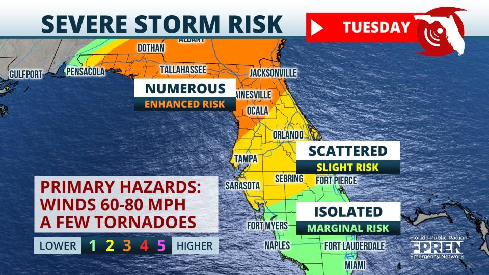
11:40 a.m.: A storm system heading toward Florida is expected to move through the Panhandle late Monday and into the rest of the state Tuesday, according to the Florida Public Radio Emergency Network.
"80+ mph wind gusts will be possible from storms and a few tornadoes could develop, too. Before the storms arrive, winds will pick up. 45 mph gusts are possible."
Strong to severe thunderstorms expected in Northeast Florida
11 a.m. Strong to severe thunderstorms forecast Tuesday afternoon and evening for Northeast Florida.
Damaging wind and tornado risk Tuesday from noon through sunset.
Windy conditions are expected throughout the area Tuesday. Sustained winds of 25-35 mph, with frequent gusts of 45 to 55 mph.
EARLIER STORY
Days after an EF-0 tornado touched down in Fort Lauderdale, Florida residents have been warned to brace for severe weather, including a threat for tornadoes and damaging winds.
A "rare" storm warning was issued by the National Weather Service Mobile beginning Monday afternoon for all Gulf waters and the bays, sounds and waterways.
"This is only the second storm warning issued by us since 1994 for the Gulf waters," forecasters said.
"We are becoming increasingly concerned about the potential for damaging winds of 70-plus mph and tornadoes — a couple could be strong EF2+ tornadoes — Monday night into Tuesday morning. The greatest risk for tornadoes is from 3 a.m. to 9 a.m. on Tuesday," the Weather Service warned.
The Florida Division of Emergency Services echoed the warnings.
"Floridians should plan for another round of strong winds, flooding and isolated tornadoes Monday night into Tuesday," the agency tweeted.
"There is an enhanced risk (level 3/5) of severe storms across the central Gulf Coast Monday night into Tuesday morning. All severe hazards possible, including tornadoes (some possibly strong and after dark), destructive winds, and large hail," said the NWS Storm Prediction Center.
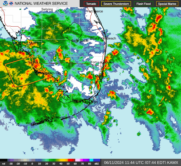
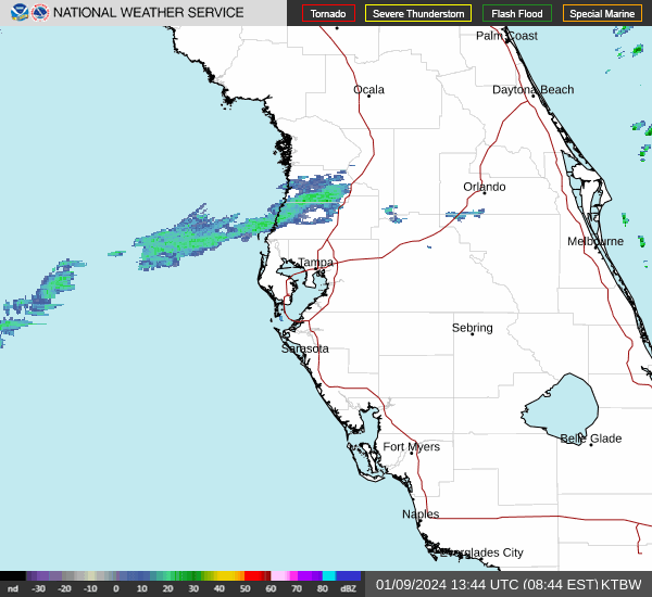
"A potent storm system will sweep across the eastern United States over the next 48 hours, with the greatest impacts in our area (Southwest Florida) expected Tuesday/Tuesday night," said the National Weather Service Tampa Bay late Sunday on X, formerly known as Twitter.
Farther north, forecasters continue to warn of a "potent" and dangerous severe weather threat coming to North Florida Monday night and into Tuesday.
High wind warnings, wind advisories, high surf warnings along with gale and coastal flood watches have been issued in several locations around the state.
EF-0 tornado touches down in Fort Lauderdale
Our survey team today gathered some data from yesterday's tornado with an initial estimated touch down at 5:47pm near the Lauderdale Yacht Club where it then progressed NE across the intracoastal waterway into the Las Olas Isles. pic.twitter.com/YBq6N7y3sY
— NWS Miami (@NWSMiami) January 7, 2024
The National Weather Service in Miami said Saturday's tornado, with peak winds of 80 mph, touched down at 5:47 p.m. and traveled 1.5 miles.
The twister touched down near the Lauderdale Yacht Club, near the Intracoastal Waterway and moved east into the ocean. The National Weather Service Miami estimated the tornado's width at 100 yards.
No injuries were reported, said Fort Lauderdale Mayor Dean Trantalis posted on X, formerly Twitter.
Most of the damage observed along the path was minor tree, roof, and power line damage, the Weather Service reported.
'Oh my God': Watch TikTok, Twitter videos of tornado that ripped through Fort Lauderdale
Weather alerts issued in Florida
Power outages across Florida
Weather radar and forecast for Pensacola

Follow National Weather Service Mobile on X, formerly known as Twitter
Monday: A chance of showers and thunderstorms between 1 p.m. and 4 p.m., then showers and possibly a thunderstorm after 4 p.m. High near 66. Windy, with an east wind 15 to 25 mph, with gusts as high as 35 mph. Chance of precipitation is 90%. New rainfall amounts between a quarter and half of an inch possible.
Monday night: Showers and possibly a thunderstorm. Some of the storms could be severe. Temperature rising to around 65 by 2 a.m. Windy, with a southeast wind 25 to 35 mph, with gusts as high as 50 mph. Chance of precipitation is 100%. New rainfall amounts between 1 and 2 inches possible.
Tuesday: Showers and possibly a thunderstorm, mainly before 1 p.m. Some of the storms could be severe. Temperature falling to around 54 by 5 p.m. Windy, with a west wind 30 to 35 mph decreasing to 20 to 25 mph in the morning. Winds could gust as high as 50 mph. Chance of precipitation is 100%. New rainfall amounts between three quarters and one inch possible.
Tuesday night: Mostly clear, with a low around 37. Windy, with a west wind 20 to 25 mph decreasing to 10 to 15 mph after midnight. Winds could gust as high as 35 mph.
Watches and warnings in effect for Pensacola:
High wind warning: 4 p.m. Jan. 8 to 9 a.m. Jan. 9 CST. South winds 25 to 35 mph with gusts up to 60 mph expected.
Wind advisory: 9 a.m. Jan. 9 to 6 p.m. Jan. 9 CST. West winds 15 to 25 mph with gusts up to 40 mph expected.
High surf warning: 3 p.m. Jan. 8 to 7 a.m. Jan. 10 CST. Dangerously large breaking waves of 8 to 13 feet expected in the surf zone.
Coastal flood advisory: 6 p.m. Jan. 8 to 6 a.m. Jan. 9 CST. Minor coastal flooding expected.
Rip current statement: 6 a.m. Jan. 8 to 6 a.m. Jan. 11 CST. Dangerous rip currents expected.
Weather radar and forecast for Tallahassee

Follow the National Weather Service Tallahassee on X, formerly known as Twitter
Monday: A 40 percent chance of showers after 1 p.m. Mostly cloudy, with a high near 59. East northeast wind 5 to 15 mph.
Monday night: Showers and possibly a thunderstorm. Temperature rising to around 62 by 4 a.m. Breezy, with an east southeast wind 15 to 20 mph, with gusts as high as 35 mph. Chance of precipitation is 80%. New rainfall amounts between a quarter and half of an inch possible.
Tuesday: Showers and possibly a thunderstorm. Some of the storms could be severe. Temperature rising to near 66 by 10 a.m., then falling to around 58 during the remainder of the day. Windy, with a south wind 25 to 30 mph becoming west southwest 15 to 20 mph in the afternoon. Winds could gust as high as 45 mph. Chance of precipitation is 100%. New rainfall amounts between 1 and 2 inches possible.
Tuesday night: A 10 percent chance of showers before 7 p.m. Mostly clear, with a low around 38. West southwest wind 10 to 15 mph.
Be prepared: Severe weather threat upgraded for north Florida with 'incredible' wind field possible
Watches and warnings in effect for Tallahassee
Wind advisory: 9 p.m. Jan. 8 to 5 p.m. Jan. 9 EST. South winds 25 to 35 mph with gusts 50 to 55 mph expected.
Weather radar and forecast for Jacksonville

Follow the National Weather Service Jacksonville on X, formerly known as Twitter
Monday: A 10 percent chance of showers after 5 p.m. Cloudy, with a high near 65. Northeast wind 7 to 13 mph becoming east in the afternoon. Winds could gust as high as 20 mph.
Monday night: A chance of showers and thunderstorms before 10 p.m, then a slight chance of showers between 10 p.m. and 1 a.m., then a chance of showers and thunderstorms after 1 a.m. Mostly cloudy, with a temperature rising to around 65 by 5 a.m. Breezy, with a southeast wind 11 to 18 mph, with gusts as high as 28 mph. Chance of precipitation is 50%. New rainfall amounts of less than a tenth of an inch, except higher amounts possible in thunderstorms.
Tuesday: A chance of showers and thunderstorms, then showers and possibly a thunderstorm after 11 a.m. Some of the storms could be severe. High near 76. Very windy, with a south wind 22 to 30 mph, with gusts as high as 44 mph. Chance of precipitation is 100%. New rainfall amounts between a half and three quarters of an inch possible.
Tuesday night: Showers and thunderstorms likely before 10 p.m., then a chance of showers between 10 p.m. and 1 a.m. Mostly cloudy, then gradually becoming mostly clear, with a low around 44. Windy, with a west wind 13 to 20 mph, with gusts as high as 30 mph. Chance of precipitation is 60%.
Watches and warnings in effect for Jacksonville
What residents can expect:
Scattered strong to severe thunderstorms, along with strong winds, isolated tornadoes and hail are possible from late Monday night into Tuesday afternoon, the National Weather Service Jacksonville warned.
Wind gusts could hit 50 to 70 mph.
Weather radar and forecast for Daytona Beach

Follow the National Weather Service Melbourne on X, formerly known as Twitter
Monday: A 20 percent chance of showers. Mostly cloudy, with a high near 69. East wind 10 to 15 mph.
Monday night: Mostly cloudy, with a low around 63. Windy, with a southeast wind 15 to 20 mph, with gusts as high as 25 mph.
Tuesday: Showers and possibly a thunderstorm after 1 p.m. Some of the storms could produce gusty winds and heavy rain. High near 78. Windy, with a south southeast wind 20 to 30 mph, with gusts as high as 40 mph. Chance of precipitation is 80%. New rainfall amounts between a quarter and half of an inch possible.
Tuesday night: Showers likely and possibly a thunderstorm before 1 a.m. Cloudy during the early evening, then gradual clearing, with a low around 49. Windy, with a west southwest wind 15 to 25 mph, with gusts as high as 35 mph. Chance of precipitation is 60%.
Watches and warnings in effect for Daytona Beach
Small craft advisory: 4 p.m. Jan. 8. East-southeast winds 15 to 25 knots and seas up to 7 feet.
Gale warning: 10 p.m. Jan. 8. Southeast winds 25 to 35 knots with wind gusts up to 45 knots and seas 7 to 12 feet. The gale warning will expand to include the nearshore waters after 4 a.m. on Tuesday, the National Weather Service Melbourne said.
What residents can expect:
Damaging wind gusts of 60-plus mph are possible Tuesday afternoon into the evening.
A tornado or two, possibly strong.
Lightning and small hail.
A moderate risk of rip currents exists at all central Florida Atlantic beaches today.
The Saint Johns River near Astor remains just in Action Stage, and is forecast to remain just near 2.0 feet through early this week.
Weather radar and forecast for Melbourne
Follow the National Weather Service Melbourne on X, formerly known as Twitter
Monday: Mostly cloudy, with a high near 71. East wind 10 to 15 mph, with gusts as high as 20 mph.
Monday night: Mostly cloudy, with a low around 67. Windy, with a southeast wind 15 to 20 mph, with gusts as high as 30 mph.
Tuesday: A 40 percent chance of showers and thunderstorms after 1 p.m. Mostly cloudy, with a high near 80. Windy, with a southeast wind 20 to 25 mph, with gusts as high as 40 mph.
Tuesday night: Showers and possibly a thunderstorm before 1 a.m. Some of the storms could produce gusty winds and heavy rain. Low around 55. Windy, with a south southwest wind 20 to 25 mph becoming west 15 to 20 mph after midnight. Winds could gust as high as 35 mph. Chance of precipitation is 90%.
Watches and warnings in effect for Melbourne
Small craft advisory: 4 p.m. Jan. 8. East-southeast winds 15 to 25 knots and seas up to 7 feet.
Gale warning: 10 p.m. Jan. 8. Southeast winds 25 to 35 knots with wind gusts up to 45 knots and seas 7 to 12 feet. The gale warning will expand to include the nearshore waters after 4 a.m. on Tuesday, the National Weather Service Melbourne said.
What residents can expect:
Damaging wind gusts of 60-plus mph are possible Tuesday afternoon into the evening.
A tornado or two, possibly strong.
Lightning and small hail.
A moderate risk of rip currents exists at all central Florida Atlantic beaches today.
Weather radar and forecast for Port St. Lucie
Follow the National Weather Service Melbourne on X, formerly known as Twitter
Monday: Mostly cloudy, with a high near 73. East wind 10 to 15 mph, with gusts as high as 20 mph.
Monday night: Mostly cloudy, with a low around 67. Windy, with an east wind 15 to 20 mph, with gusts as high as 25 mph.
Tuesday: A 20 percent chance of showers and thunderstorms after 1 p.m. Mostly cloudy, with a high near 81. Windy, with a southeast wind 20 to 25 mph, with gusts as high as 40 mph.
Tuesday night: Showers and possibly a thunderstorm before 1 a.m., then a slight chance of showers. Some of the storms could produce gusty winds and heavy rain. Low around 57. Windy, with a south southwest wind 25 to 30 mph becoming west 15 to 20 mph after midnight. Winds could gust as high as 40 mph. Chance of precipitation is 90%.
Watches and warnings in effect for Port St. Lucie
Small craft advisory: 4 p.m. Jan. 8. East-southeast winds 15 to 25 knots and seas up to 7 feet.
Gale warning: 10 p.m. Jan. 8. Southeast winds 25 to 35 knots with wind gusts up to 45 knots and seas 7 to 12 feet. The gale warning will expand to include the nearshore waters after 4 a.m. on Tuesday, the National Weather Service Melbourne said.
What residents can expect:
Damaging wind gusts of 60-plus mph are possible Tuesday afternoon into the evening.
A tornado or two, possibly strong.
Lightning and small hail.
A moderate risk of rip currents exists at all central Florida Atlantic beaches today.
Weather radar and forecast for West Palm Beach
Follow the National Weather Service Miami on X, formerly known as Twitter
Monday: Mostly cloudy, with a high near 75. Windy, with an east wind 22 to 25 mph, with gusts as high as 28 mph.
Monday night: Mostly cloudy, with a low around 71. Windy, with an east wind 29 to 36 mph.
Tuesday: Mostly cloudy, with a high near 79. Windy, with a southeast wind 32 to 36 mph, with gusts as high as 43 mph.
Tuesday night: Showers and possibly a thunderstorm between 8 p.m. and 2 a.m., then a slight chance of showers and thunderstorms after 2 a.m. Low around 64. Windy, with a south wind 24 to 33 mph becoming west after midnight. Winds could gust as high as 40 mph. Chance of precipitation is 80%.
Watches and warnings in effect for West Palm Beach
High rip current risk: In effect through Tuesday evening. Dangerous rip currents expected.
What residents can expect:
Hazardous marine conditions will continue today across the Atlantic waters as easterly winds range between 20 and 25 knots and wave heights rise up to around 7 feet. As winds and seas increase tonight, marine conditions will become dangerous across the Atlantic waters.
Wind gusts over 35 mph will be possible on Tuesday ahead of an approaching cold front.
A few strong to severe thunderstorms are possible late Tuesday into early Wednesday ahead of an approaching cold front.
Dangerous beach conditions due to rip currents and high surf are likely over the east coast beaches through the middle of the week. A period of hazardous conditions along the west coast beaches will also be possible during the middle of the week.
Weather radar and forecast for Naples
Follow the National Weather Service Miami on X, formerly known as Twitter
Monday: Mostly cloudy, with a high near 75. East wind 11 to 14 mph, with gusts as high as 22 mph.
Monday night: Mostly cloudy, with a low around 67. Breezy, with an east wind 13 to 18 mph, with gusts as high as 29 mph.
Tuesday: A 40 percent chance of showers and thunderstorms after 1 p.m. Partly sunny, with a high near 77. Windy, with a south wind 20 to 28 mph, with gusts as high as 41 mph.
Tuesday night: Showers and possibly a thunderstorm before 1 a.m. Low around 62. Windy, with a south wind 16 to 21 mph becoming west 9 to 14 mph after midnight. Winds could gust as high as 31 mph. Chance of precipitation is 80%.
Watches and warnings in effect for Naples
High rip current risk: In effect through Tuesday evening. Dangerous rip currents expected.
What residents can expect:
Hazardous marine conditions will continue today across the Atlantic waters as easterly winds range between 20 and 25 knots and wave heights rise up to around 7 feet. As winds and seas increase tonight, marine conditions will become dangerous across Gulf waters.
Wind gusts over 35 mph will be possible on Tuesday ahead of an approaching cold front.
A few strong to severe thunderstorms are possible late Tuesday into early Wednesday ahead of an approaching cold front.
A period of hazardous conditions along the west coast beaches will also be possible during the middle of the week.
Minor coastal flooding will be possible over Collier County and mainland Monroe County later on Tuesday into Tuesday night.
Weather radar and forecast for Fort Myers
Follow the National Weather Service Tampa Bay on X, formerly known as Twitter
Monday: Mostly cloudy, with a high near 72. East wind 9 to 14 mph, with gusts as high as 21 mph.
Monday night: Mostly cloudy, with a low around 67. Breezy, with an east wind 13 to 18 mph, with gusts as high as 26 mph.
Tuesday: A 50 percent chance of showers and thunderstorms after 1 p.m. Partly sunny, with a high near 78. Windy, with a south wind 18 to 23 mph increasing to 24 to 29 mph in the afternoon. Winds could gust as high as 43 mph. New rainfall amounts of less than a tenth of an inch, except higher amounts possible in thunderstorms.
Tuesday night: Showers and possibly a thunderstorm before 1 a.m. Low around 59. Windy, with a south southwest wind 19 to 24 mph becoming west 10 to 15 mph after midnight. Winds could gust as high as 36 mph. Chance of precipitation is 80%.
Watches and warnings in effect for Fort Myers
Coastal flood watch: 10 a.m. Jan. 9 to 7 a.m. Jan. 10. Significant coastal flooding possible. Numerous roads may be closed. Low lying property including homes, businesses, and some critical infrastructure may be inundated. Some shoreline erosion may occur.
Gale watch: Issued along the coast Tuesday and Tuesday night
Weather radar and forecast for Sarasota
Follow the National Weather Service Tampa Bay on X, formerly known as Twitter
Monday: A 40 percent chance of showers, mainly after 1 p.m. Mostly cloudy, with a high near 71. Breezy, with an east northeast wind 14 to 16 mph, with gusts as high as 24 mph.
Monday night: Mostly cloudy, with a low around 64. Windy, with a southeast wind 18 to 22 mph, with gusts as high as 34 mph.
Tuesday: Showers and possibly a thunderstorm after 1 p.m. High near 77. Very windy, with a south southeast wind 25 to 34 mph, with gusts as high as 50 mph. Chance of precipitation is 80%. New rainfall amounts between a quarter and half of an inch possible.
Tuesday night: A 50 percent chance of showers and thunderstorms before 1 a.m. Cloudy during the early evening, then gradual clearing, with a low around 58. Windy, with a west wind 14 to 22 mph, with gusts as high as 33 mph.
Watches and warnings in effect for Sarasota
Coastal flood watch: 10 a.m. Jan. 9 to 7 a.m. Jan. 10. Significant coastal flooding possible. Numerous roads may be closed. Low lying property including homes, businesses, and some critical infrastructure may be inundated. Some shoreline erosion may occur.
Gale watch: Issued along the coast Tuesday and Tuesday night
This article originally appeared on Treasure Coast Newspapers: Florida storms, severe weather forecast: tornadoes, flooding possible

