Ready for a warm-up, Canada? You’ll love next week’s forecast
After the heart of the polar vortex sent a once-in-a-generation chill down the spines of Canadians from coast to coast, we’re on the lookout for a more familiar pattern in the days ahead:
Warmth!
‘Warmth’ is relative in January, of course, but there’s no denying the comparable comfort on the way for millions across Canada as above-seasonal temperatures dance on our not-too-distant horizon.
DON’T MISS: El Niño to break Canada out of a record-cold January
Historic cold, deep snows fly in the face of a strong El Niño
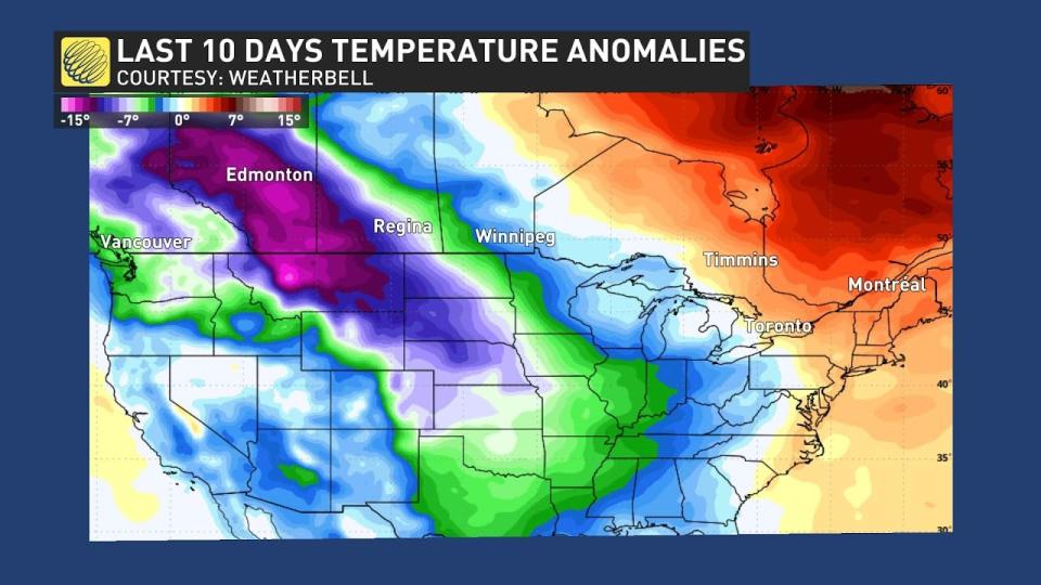
A bitter air mass gripping the country for more than a week brought about some of the coldest temperatures and most dangerous wind chills we’ve seen in years—a complete reversal from the toasty December most of Western Canada experienced.
We’re in the midst of a strong El Niño. This pattern of warmer-than-normal water temperatures in the eastern Pacific has a big influence on Canadian winter weather. A typical El Niño winter features above-seasonal temperatures across Western Canada, which is what we saw dominate the region through December and early January.
Edmonton endured its longest-ever wait for a temperature of -15°C or colder this winter, breaking the old record by more than two weeks. The city didn’t hit 15 degrees below zero until January 7 this year…and then the bottom fell out as the polar vortex swept from the Arctic toward lower latitudes.
MUST SEE: What is the polar vortex? How it’s responsible for dangerous cold
Days after the city ended its all-time winter warmth record, Edmonton Airport notched five days in a row with lows below -40°C. Keg River even dropped below -50°C two mornings in a row—a feat unseen in the province since 2004.
An even more remarkable feat occurred next door in British Columbia, where Vancouver saw its second-snowiest January day on record after more than 25 cm of snow fell at the city’s airport. That kind of snow at sea level is almost unheard of for a strong El Niño winter.
Ski resorts are particularly happy about the recent cold snap. After a ski season that looked like it may never begin, many resorts across the country now have solid bases heading into the second half of January.
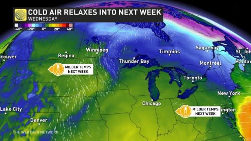
Warmer temperatures are on the way
Unusual patterns don’t last forever, and all signs point toward a return to our above-seasonal pattern for much of Canada in the days ahead.
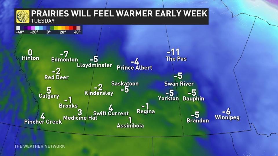
The jet stream will relax over the next seven days, flattening out a bit to allow milder Pacific air to flow across Western Canada. Alberta and Saskatchewan could even benefit from mild downsloping winds off the Rockies. Some communities here could see temperatures in the mid-single digits, which would be nearly 10 degrees above seasonal in spots.
STAY SAFE: Steps to follow to ensure your survival after a fall through the ice
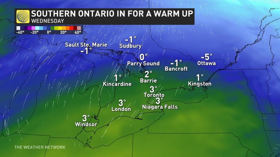
More comfortable air is on the way for southern Ontario, as well, where we’ll see temperatures climb above freezing by the second half of next week. Temperatures in the lower single digits could even reach the snow belts, helping to melt some of the impressive snow banks they’ve built lately.
As we close out the month of January, how long will this warm-up stick around?
According to long-range forecaster Dr. Doug Gillham, this pattern looks like it has some staying power. Temperatures should remain on the milder side for a large swath of Canada through the end of January before a more amplified—and active—jet stream takes hold heading into the start of February.

