Record-breaking high pressure is stirring up trouble in the Atlantic
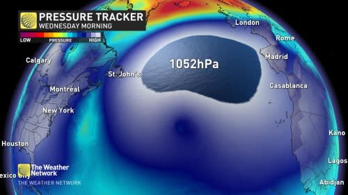
It's not often you see a 1052 hPa high pressure in the middle of December in the centre of the North Atlantic, but here we are.
WINTER 2024: El Niño will play a critical role in the weeks ahead
We can look at re-analysis data and check the records since 1950 to see if we've had a more powerful upper ridge across that area. These insightful maps by Tomer Burg highlight the dramatic ridge in action:
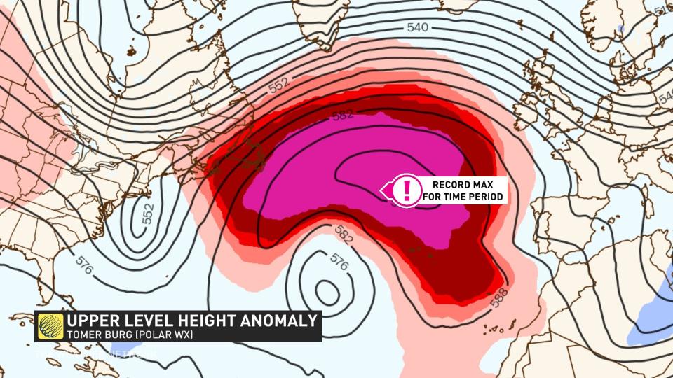
Sure enough, it's a record for the area and the corresponding period of mid-December.
Is it even more rare, though?
What about any time in the year? We’ll look at the surface pressure, here:

It appears so, which is particularly remarkable! Highs of this intensity are typically found close to an Arctic air mass and over land. Obviously, though, none of these attributes are even remotely close to this record feature.
DON'T MISS: Snow Grinch? El Niño robs Canada’s white Christmas
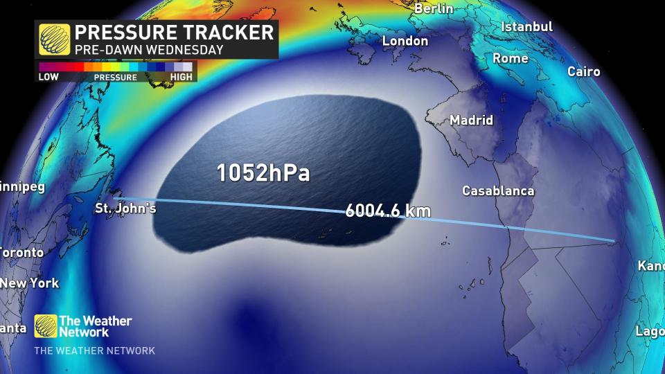
Size
It truly is a sprawling weather feature, enveloping St. John's, N.L., Spain, Morocco, and West Sararah under a dome of high pressure. This high-pressure system is about 6,000 kilometres wide, or longer than Canada.
Over the upcoming weekend, a deep trough will develop downstream across eastern Europe, all due to the amplified pattern.
Impacts
Due to its influential nature, weather systems are forced to move south-to-north, rather than in typical jet stream fashion, from the west to the east.
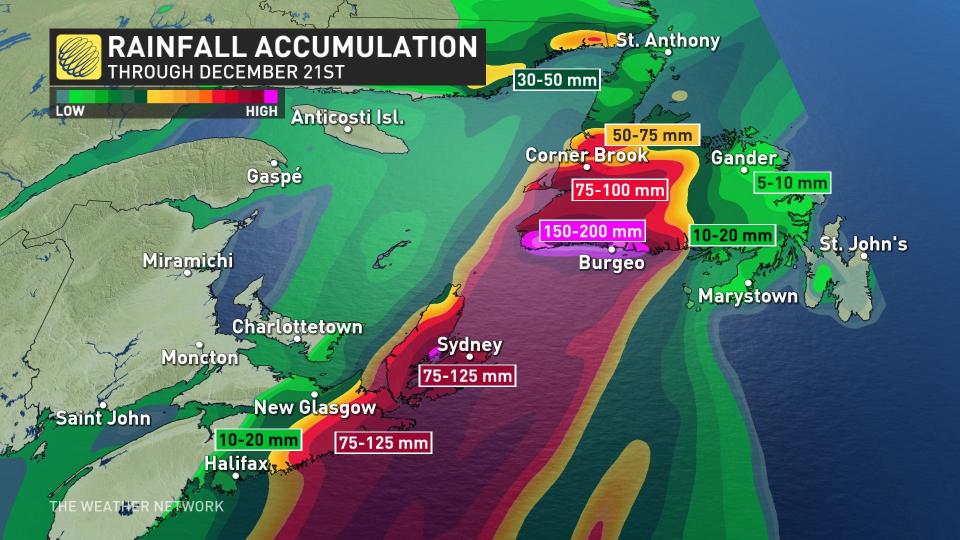
This week, Montreal and Quebec experienced some of the rainiest winter days in history, stirring up trouble across Quebec and Atlantic Canada. A lot of this active weather can be directly attributed to that ridge, not allowing the rain to move eastward.