Take a refreshing winter hike by a peaceful stream at Tucker Woods Preserve in Charlestown
- Oops!Something went wrong.Please try again later.
CHARLESTOWN — A winter walk on a short, forested trail with a long, rich history can brighten a dreary morning during the depths of the season.
I found one at the Tucker Woods Preserve.
The land I hiked is just off Alton Carolina Road and was farmed for decades during the last century by Louis Tucker, who sold eggs, corn, strawberries, potatoes and vegetables from a sunroom at the front of his house.
After he died, developers planned houses on the hay fields and under the pitch pine and oak woodlands that are crossed by gently tumbling streams.
The Town of Charlestown, however, stepped in and purchased the land in 2021 with a $400,000 state grant and another $500,000 in town open space funds that voters approved in a 2015 referendum.
Charlestown Conservation Commission volunteers cut the trails and the town’s Department of Public Works put in the parking lot.
More:These 10 Rhode Island trails should be on your bucket list
The 66.5-acre public preserve has filled a gap in a conservation corridor between the adjacent Francis C. Carter Memorial Preserve, which is managed by The Nature Conservancy, and the state’s Carolina Management Area.
The Carter Preserve is also contiguous with the Indian Cedar Swamp, a 1,000-acre wetland held in conservation for the Narragansett Tribe. Together, all the lands, including Tucker Woods, are now part of an 11-mile corridor of open space that extends from Ninigret National Wildlife Refuge on the ocean through the Carolina Management Area.
When Tucker died, he told his family members that he hoped his land would not be broken up and would stay in its natural state.
He got his wish.
Walking RI:Retracing Thoreau's 1854 hike through Providence
Walking RI:Cure your cabin fever at Scituate's Lawton Farm
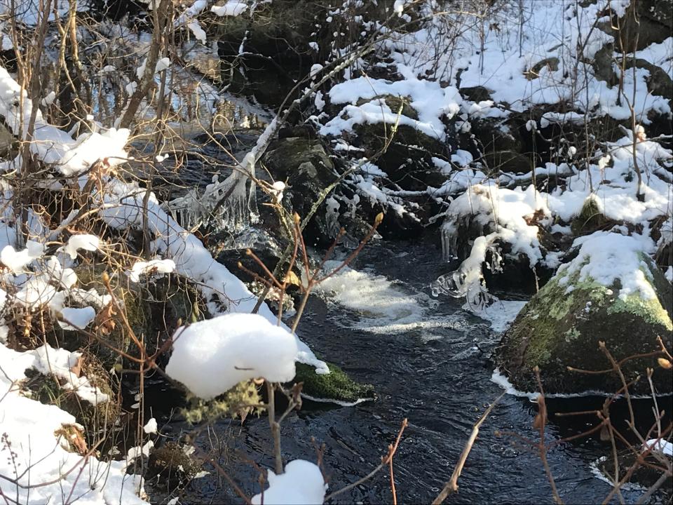
Sights along the way: A gentle brook, wetlands and Ice Age remnants
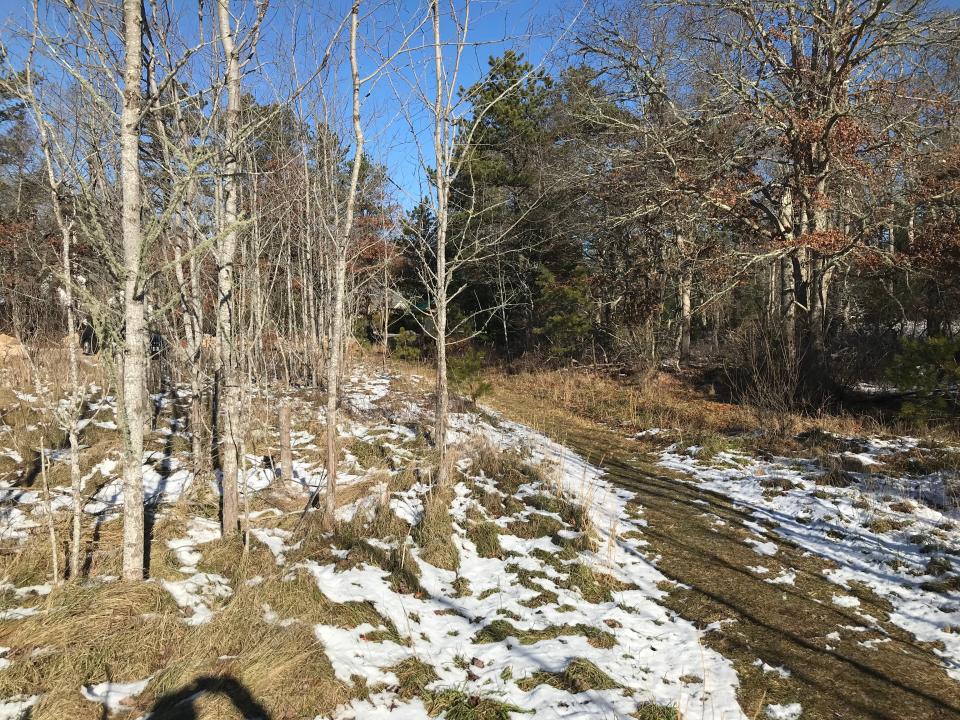
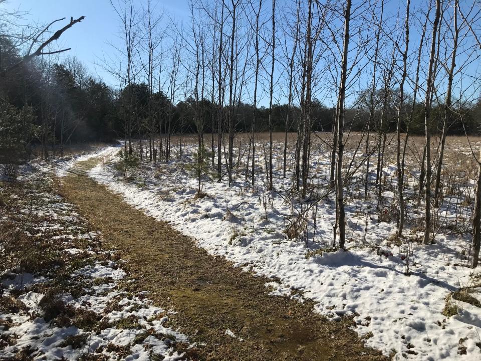
With all of that background in mind, I set out from a turnout off Alton Carolina Road (Route 91) and passed an information kiosk and a line of tall, thin, smooth sumac trees that stand like sentries guarding a large, open hay field. I headed south on the blue-blazed trail, once a cart path, that followed the fringe of the 4.5-acre field.
The trail soon runs under pine trees and was covered with pine needles and a light overnight snow, making for a quiet, soft walk. I noticed a few boot prints and pawprints, but saw no one, man or beast.
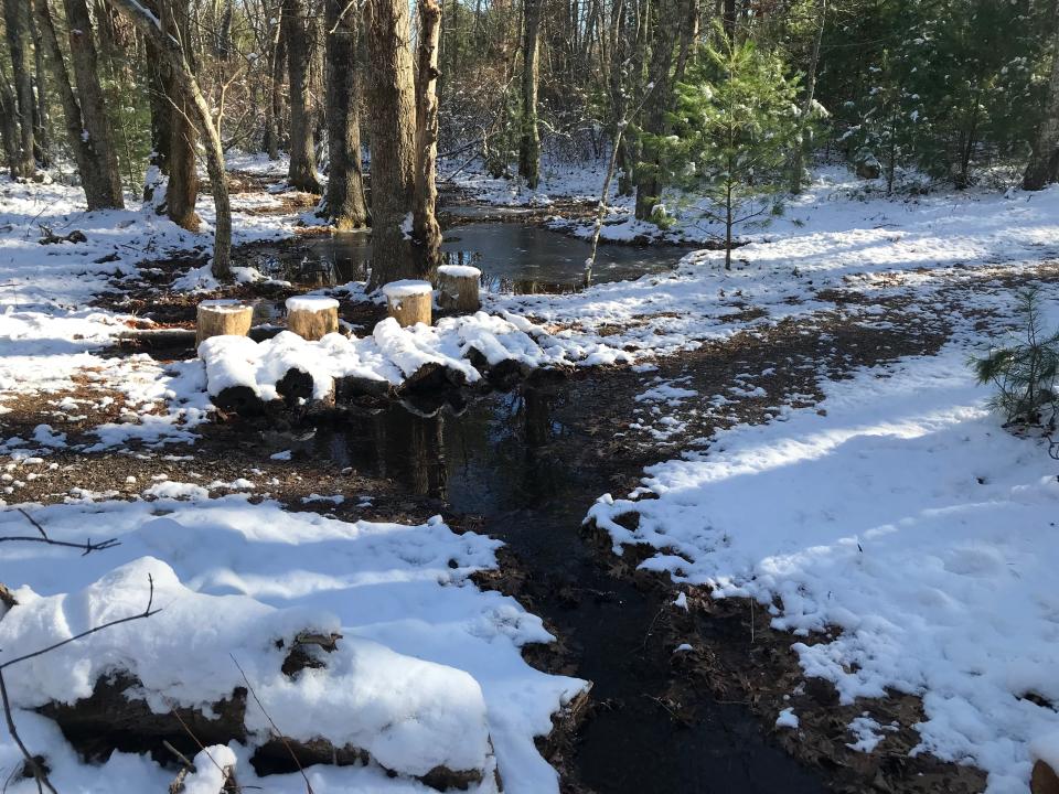
Just ahead, the yellow-blazed trail opened on the right, but I saved that for later. Continuing on the blue-blazed trail, I crossed a narrow, unnamed brook and a log bridge. Several stubby logs were placed upright to serve as sitting stools for those who want to study the water’s flow and the surrounding wetlands.
On the left, the land rose to a ridge of glacial till left behind by the Ice Age, and I noticed some huge boulders on the high ground. I continued on to a fork and took a right on a loop trail that circled through the woods on a gentle incline.
More:Prowl for owls, hike or snowshoe under the full moon at Audubon events in February
More:20 fun things to do in Rhode Island this winter when you don't want to go outside
To the right and downhill, I could see the brook I had crossed earlier running through a small ravine before passing under a high berm that supported railroad tracks. Through the trees, I could see a transformer station just off the tracks and an opening in a stone wall. A road ran through the opening and led to a clearing on private property.
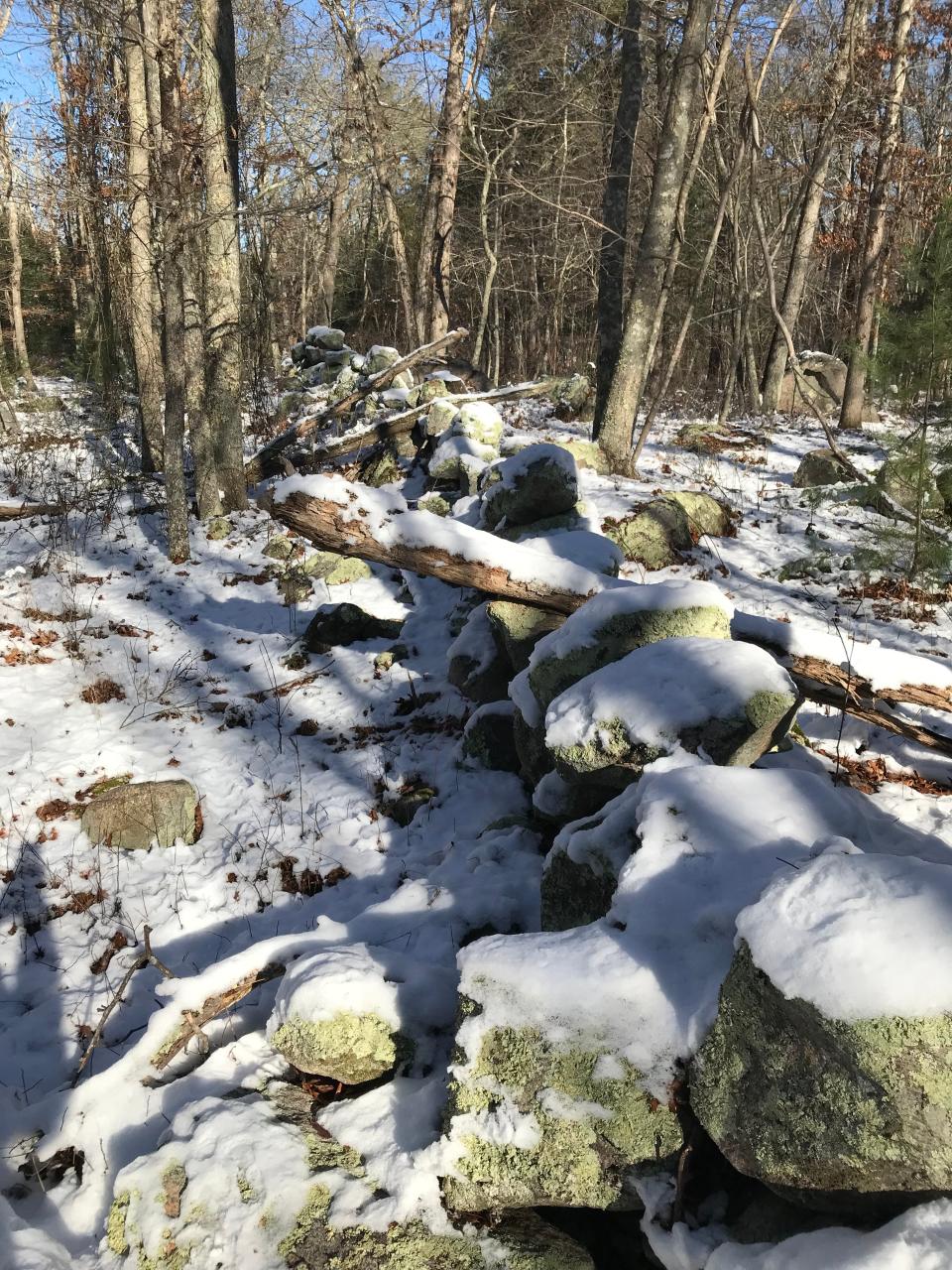
I respected the property owner’s wishes and turned back to the blue-blazed loop that followed a snow-covered stone wall and marked the eastern border of the property. Several side paths through the wall were blocked with fencing or brush.
Continuing on the blue-blazed trail, I completed the loop and headed north on the trail I had walked in on to where Louis Tucker had farmed for 57 years.
Walking RI:Hike the 'Big Hill' in Cumberland, where skiing was once a favorite winter pastime in RI
Walking RI: This Hopkinton RI trail was featured in Wes Anderson's 'Moonrise Kingdom'
Who were the Tuckers who farmed this land?
Lynn Macalister, chair of the Charlestown Conservation Commission, told me that she'd learned from researching land records and talking with a Tucker family relative that Louis had worked as a machinist at Hazards Carolina Mill in nearby Richmond after attending the Technical School in Boston.
Despite his mechanical background, Louis stopped driving his first car after he backed into a garage door and swore never to drive the crazy things again. After that, his wife, Ivah, got her license and drove the family around.
Walking RI:Find peace on a hike at Cumberland preserve once owned by Sisters of Mercy
Louis and Ivah bought the land on Alton Carolina Road in 1914, converted and expanded a one-room shack into a house for their six children, and farmed the fields into the 1970s. When they worked the land, they found many arrowheads that were remnants from the Indigenous peoples who had once lived there. Ivah died in 1968 and Louis in 1974.
Quentin Tucker, one of their sons, helped out on the farm, lived down the road and became a poultry and egg farmer who delivered the products to local residents.
Animals might you spot near the streams
While walking down the blue-blazed trail, I came to the yellow-blazed trail on the left and took it slightly downhill to a side spur on the left that led to the brook I had crossed before. Two log stumps had been placed at an opening on the banks. I brushed the snow off one and sat there awhile, watching the icy brook tumble over a small waterfall created by rocks from a stone wall that crossed the brook and ran up the hillside. I also noted some deer tracks in the soft soil at the edge of the water.
The only sound was the tumbling water.
Walking RI: Seal-watching and scenic splendor at Rome Point in North Kingstown
Walking RI: Follow in the footsteps of Trappist monks in Cumberland
Hikers report that, in different seasons, signs of river otters, beavers and box turtles have been found near the streams. Pileated woodpeckers, ospreys and even a bald eagle also have been spotted.
Environmentalists say the rain captured and cleansed by the protected forests improves ground water quality and recharges the Indian Cedar Swamp Groundwater Reservoir.
The land to the east and on the other side of the brook where I sat is part of the Carter Preserve, where wetland maps show the stream connects to Ice House Pond and then to the Pawcatuck River. Quentin Tucker cut ice from the pond and delivered it to ice boxes at nearby houses.
Walking RI: A birder's paradise by the shore in Middletown
Walking RI: Winter blahs? Make tracks for Lincoln Woods
Near the pond are the remains of a shingle mill once run by Benjamin Tucker, believed to be a relative of Louis Tucker.
When my break was over, I retraced my steps on the side spur to the yellow-blazed trail and headed northwest on a path that crossed a brook and passed ferns, wetlands and the outlines of a vernal pool. Lady slippers are known to grow along the path. I reached the blue-blazed trail and took it back to the trailhead.

In all, the preserve’s 1.3 miles of wide, easy-to-walk paths took me about an hour to traverse.
Though the trails opened last June, volunteers are still researching the deep history of Tucker’s farm and the land. They also plan to cut a new trail along the stone wall to the high point. It’s only 132 feet above sea level but should provide a great view of the miles of surrounding, protected land.
That will make a good addition to an enjoyable winter walk through lovely terrain. Louis Tucker would be pleased.
Trail Tip
Signs at the entrance of the Tucker Woods Preserve warn hikers to beware of falling tree limbs because a spongy moth infestation has defoliated oak trees and weakened branches.
Also, no hunting, camping, fires, bicycling, motorized vehicles, horses or dirt bikes are allowed on the property.
The Walking Rhode Island column will appear twice a month in the Sunday Journal. John Kostrzewa, a former assistant managing editor/business at The Providence Journal, welcomes email at johnekostrzewa@gmail.com.
This article originally appeared on The Providence Journal: A pine forest hike with peaceful streams at Charlestown's Tucker Woods

