What a new report says about the health of the Milwaukee, Kinnickinnic and Menomonee rivers
While the Milwaukee River watershed has vastly improved over the last few decades, a new report shows that there is still a lot of room to grow.
Milwaukee Riverkeeper, a science-based advocacy organization, released its 2022 report card detailing the health of the watershed, which includes the Milwaukee, Menomonee and Kinnickinnic rivers. The report provides an overall score for the basin each year; in 2021 it received a D+ and in 2022 it received a C-.
The Milwaukee River watershed spans seven counties and is home to roughly 1.3 million people. Cleaning up waterway and improving the health of the watershed is important to support the regional economy, fish and wildlife populations, public health and recreation.
Here are takeaways from the report.
Much of the Milwaukee River watershed is agriculture land
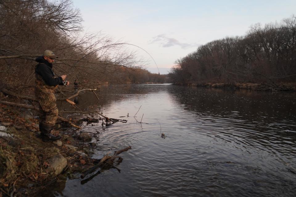
The Milwaukee River watershed includes more than 700 total miles of river, of which roughly 45% are considered impaired. There are 18 miles of streams used by trout to feed, spawn and reproduce. Within the watershed, 34% is agriculture land, 31% is grassland or forest, 18% is developed land and 16% is wetland.
For the 2022 report, 97 total sites were monitored, and data collection is largely done by volunteers in partnership with the Milwaukee Metropolitan Sewerage District, Wisconsin Department of Natural Resources and Ozaukee County.
More: Milwaukee's rivers were once open sewers to Lake Michigan. Here's how they're being cleaned up.
Phosphorus, fecal bacteria continue to plague watershed
While the overall phosphorus grade improved slightly by 6% in 2022, it still received a failing grade, according to the report. Phosphorus pollution is largely attributed to fertilizers and farm runoff.
Out of all of the water quality metrics that were measured, fecal bacteria grades improved the most. However, the watershed still only met standards about 50% of the time.
Bacteria can make their way into waterways via leaky sewage pipes, failing septic systems and pet waste. Monitoring bacteria in the watershed can help determine if waterways are clean enough for recreational use.
And while many of the subwatersheds, which are smaller watersheds nested within larger ones, also saw significant improvements in these two major pollutants, they are still not at levels that are considered safe, said Cheryl Nenn, riverkeeper with the Milwaukee Riverkeeper.
According to Nenn, dramatic changes in these two pollutants is unlikely without large-scale regulatory changes in agriculture and infrastructure improvements in urban settings.
Road salt struggles persist
Another water quality parameter measured was high specific conductivity. Conductivity is a measure of water’s ability to pass an electrical current due to charged particles present. It increases when salts are present. Chloride from road salt is one factor that can increase a waterway’s conductivity. Salts are also present in industrial waste, sewage, fertilizers and sediment.
Chloride is especially problematic in smaller waterways, like creeks and streams, because they have less water to dilute the salty pollutant. Chloride can kill off aquatic plants and animals. Too much chloride can even cause fish to dry out, reducing fishery quality and size, or killing them altogether.
Conductivity levels that are considered healthy for aquatic life were met less than 10% of the time in the watershed in 2022, according to the report.
More: Road salt can have lasting impact on fresh water. Here's how to use less and stay safe.
Milwaukee River estuary received lower grade than previous year
The report included grades for seven subwatersheds within the Milwaukee River watershed. One subwatershed was the Milwaukee River Estuary, which includes the lower reaches of the Milwaukee, Menomonee and Kinnickinnic rivers. The estuary is designated as a Great Lakes area of concern or one of the most polluted spots throughout the basin.
While efforts are currently underway to get rid of legacy pollution that still sits at the river bottom and restore native habitat, the estuary was the only area to decrease in grade in 2022. Increased turbidity, which comes from increased soil exposure, roads and construction, was partially to blame. Phosphorus levels also increased, which the report says was likely due to increased sediment runoff.
Long-term monitoring helps make informed decisions
Collecting long-term data helps get a detailed view of the health of rivers, creeks and watersheds. It can also help pinpoint the areas that need better land management practices and better policies to reduce pollution, Nenn said. She said it can even help families make informed decision on how to use with the water by helping people decide where they can swim or fish.
Long-term monitoring can also help catch changes in the watershed right away, Nenn said. For instance, they have noticed that colder water upstream is starting to become warmer with climate and land use change. Catching these changes early on can help municipalities and land managers be proactive, like by tree planting, she said.
"It can help us answer questions that we haven't thought to ask yet," Nenn said.
Green infrastructure, collaborations provide a path forward
Outdated infrastructure is a major cause of pollutants getting into the watershed, Nenn said, but federal funding from the Bipartisan Infrastructure Law and the Inflation Reduction Act is helping to make gains on these issues.
Another bright spot for Nenn is seeing green infrastructure become the "new normal" in many municipalities. Green infrastructure helps nature do its job by absorbing and storing rain and melting snow. It protects communities against flooding and improves water quality. Examples of this infrastructure include rain gardens, bioswales and porous pavement.
"That is the kind of work that we need to see happen, really massive changes in how we engineer cities, so we're not running everything into the pipe and sending it directly into the waterway," Nenn said.
In order to make larger-scale changes throughout the watershed, Nenn said that municipalities will need to make smarter decisions to prioritize where to put green infrastructure. Collaboration and partnerships between municipalities will also be key to solve these water-related problems, especially when it comes to restoring shorelines and wetlands.
Projects continue to clean up pollution, restore habitats
While the report card highlights the need for improvement, there are many projects underway to help remediate and restore the watershed. Some examples include:
The Western Milwaukee flood management project, which will reduce flood impacts along the Menomonee River, parallel to W. State St. Construction began in 2023.
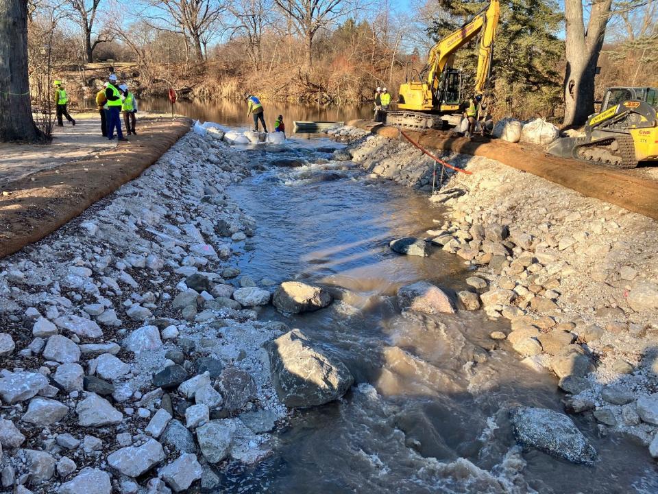
The Estabrook Falls fish passage, which will ensure most fish can move upstream on the Milwaukee River. Construction is slated to begin late 2024 or early 2025.
The Honey Creek flood management project, which will remove one mile of concrete-lined channel and restore natural habitat to slow flows during rain events and reconnect the creek to its floodplain. Construction is estimated to begin in 2025.
Restoration of the Milwaukee River Greenway, which is a part of the area of concern cleanup efforts. This project will remove legacy pollution from the river bottom that pose a risk to human health.
Projects will also continue to clean up the Milwaukee Estuary area of concern. Construction of the new pollution storage facility on Jones Island began in early 2024. The facility will hold nearly 2 million cubic yards of polluted sediment. More information about projects related to the area of concern on the Water Restoration Partnership's website.
More: A new fish passage around Kletzsch Dam will help restore Milwaukee's waterways. Here's how.
Caitlin Looby is a Report for America corps member who writes about the environment and the Great Lakes. Reach her at clooby@gannett.com or follow her on Twitter @caitlooby.
Please consider supporting journalism that informs our democracy with a tax-deductible gift to this reporting effort at jsonline.com/RFA or by check made out to The GroundTruth Project with subject line Report for America Milwaukee Journal Sentinel Campaign. Address: The GroundTruth Project, Lockbox Services, 9450 SW Gemini Dr, PMB 46837, Beaverton, Oregon 97008-7105.
This article originally appeared on Milwaukee Journal Sentinel: What to know about health of Milwaukee, Kinnickinnic, Menomonee rivers

