RI Redistricting Project releases first set of maps showing potential new boundaries
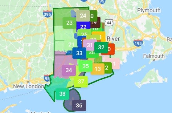
Rhode Island's every-10 years process of redrawing political boundaries hit high gear Thursday night with the first set of potential General Assembly district maps released to the public.
The maps -- two versions for the House and two for the Senate -- can be perused at the Rhode Island Redistricting website.
One set of House and Senate maps was drawn starting from the north and another set starting from the southern part of the state.
More: Battle heats up ahead of hearing on alleged 'prison gerrymandering'
Both the House and Senate maps are expected to be revised over the next several weeks as redistricting consultants working for the legislature take feedback from the public and lawmakers.
The state also needs to redraw the boundaries of its two congressional districts, but consultants have not released a proposed map for those yet.
More: Assembly leaders make picks for RI political redistricting commission
The maps released Thursday count the inmates at the Adult Correctional Institutions as residents of the prison complex in Cranston, but the Assembly commission holding hearings on the maps is still considering proposals to count them at their pre-incarceration addresses.
More: 'Prison gerrymandering': How many ACI inmates are really residents of Cranston?
The redistricting commission is meeting again on Monday at Smithfield High School to take testimony from the public on the proposed maps. It is supposed to recommend maps to the General Assembly to approve by Jan. 15.
The final maps approved by lawmakers will be used for next year's state elections.
panderson@providencejournal.com
(401) 277-7384
On Twitter: @PatrickAnderso_
This article originally appeared on The Providence Journal: Check out Rhode Island's first new political boundary maps
