Risk of 15 cm as cold winds continue to drive lake-effect snow in Ontario
Lake-effect snow squalls will continue through the day on Wednesday, with rapidly accumulating snow making for difficult travel in some areas.
A snow squall warning is in effect, urging travels to delay non-essential travel until conditions improve. It's not uncommon to go from clear skies to an area of heavy snow in just a few kilometres. Hazardous road conditions can be expected due to reduced visibility in some areas, says Environment and Climate Change Canada in the warning.
Visit our Complete Guide to Winter for an in-depth look at the Winter Forecast, tips to plan for it and much more!
Some areas near Georgian Bay and Lake Huron may see 5-15 cm by the time the snow ends later Wednesday, with a few flakes possibly flying east of the Greater Toronto Area (GTA) at times.
Threat for whiteout conditions amid snow squalls on Wednesday
Chillier air settles in on Wednesday behind a cold front. Most temperatures will be seasonal or slightly below. Colder air and winds from the northwest will drive lake-effect snow across southern Ontario.
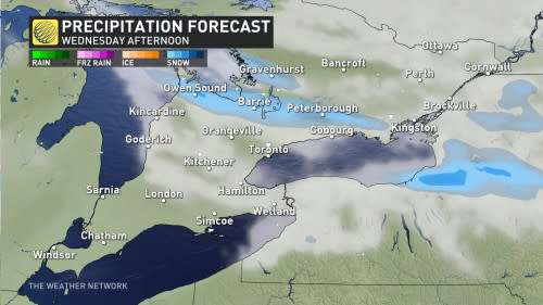
Wind gusts may reach 40 km/h, potentially exceeding 50 km/h at times. When paired with falling snow, that could cause periods of reduced visibility or whiteout conditions. That may impact commutes using Highway 400 by Wednesday afternoon.
The squalls may be strong enough for flakes to fly east of GTA, though little will accumulate.
DON'T MISS: Is it safe? How thick does ice need to be to walk or skate on?
Highest snowfall amounts will be off the shores of Lake Huron and Georgian Bay, with between 5-15 cm forecast, and locally higher amounts. Barrie may see closer to 5-10 cm.
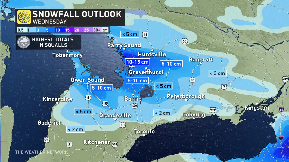
Totals drastically fall farther away from the lake-effect snow bands.
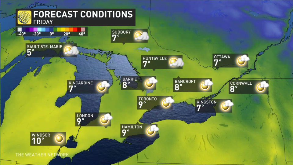
Thursday morning will see conditions improve, ahead of a very mild and sunny Friday forecast.
The weekend appears quite pleasant, with temperatures 5-10 degrees above seasonal, accompanied by a mix of sun and cloud.
Going somewhere? Check out the current highway conditions before heading out!
Mild temperatures are expected into early next week, but a quick shot of colder weather for Tuesday, with near-seasonal values for southern Ontario and a few degrees colder than seasonal for eastern areas –– lingering into Wednesday.
Mild temperatures should return for the second half of next week and into the weekend. If you are dreaming of a white Christmas, keep dreaming, but hope is fading, especially across southern Ontario.
Stay with The Weather Network for all the latest on conditions across Ontario.

