Is new Rodanthe bridge the future of NC 12 on the Outer Banks?
After a multi-month delay, a new $145-million bridge around some of the most flood-prone "hot spots" on the Outer Banks has finally opened.
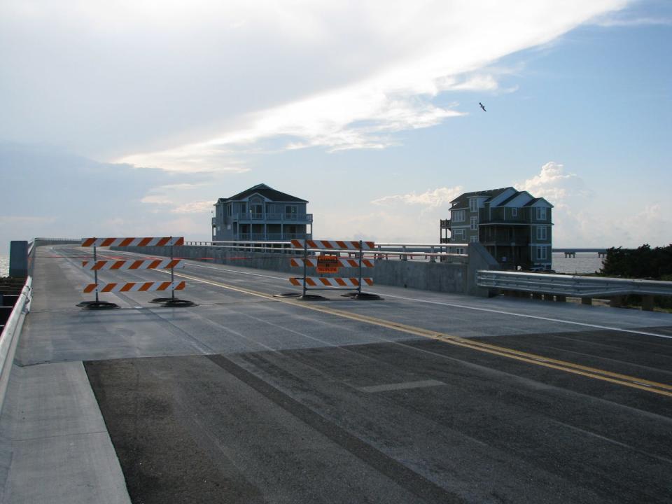
The N.C. Department of Transportation (DOT) on Thursday announced the new 2.4-mile-long bridge that carries N.C. 12 north of Rodanthe opened to traffic after delays due to a faulty expansion joint and substandard pavement markings. A ribbon-cutting for the new bridge had been held in April.
The new jug-handle bridge, which connects Rodanthe to the southern part of the Pea Island National Wildlife Refuge, carries N.C. 12 that links the isolated Outer Banks communities together around the infamous "S-curves" just north of Rodanthe. That stretch of oceanfront is notorious for flooding and road closures associated with storm surges and even monthly tides from flooding the roadway with salt water and sand.
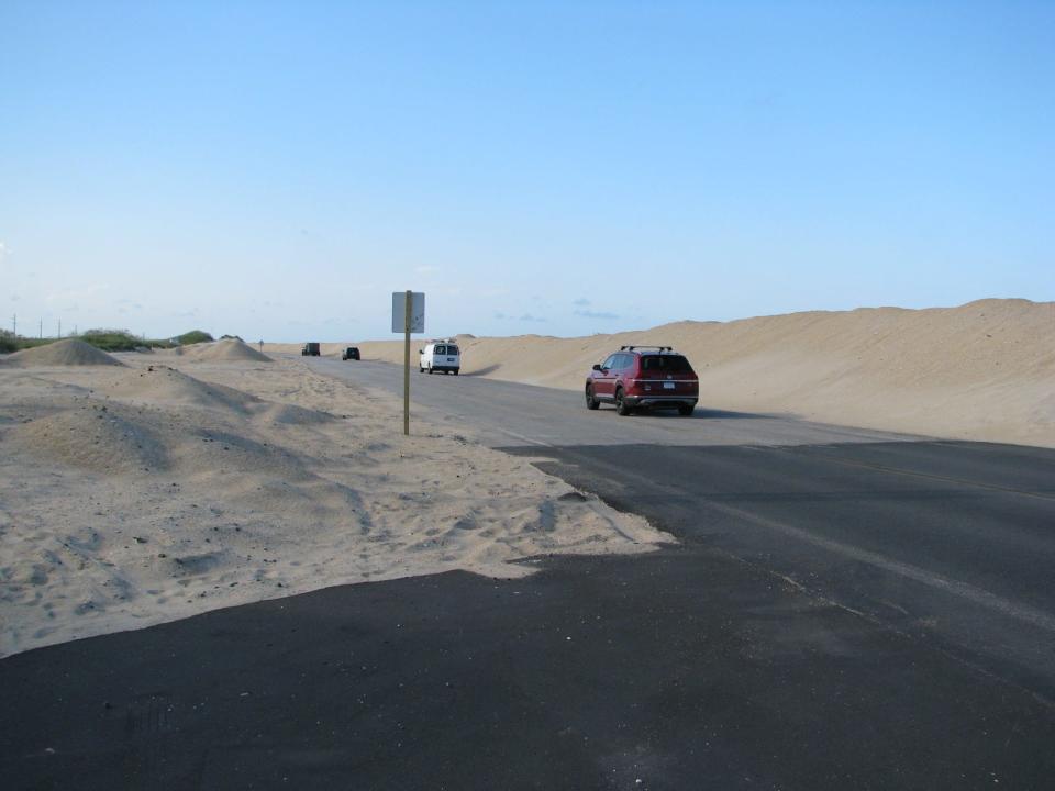
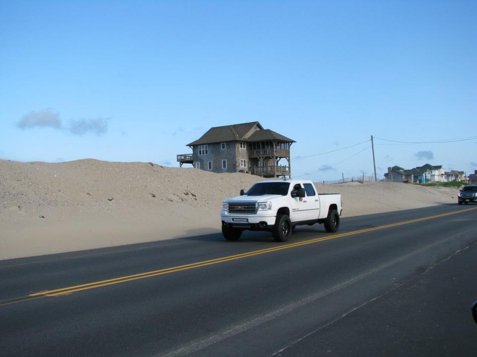
Earlier this year heavy winter storms saw a pair of oceanfront homes in Rodanthe tumble into the Atlantic Ocean. The heavy surf also broke through the unvegetated sand dunes and caused several days of road closures.
As seas continue to rise as the planet warms and climate change brings more unpredictable weather patterns and powerful storm systems to coastal areas, some environmentalists have said bridging much of N.C. 12 along its route along the narrow and precarious barrier islands of the Outer Banks might be the only way to keep the vital roadway open.
STORMY FUTURE: On the Outer Banks, structures rise and fall as climate change looms
A recent federal report led by the National Oceanic and Atmospheric Administration (NOAA) reinforced earlier findings by researchers that sea levels along the U.S. coastline could rise by an average of a foot by 2050 — worrisome news for areas like the Outer Banks, which often struggle with churning surf and overwash events whipped up by tropical storm systems.
Those systems are expected to increase in number and size due to climate change.
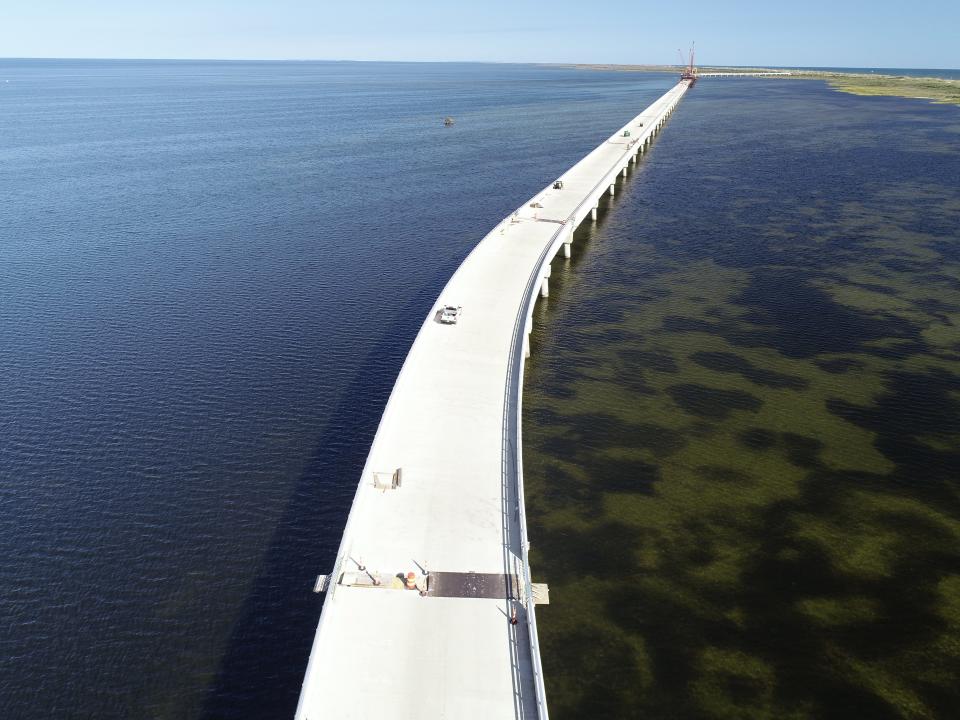
While much of the Outer Banks can become hazardous when the Atlantic gets angry, the northern part of Hatteras Island is among the most susceptible to overwash events. Home to some of the highest erosion rates on the North Carolina coast, the Pea Island refuge transitions from mudflats and marshes along Pamlico Sound to a flat beach, often all within just a few hundred feet. The refuge's characteristics, coupled with high erosion rates and flooding that can come from both the ocean and sound sides of the thin island, leave the very little area to shoehorn a roadway through.
State officials had initially proposed bridging most of N.C. 12 through the refuge since there are several overwash "hot spots" between Rodanthe and Oregon Inlet. But the cost — an extended bridge could have cost more than $1 billion — coupled with local opposition saw the project downsized to the current bridge.
Since N.C. 12 is the only highway link to the Outer Banks' southern communities, including Avon, Buxton, and Hatteras Island, the closure of the roadway has immediate and devastating impacts on the area's tourism-dependent economy.
Tourism is big business, and some would say the only business of significance in Dare County, which includes the Outer Banks. After a bit of a pandemic-driven slowdown in 2020, visitors came roaring back in 2021, eager to experience vacation and still somewhat limited in where they could travel outside the United States.
According to state tourism officials, visitors pumped $1.4 billion into the local economy in 2020 and supported nearly 11,800 jobs, about a third of Dare County's population, and generated $123 million in state and local taxes. The Cape Hatteras National Seashore, which encompasses most of the southern Outer Banks, also saw more than 3 million visitors for the first time in 2021, a 20% spike from 2020.
Here's some video of the first vehicles to cross the new Rodanthe Bridge when southbound lanes opened at 11:40 a.m. today! The northbound lanes opened around 12:20. pic.twitter.com/TS9OLFjMKn
— NCDOT NC12 (@NCDOT_NC12) July 28, 2022
With the new bridge open, the DOT intends to return the section of N.C. 12 that is bypassed by the new bridge to the U.S. Fish and Wildlife Service and remove the road's asphalt and a string of sandbags that protect it from the ocean. Utilities that run along the current state right-of-way through the wildlife refuge also will be relocated to the new causeway.
In a release, the DOT noted the Rodanthe bridge is the third new bridge to be completed on N.C. 12 in the past five years. The Capt. Richard Etheridge Bridge over New Inlet, which was carved open by Hurricane Irene in 2011, was completed in 2017, and the Marc Basnight Bridge over Oregon Inlet opened in 2019.
Reporter Gareth McGrath can be reached at GMcGrath@Gannett.com or @GarethMcGrathSN on Twitter. This story was produced with financial support from 1Earth Fund and the Prentice Foundation. The USA TODAY Network maintains full editorial control of the work.
This article originally appeared on Wilmington StarNews: New Outer Banks bridge carries NC 12 around erosion hot spots
