Warmer air surges into southern Ontario, brings unsettled weather stretch
A very active pattern in southern Ontario will bring multiple bouts of unsettled weather that will impact the region through the weekend.
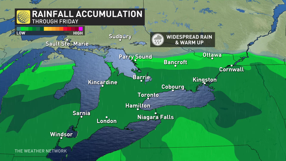
From Thursday evening's shot of heavier rain and the ongoing fog, to a possible wintry mix on Sunday to end the weekend. The warm-up Ontario is experiencing will come with a cost.
Meanwhile, eastern sections of the province will see freezing rain into Thursday morning, and then another round on Friday.
DON’T MISS: Winter takes a breather in major Canadian cities with January thaw
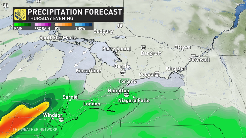
Thursday into Friday: More impactful system hits with heavier rain
Another system will move in on Thursday evening and overnight, pushing rain and mild air even farther north into Sudbury and North Bay. The Greater Toronto Area (GTA) can expect showers throughout the event, with much heavier rain targeted to the snowbelt regions.
Temperatures overnight may not dip below freezing, conditions that don't bode well for the region's ski slopes needing cooler January weather. In fact, expect daytime highs by Friday to tease early spring-like values.
There is still the risk of freezing rain for some areas in Algonquin Park over to the Quebec border, and in eastern Ontario, including Ottawa. This will cause slippery conditions once again on Friday morning.
RELATED: Two freezing rain threats with major travel impacts in eastern Ontario, Quebec
Rain will be slightly heavier than the precipitation that fell on Wednesday, but it won’t pose much in the way of impacts.
Fog will continue to be present on Thursday, and even into Friday, as milder air sticks around.
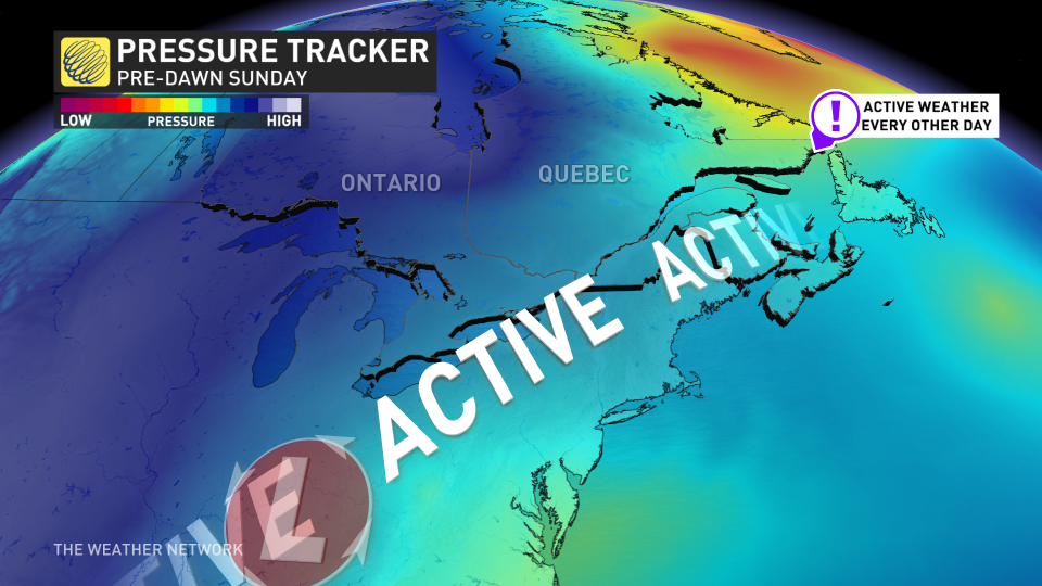
Sunday: Chance for winter weather to return
While it's too early for specifics, the third system tracking south of the border may bring back seasonal temperatures and snowfall to close off the weekend.
A couple days of colder weather are forecast early next week, especially for eastern Ontario, but much milder weather and early spring-like temperatures are forecast for the second half of next week, and continuing well into the first week of February, as well.
However, winter is not over. We are watching the potential for an extended stretch of colder winter weather from mid-February through early March.
Be sure to check back on Feb. 1 for an extended look at what the month ahead has in store in our official monthly outlook.
Stay with The Weather Network for the latest on your forecast across Ontario.

