Hurricane Sam has strengthened to a Category 4. It’s forecast to turn in a few days
As predicted, Hurricane Sam now blows with Category 4, 145 mph winds according to the National Hurricane Center. It still should miss Florida after it turns.
But, as that hasn’t happened yet, the U.S. East Coast should still pay attention to Sam.
Sam and a disturbance are in the Atlantic Ocean as of Sunday morning. Here’s the latest update on them:
Hurricane Sam forecast
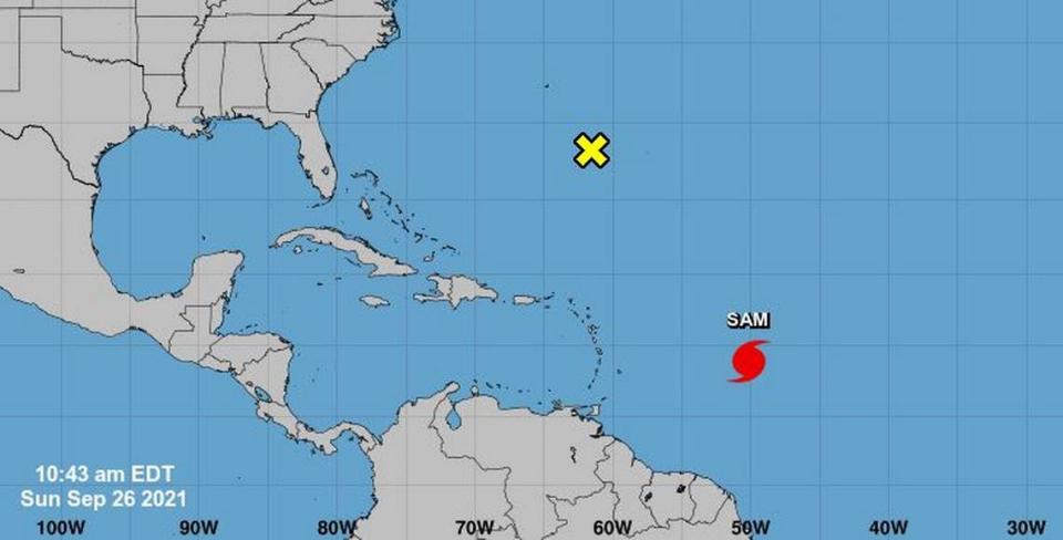
As of the 11 a.m. advisory, Sam is 905 miles east-southeast of the Northern Leeward Islands with maximum sustained winds of 145 mph and gusts surpassing that speed. Sam’s slowed to moseying west-northwest at 8 mph. The forecast track has it making its big turn Wednesday through Friday.
The NHC still calls Sam “a small hurricane,” with hurricane-force winds 30 miles from the center and tropical storm force winds 90 miles from the center.
Sam’s supposed to continue it’s current path through Sunday, “followed by a turn toward the northwest on Monday. Then, a northwestward motion is forecast to continue through midweek.”
Once that happens, Sam’s projected to weaken again.

While a turn to the right is expected well before it approaches Florida, sending Sam north into the Atlantic, it hasn’t happened yet. There aren’t any coastal watches or warnings, but people in the Lesser Antilles are warned to watch for deadly surf and rip currents.
Nice way to start a Friday, seeing overnight models in a little better agreement with a more NW motion next week. If we see this trend continue, it will help build confidence in the outcome but still plenty of time to watch closely. Threat to Northern Leeward Islands for now. pic.twitter.com/U01Xo0Kvou
— Craig Setzer (@CraigSetzer) September 24, 2021
A disturbance “several hundred miles south of Bermuda,” likely the remnants of Tropical Storm Peter has a 20% chance of forming into a storm over the next five days.