San Bernardino County mountains brace for first blizzard warning on record
Residents of the San Bernardino County mountains are bracing for potential blizzard conditions Friday and Saturday, joining their western neighbors preparing for extreme winter weather as a massive storm moves into Southern California.
The National Weather Service office in San Diego issued its first-ever blizzard warning, it said Thursday, putting the San Bernardino County mountains on alert following a similar warning for the mountains of Los Angeles and Ventura counties earlier this week.
The blizzard warnings for the three counties will be in effect from 4 a.m. Friday through 4 p.m. Saturday, when the brunt of the storm is expected to hit the region.
This is likely the second blizzard warning on record in Los Angeles County, according to the National Weather Service office in Oxnard.
The first was issued in 1989, when a strong winter storm brought rare snowfall to Southern California, from Palm Springs to the hillsides of Malibu.
A Blizzard Warning, the first issued by this office, is now in effect for the San Bernardino County Mountains from 4 AM Friday to 4 PM Saturday.
Travel will be VERY DIFFICULT TO IMPOSSIBLE due to the extremely heavy snow and extremely high winds expected. #CAwx pic.twitter.com/MAq7kGVpDF— NWS San Diego (@NWSSanDiego) February 23, 2023
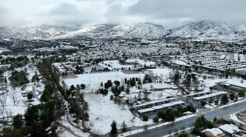
The San Bernardino alert warns of up to 5 feet of snow accumulating above 5,000 feet in elevation, which includes mountain communities such as Big Bear and Lake Arrowhead, as well as wind gusts up to 60 mph and extremely limited visibility because of fog. Crestline, Running Springs and Wrightwood are also included in the blizzard warning.
"Travel will be very difficult to impossible," the weather service warned. "The hazardous conditions will impact the morning and evening commute. Visibility will be near zero."
In L.A. and Ventura counties, the blizzard conditions in the mountains could include gusts up to 80 mph and near-zero visibility, with some isolated peaks above 4,000 feet in elevation seeing up to 8 feet of snow by Saturday. The blizzard warning included the areas of Lockwood Valley, Mt. Pinos, Acton and Mt. Wilson.
A blizzard warning is also in effect from 11 p.m. Thursday to 8 p.m. Friday for the Tehachapi, Grapevine and Frazier mountain communities, according to the National Weather Service. That alert warns of up to 37 inches of snow and wind gusts up to 65 mph.
“This could be really substantial,” said Daniel Swain, a UCLA climate scientist. “In fact, it could be a historically significant snowfall for parts of the Southern California mountains."
Despite the temptation to take advantage of the fresh powder in the mountains, Swain warned that it is best to stay home.
“This is not a weekend you’re going to be able to go up and ski — no one is going to be able to get in or out, potentially for days,” he said. “And so if you live up there, be prepared for a phenomenal amount of snow."
Times staff writer Hayley Smith contributed to this report.
This story originally appeared in Los Angeles Times.

