Satellite imagery captures wildfires breaking across Greece (photo)
It's been a disastrous season for wildfires, and there's no end in sight.
Following devastating blazes on the island of Rhodes in July, more than 350 new wildfires have broken out across Greece this week, according to the New York Times. The most severe, located just outside the city of Alexandroupoli on the mainland near Türkiye, is being propelled by gale-force winds.
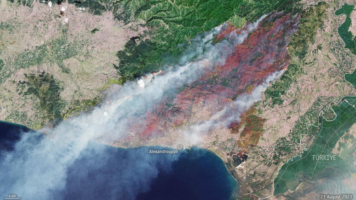
The fire, which has been burning for several days, was aerially captured by the European Space Agency's (ESA) Copernicus Sentinel-2 mission, a constellation of two satellites that each have a high-resolution multispectral imager to observe changes in our planet's land and vegetation. These components make the satellites particularly helpful during natural disasters like wildfires.
In the image, which is a composite indicating natural light signals and infrared wavelength patterns, the brown areas show burnt land while bright reds and oranges show the active fire front. At the time this image was taken, on Wednesday (Aug. 23), that front spanned 43.5 miles (70 km), with its smoke plumes trailing some 1,000 miles (1,600 km) towards Tunisia. The fire prompted evacuations of several villages in the region, as well as a hospital in Alexandroupoli, and has already claimed the lives of 18 people — possibly migrants who had crossed into Greece from Türkiye, per Reuters.
Given Greece's hot and dry climate, it's particularly susceptible to wildfires — and according to ESA, climate change and land-use change will only make these fires worse. Yet both variables continue to be exacerbated due to human-driven activity such as burning coal for power and cutting down trees to build infrastructure.
Related: Satellites watch wildfires rage across Canadian northwest (photos)
Related Stories:
— Climate change may be changing the color of Earth's oceans
— Removing carbon from Earth's atmosphere may not 'fix' climate change
— Satellites watch as wildfires rage across Greece (photos)
During natural disasters such as this one, the Copernicus Sentinel-2 mission monitors the situation and provides crucial information to civil authorities and humanitarian efforts as part of the Copernicus Emergency Mapping Service. That service is currently active in North Attica, Rodopi, Euboea Island, the Sterea Ellada region and East Macedonia.
For more wildfire information from ESA, you can explore the Sentinel-3 World Fire Atlas, which monitors fires around the world.

